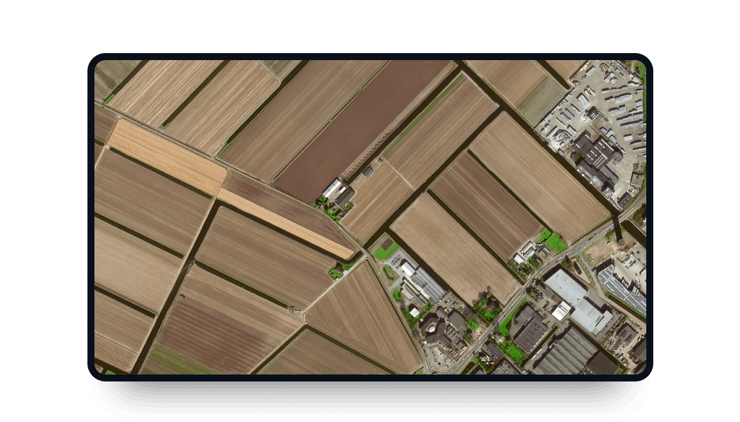
Superview-1 high-resolution images
Explore LandViewer and access high-frequency, 0.5m-resolution data from SuperView-1.
-
Data type
Optical
-
Resolution
0.5 m
-
Revision
daily
-
Spectral bands
Panchromatic, Red, Green, Blue, NIR
-
Data archives
Archive since 2016
-
New Image Tasking
Available

How to order SuperView 1 satellite images on LandViewer
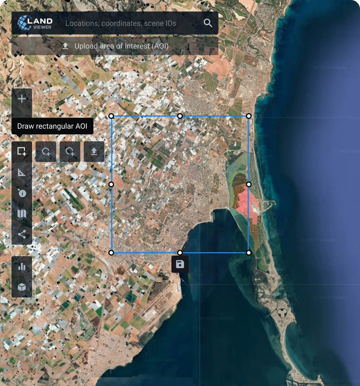
Specify your Area of Interest (AOI)
Set your target area: manually draw a polygon, search for a location, or upload your file to find the perfect coverage.
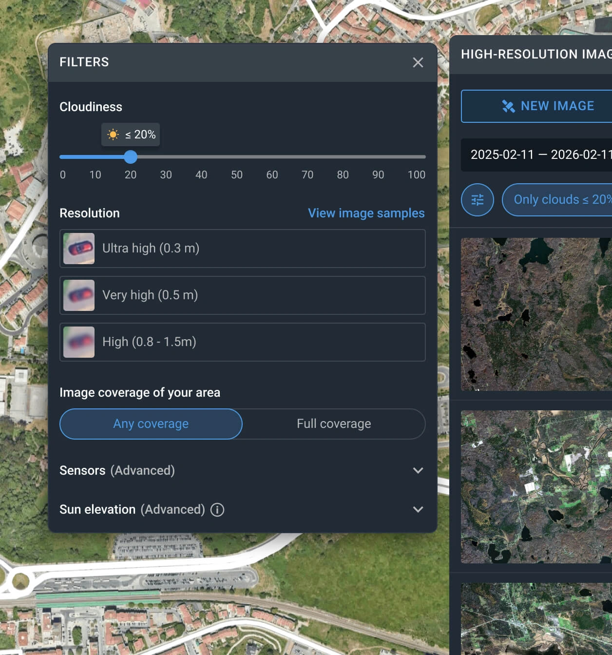
Apply search filters
Apply date, resolution, and cloud cover filters to quickly pinpoint the exact SuperView-1 satellite imagery covering your region.
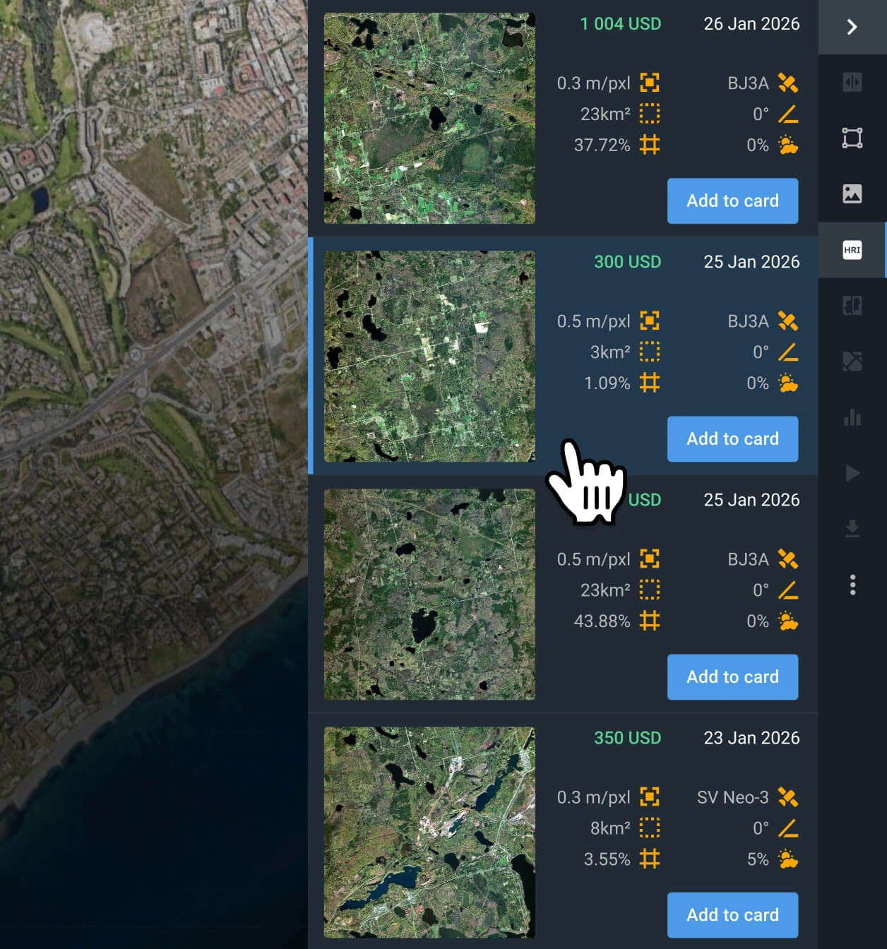
Select relevant SuperView-1 images
Browse the available search results, check pricing details, and select the specific SuperView scenes that best fit your project goals.
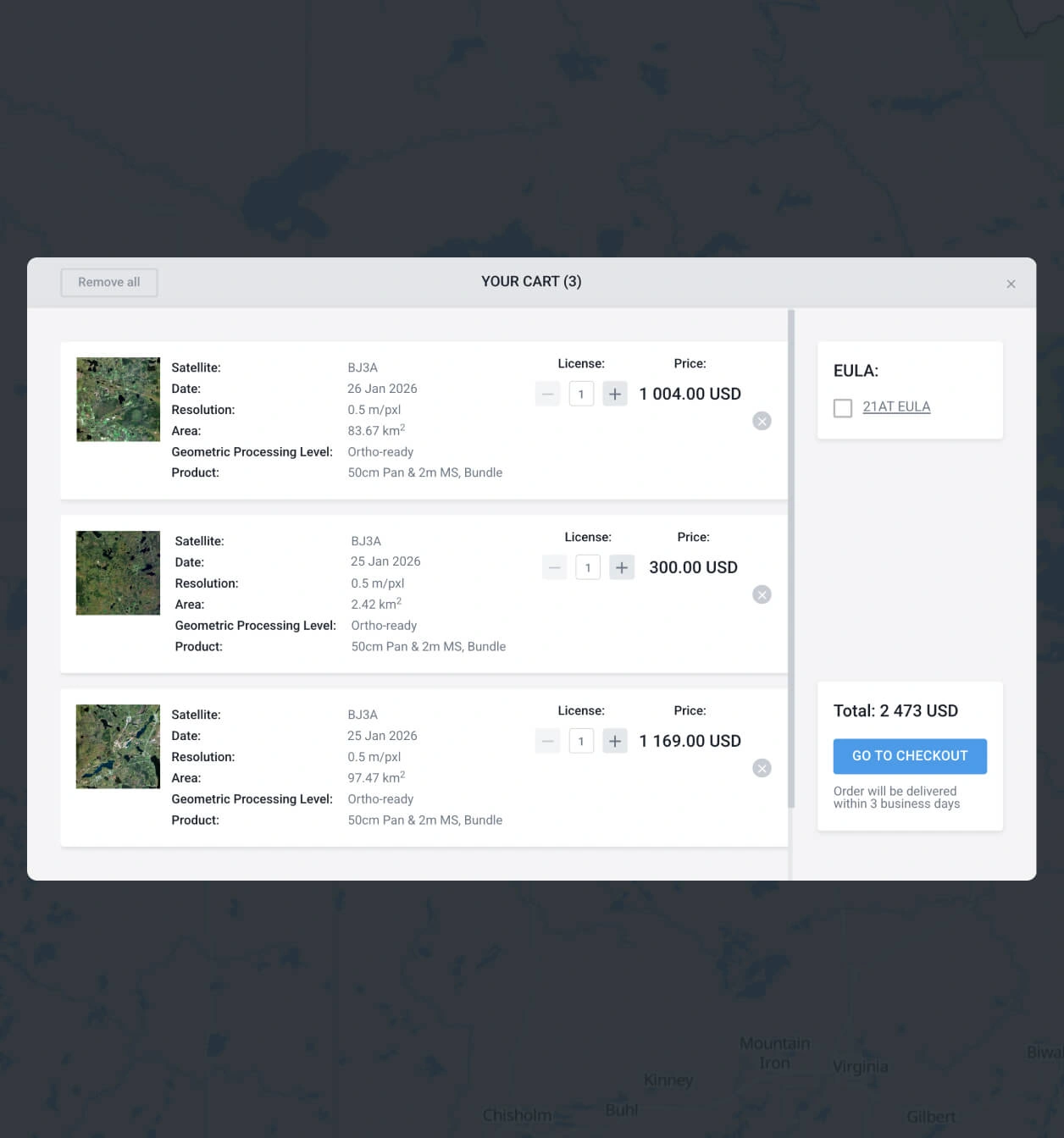
Choose and buy SuperView images
Add the chosen satellite images to your cart and instantly submit the order. You can also reach out to our sales team to get more payment details.
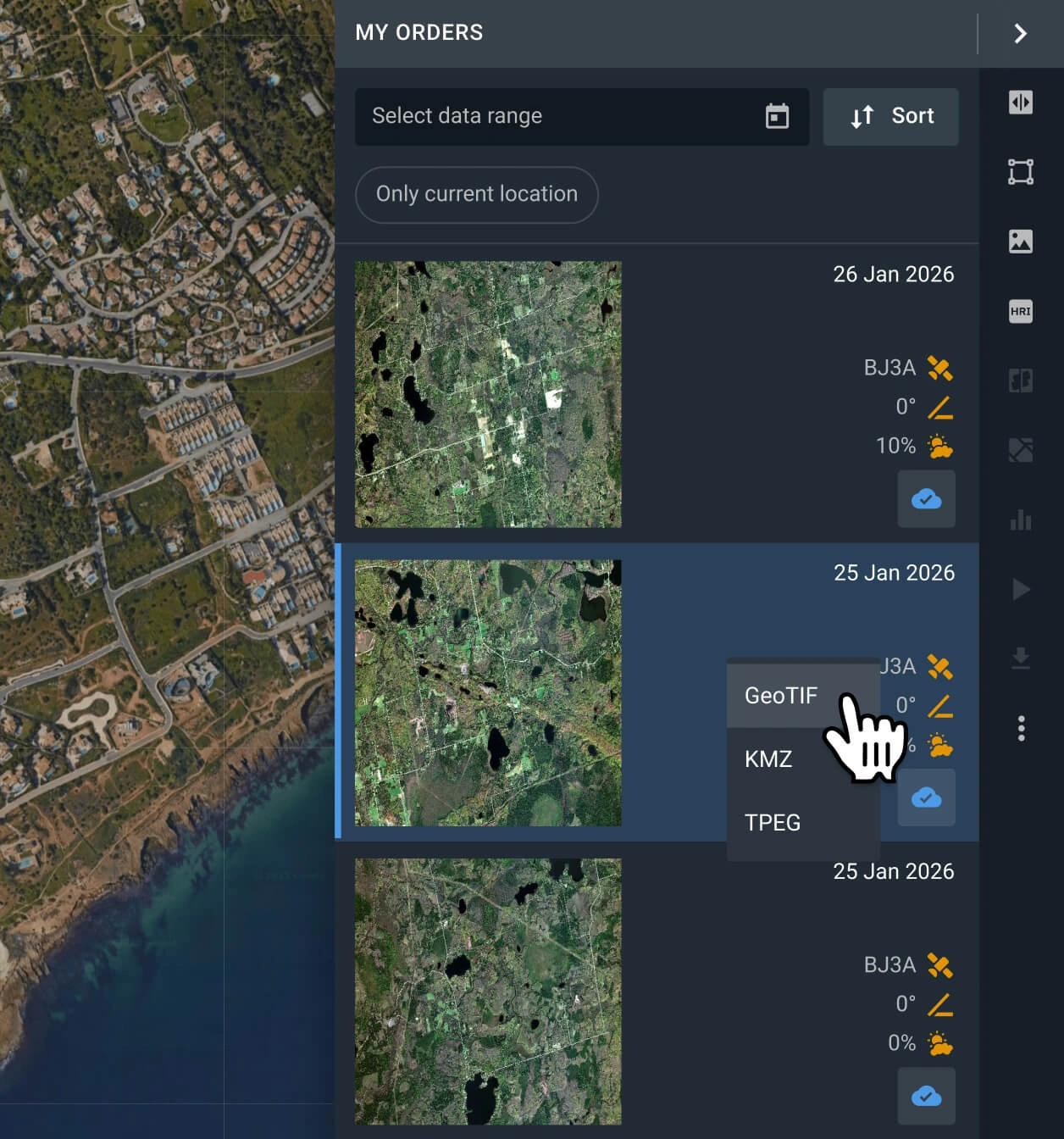
Export or analyze SuperView-1 data
Access high-resolution data in LandViewer within 2 days. Download in GeoTIFF/KMZ/JPEG format for GIS software or analyze directly in the platform.
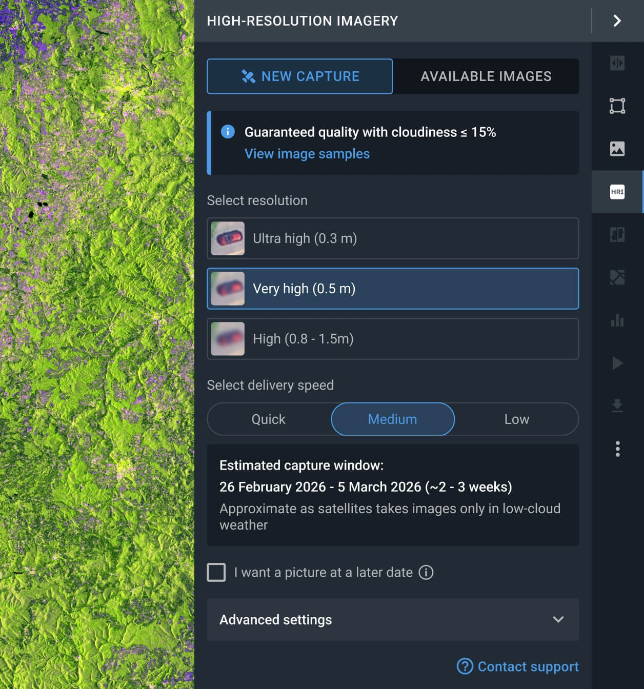
Task a satellite for new scenes
No archive match? Explore SuperView tasking and command sensors for a fresh capture that will match your needs.
FAQ
How much does it cost to buy SuperView imagery?
Accessing archived SuperView scenes costs from $14.00 per square kilometer, with a minimum area of interest (AOI) of 25 sq km. If you need to order SuperView imagery for a new capture (tasking), the price starts at $19.00 per square kilometer, with a minimum AOI of 100 sq km.
What are the most common use cases for SuperView-1 imagery?
It is most commonly used for high-accuracy building site mapping, land cover analysis, property border verification, urban planning, agriculture and forestry management, and environmental monitoring. Border security, maritime surveillance, and oil/gas exploration are other common applications.
How do I task SuperView-1 for my specific area?
To order tasking, simply fill out the contact form below and our sales team will assist you. Alternatively, go to the LandViewer platform, open the "New Image" tab in the High-resolution imagery section, select your desired resolution and delivery speed, and place the order for your AOI.
What processing levels come with SuperView-1 satellite images?
By default, all SuperView-1 data is georeferenced, making it ready for use in third-party GIS software like ArcGIS or QGIS. If your project requires advanced processing, such as orthorectification, please consult our support team, we can provide this in most cases.
Can I schedule long-term monitoring of my AOI with the SuperView-1?
Yes, regular and long-term monitoring is possible. To set up a recurring schedule, please contact our sales department or complete the contact form on this page, and our specialists will reach out to you shortly.
How can I ensure the captures are cloud-free?
LandViewer features a built-in cloud coverage filter that allows you to define your maximum acceptable cloudiness limit. Any SuperView-1 imagery that exceeds this threshold is automatically hidden, ensuring you only see the clearest and most suitable results.
What if I can't find relevant SuperView-1 imagery for my AOI?
In addition to SuperView, LandViewer provides access to optical data from over 15 other high-resolution providers. Just adjust the resolution filters in your search to discover suitable alternative captures for your area.
What are my options if I need a higher resolution than SuperView-1 provides?
If you require sharper details than the 0.5m resolution offered by SuperView-1, explore the catalogs for Beijing-3B, SuperView NEO-1, or BlackSky Gen 3. They provide the highest spatial resolutions currently available on our platform.


