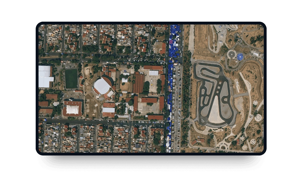
KOMPSAT-3 high-resolution images
Sign up on the LandViewer platform to benefit from the high resolution and great revisit time of the KOMPSAT-3 satellite.
-
Data type
Optical
-
Resolution
0.5 m
-
Revision
1.5 days
-
Spectral bands
Panchromatic, Red, Green, Blue, IR & NIR
-
Data archives
Archive since 2012
-
New Image Tasking
Available

How to access KOMPSAT-3 scenes on the LandViewer platform
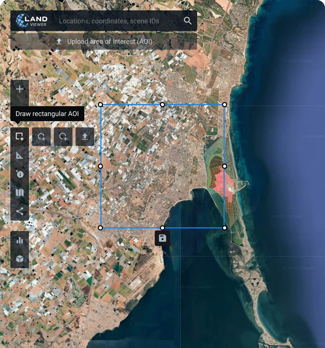
Set your area of interest (AOI)
It’s a simple step and can be done in several ways: searching for a location, drawing a polygon on the map, or uploading a file containing all the parameters needed.
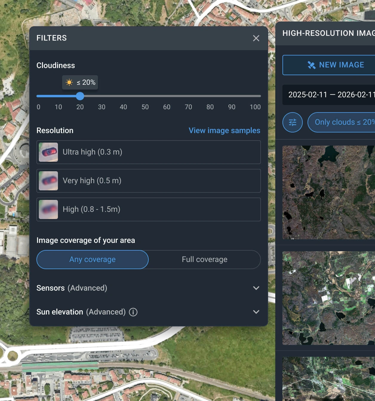
Apply the filters to reduce the number of KOMPSAT-3 images
The filter can be used with one or more conditions, such as date, resolution, sensor, cloud coverage, and AOI coverage.
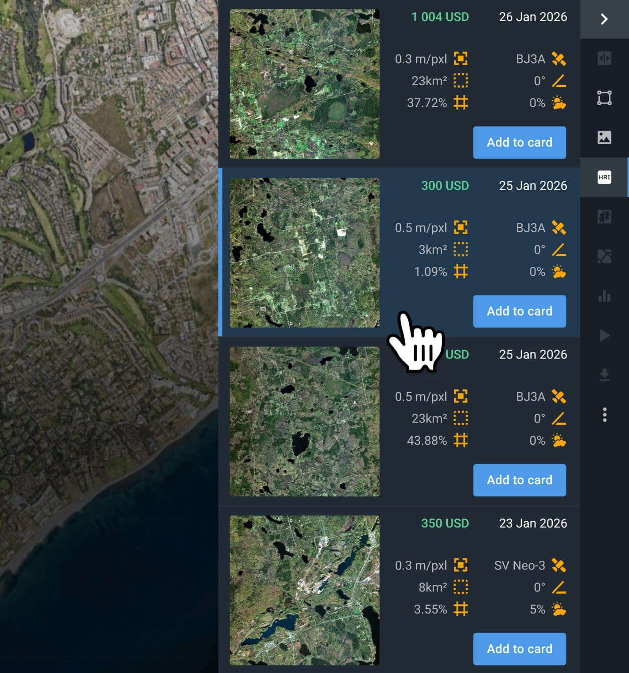
Select the most relevant captures
Browse the filtered results and review the pricing and other details for each option. Find the KOMPSAT-3 imagery that better fits your goal.
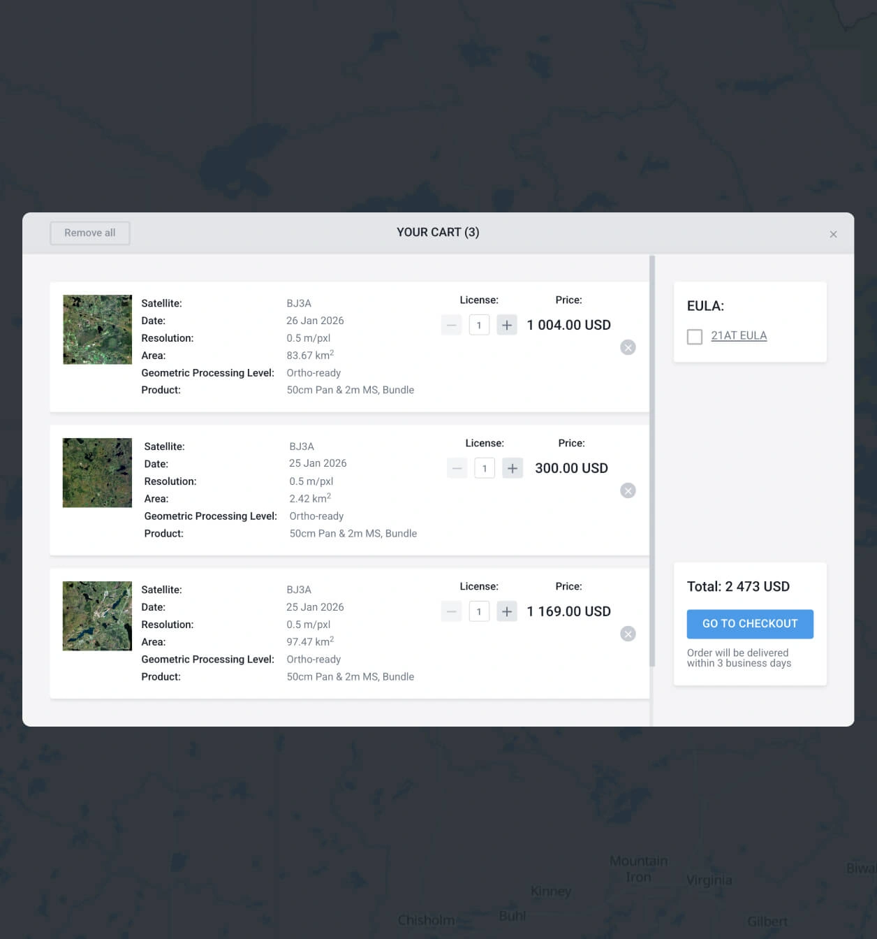
Add what you need to the cart and make your order
Check the cart and finish the purchase. Pay right away by following the instructions on the screen or contact our sales representative to obtain your payment details.
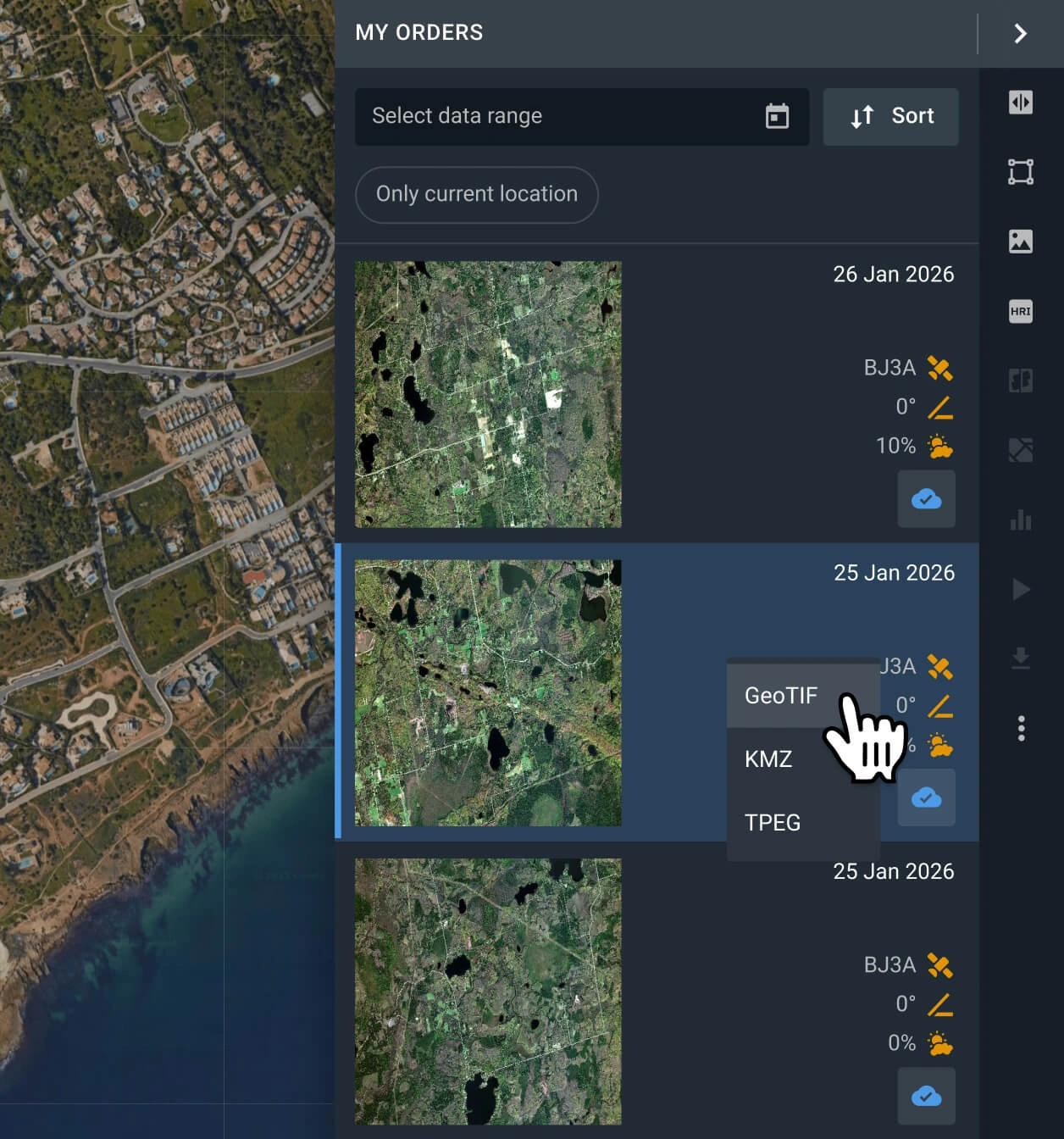
Start with your analysis or export the data
Your KOMPSAT-3 captures will be available within 2 business days. Conduct analysis with the built-in options, or export the data in GeoTIFF, KMZ, or JPEG format.
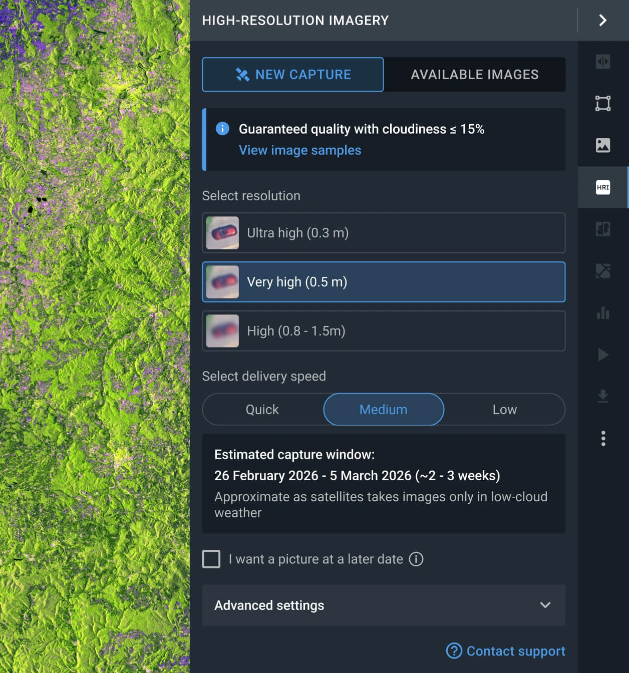
Request a new image with the tasking option
If none of the images of the archive can be used in your project, you can use the tasking option to request fresh data.
FAQ
What is the cost of a KOMPSAT-3 image?
Archived KOMPSAT-3 data starts at $11 per sq km, with a minimum area of 25 square kilometers. New captures requested via the tasking option cost from $16 per sq km, with a minimum area of 100 square kilometers.
What are the most common use cases for KOMPSAT-3 images?
The most common use cases are high‑detail mapping, land development control, agriculture/vegetation monitoring, and disaster response. It is particularly effective for assessing property conditions and supporting construction site planning with precise, up-to-date imagery.
How does the tasking service work with the KOMPSAT-3 satellite?
There are 2 options to request this service. Fill out the form below and our sales team will assist you. The alternative is to access the LandViewer platform and click the New image tab in the High-resolution imagery section. Set a resolution, delivery speed and AOI to create your order.
What processing levels are available for KOMPSAT-3 data?
Every image comes with georeferenced data, helping its export to third-party software. In most cases, we can provide advanced processing (i.e., orthorectification); please contact our support team if you need it.
Can I set a regular monitoring program for my AOI using KOMPSAT-3?
Yes, you can. Get in touch with our sales representatives or fill out the inquiry form on our website. Our specialists will contact you to discuss your specific needs.
What are the main advantages of the KOMPSAT-3?
The KOMPSAT-3 satellite is distinguished by its afternoon capturing time and 14-bit imaging depth. These features make it a superior choice for vegetation and agricultural analysis, serving as an ideal data source to pair with morning-acquired scenes.
Can you provide digital elevation maps?
Yes, we can generate high-accuracy elevation maps using KOMPSAT 3 stereo-pair imagery. This is available as a custom request; please contact us for a quote based on your specific area.
Is KOMPSAT-3 appropriate for wide-scale observations?
Yes. KOMPSAT-3 is ideal for large-area monitoring due to its high-resolution wide-swath and agile tasking, allowing for frequent revisits and comprehensive coverage of expansive territories.


