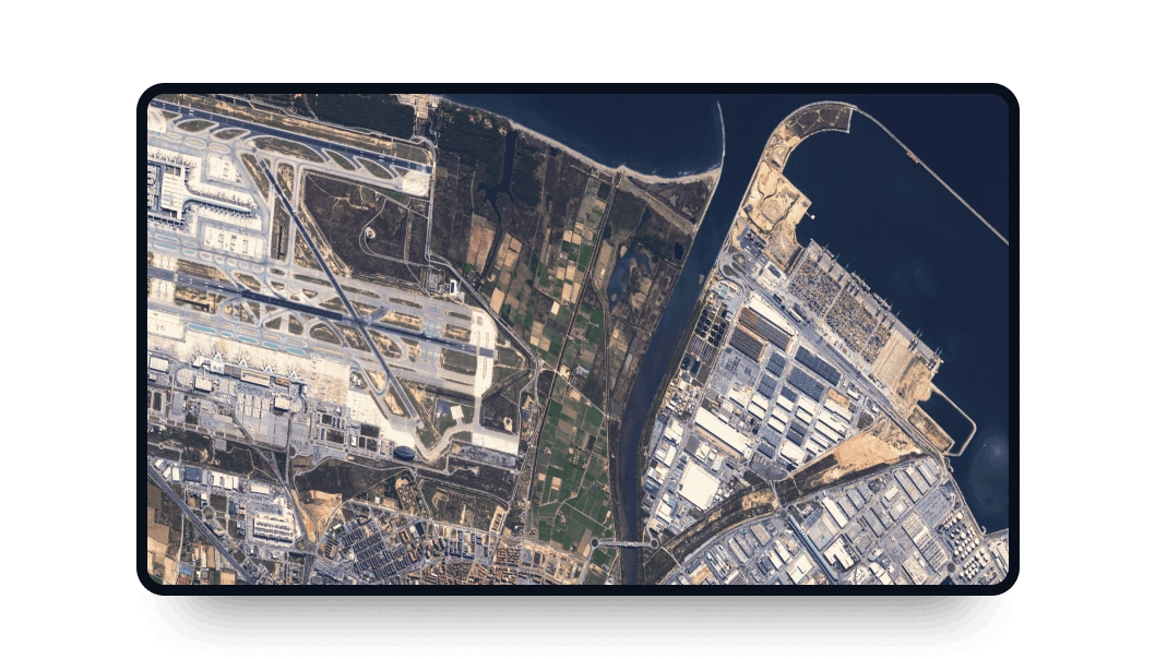
Göktürk-1 high-resolution images
Access high-frequency multispectral data from the Göktürk-1 satellite directly on the LandViewer platform:
-
Data type
Optical
-
Resolution
0.5 m
-
Revision
2-3 days
-
Spectral bands
Panchromatic, Red, Green, Blue, NIR
-
Data archives
Archive since 2016
-
New Image Tasking
Available

How to access Göktürk-1 images on LandViewer
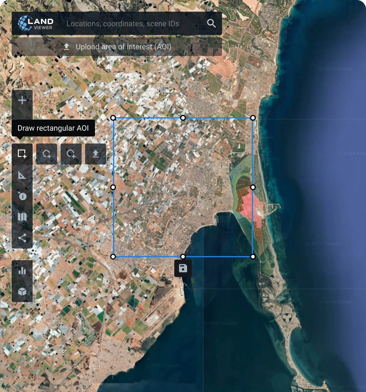
Specify your target Area of Interest (AOI)
Search a location, draw a custom area, or upload a spatial file to choose the exact observation zone for your Göktürk-1 data.
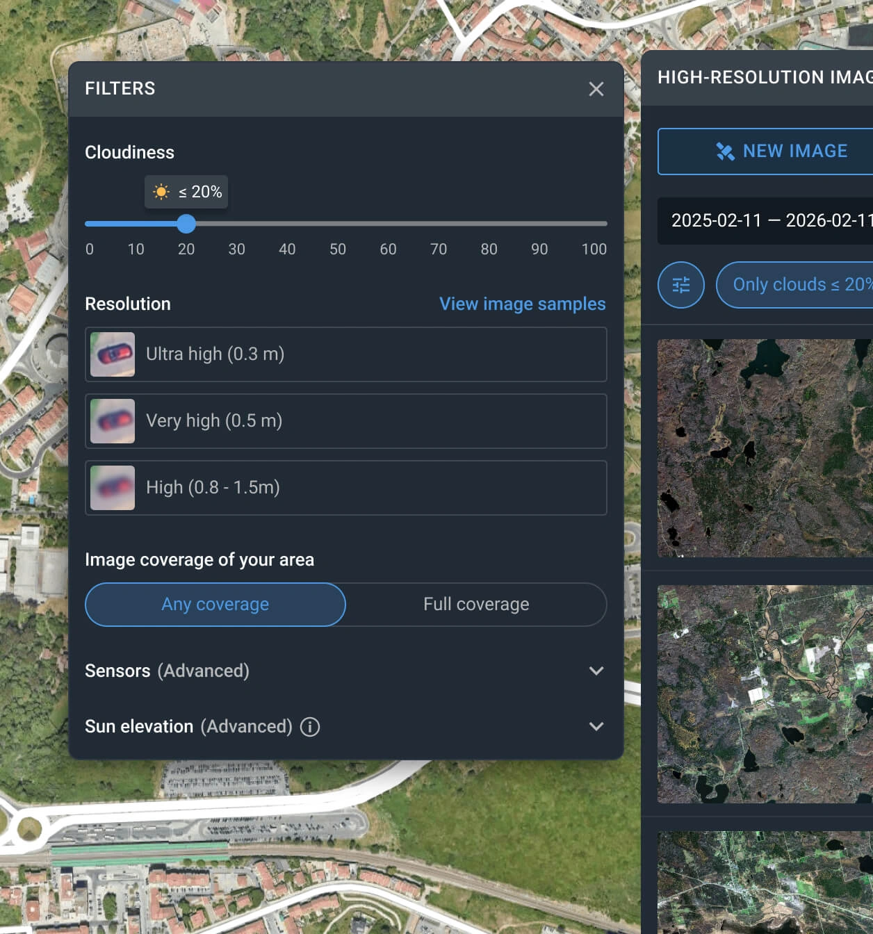
Filter the satellite data archive
Adjust parameters like resolution, specific dates, and cloud cover to instantly locate relevant Göktürk-1 captures.
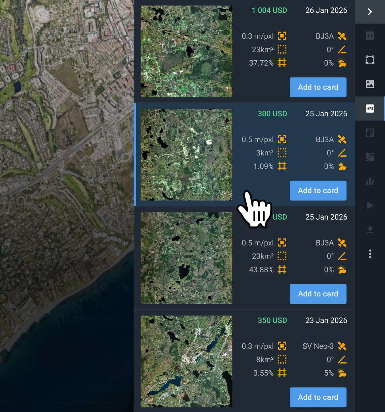
Choose the optimal imagery scene
Review the filtered options, compare pricing and technical specifications, and select the scene that perfectly aligns with your project.
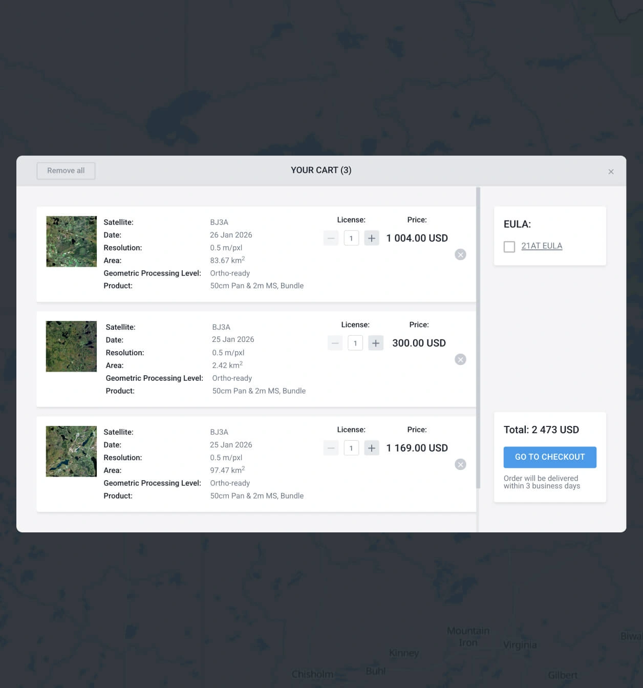
Finalize your data purchase
Add the chosen Göktürk-1 satellite scene to your cart for instant checkout, or reach out to our sales managers to coordinate your order.
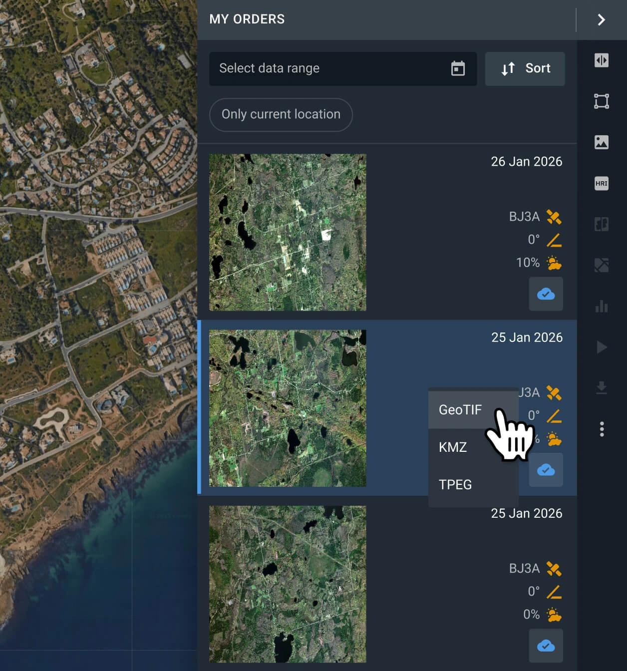
Export files or analyze on-platform
Access your data within 2 days. Download it in GeoTIFF, KMZ, or JPEG formats for GIS software, or utilize LandViewer’s built-in analytical indices and bands.
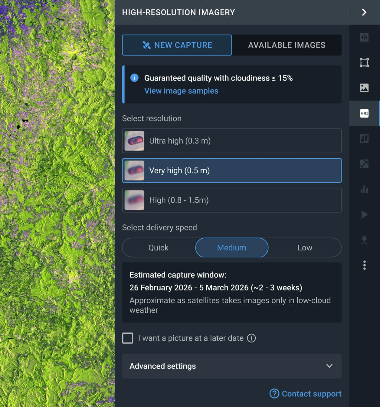
Task the satellite for a new image
If historical archives don't match your needs, order custom tasking to command Göktürk-1 for a brand-new, high-resolution capture.
FAQ
How much does Göktürk-1 data cost?
Accessing archived Göktürk-1 data costs from $7.00 per sq. km. with a minimum required AOI of 25 sq. km. If your project requires a new custom capture, the rate starts at $12.00 per sq. km. with a minimum AOI of 75 sq. km.
How do I task the Göktürk-1 satellite for my AOI?
You can order a new capture directly in LandViewer. Navigate to the "New Image" tab in High-resolution imagery, select your preferred resolution and delivery speed, and finalize the order. Alternatively, submit the contact form below and our sales team will handle the setup for you.
Are the scenes pre-processed for GIS integration?
Yes. All delivered Göktürk-1 scenes are fully georeferenced and compatible with software like ArcGIS and QGIS. If your analysis demands advanced geometric corrections, such as orthorectification, please consult our support team for processing upgrade.
Is continuous monitoring available for my target area?
Absolutely. We facilitate long-term, routine observation schedules. Just complete the contact form on this page or reach out to our sales department, and our specialists will assist you.
Do you offer emergency tasking for rapid imagery acquisition?
Yes, we provide three tasking tiers: standard, priority, and emergency. This allows you to choose a plan based on how quickly you need the data. You can review the pricing and turnaround times directly in LandViewer, or contact our sales experts for detailed guidance.
Do you provide additional spatial analytics?
Yes! Every purchased capture automatically includes analytical layers such as NDVI, NDWI, and Color Infrared. For highly specialized mapping needs, our in-house R&D division of scientists and developers is available to engineer custom, advanced analytical solutions.
What are the most common use cases for Göktürk-1 imagery?
It excels in asset mapping, urban planning, infrastructure and site monitoring, cadastral surveys, and change detection. The satellite's data is particularly useful when a clear visualization of buildings, roads, and other man-made structures is required.


