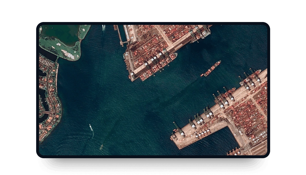
GEOSAT 2 high-resolution images
Access the LandViewer platform to obtain GEOSAT 2 high resolution imagery suitable for multiple projects.
-
Data type
Optical
-
Resolution
0.75 m
-
Revision
2 days
-
Spectral bands
Panchromatic, Red, Green, Blue, NIR
-
Data archives
Archive since 2016
-
New Image Tasking
Available

How to get the most out of GEOSAT 2 data with LandViewer
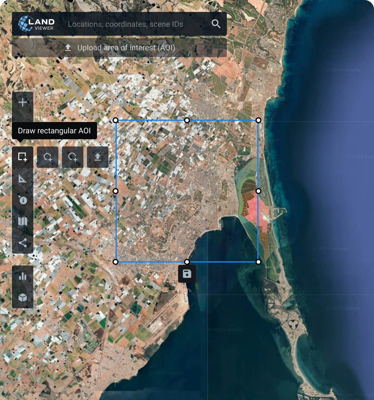
Set your AOI (area of interest)
It’s a simple step and can be done in several ways: searching for a location, drawing a polygon on the map, or uploading a file containing all the parameters needed.
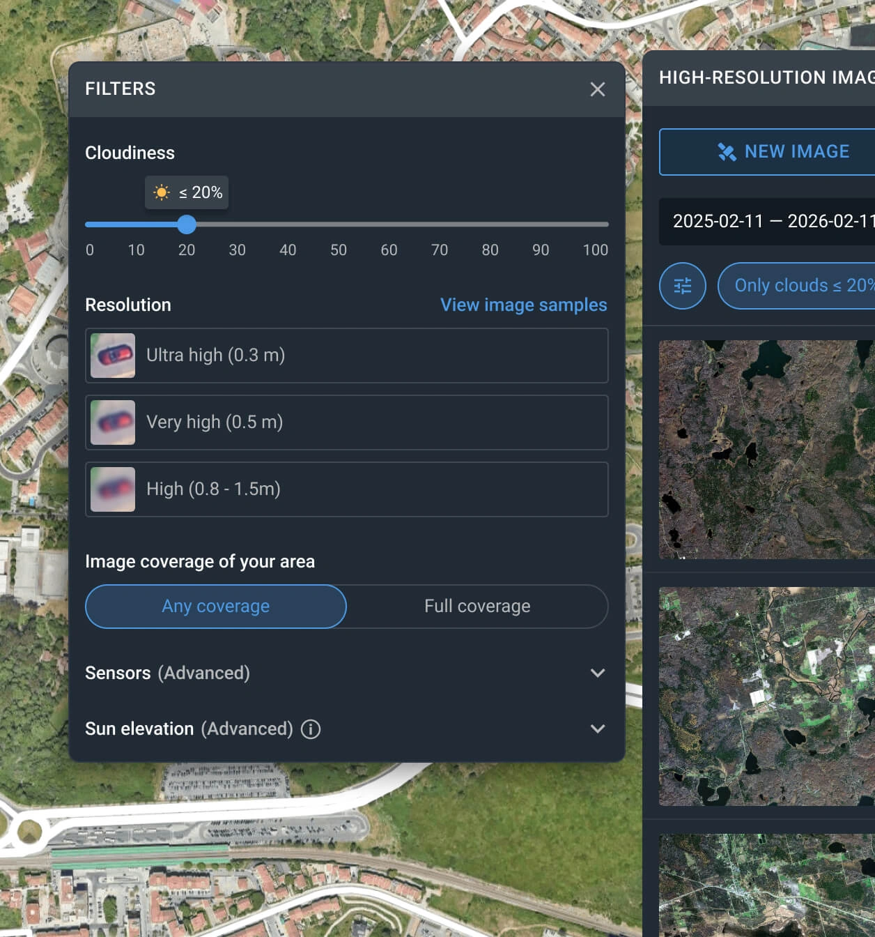
Apply filters to narrow down the search
Customize your search using filters like date range, resolution, sensor type, AOI coverage, and cloud level to quickly locate the most relevant GEOSAT 2 scenes.
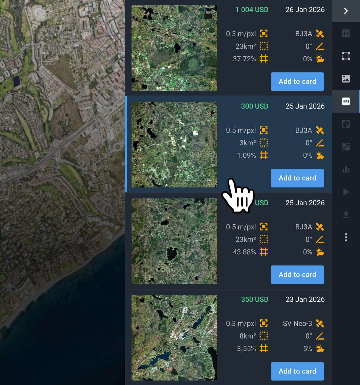
Select the GEOSAT 2 scenes that you need
Browse through the filtered results to find the most relevant captures for your case. Check the pricing and other details before selecting.
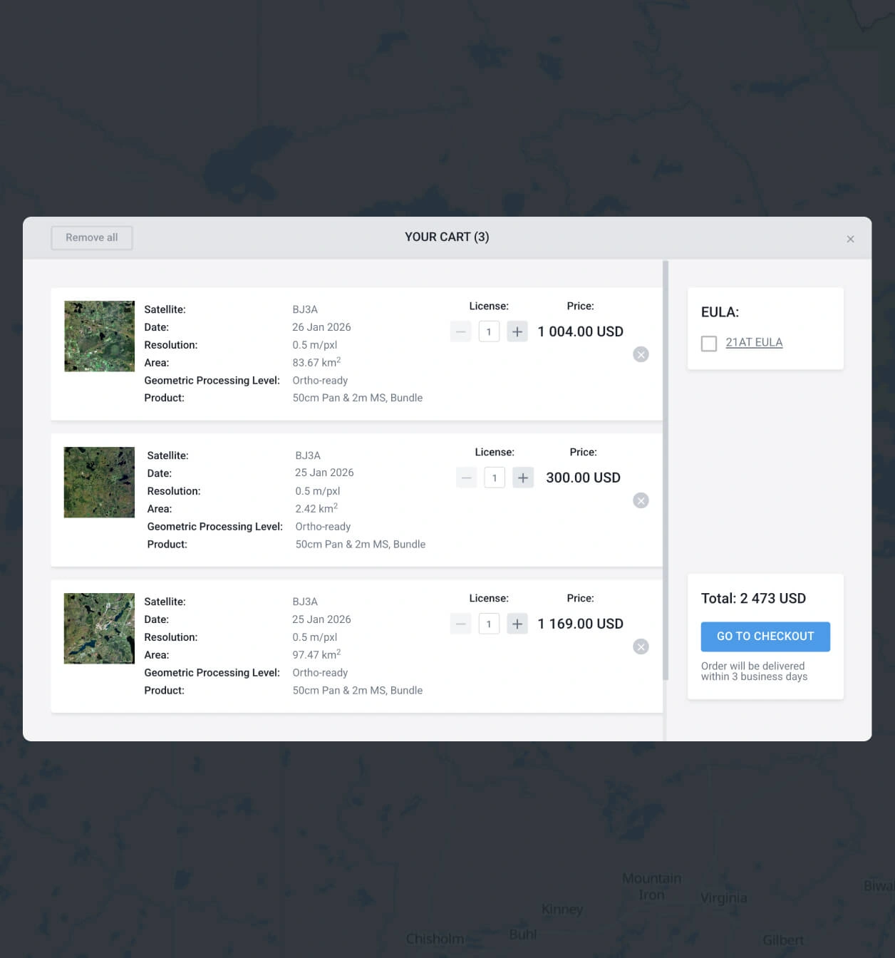
Add what you need to the cart and make your order
Add as many images of GEOSAT 2 as you need, and submit your order. You can purchase them yourself or reach our sales team to obtain your payment details.
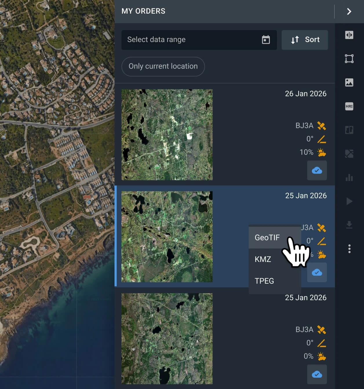
Conduct analysis on your recently purchased GEOSAT 2 data or export it
Your scenes will be available on the LandViewer platform within 2 days. You can run analysis on the platform, or export them in GeoTIFF, KMZ, or JPEG format.
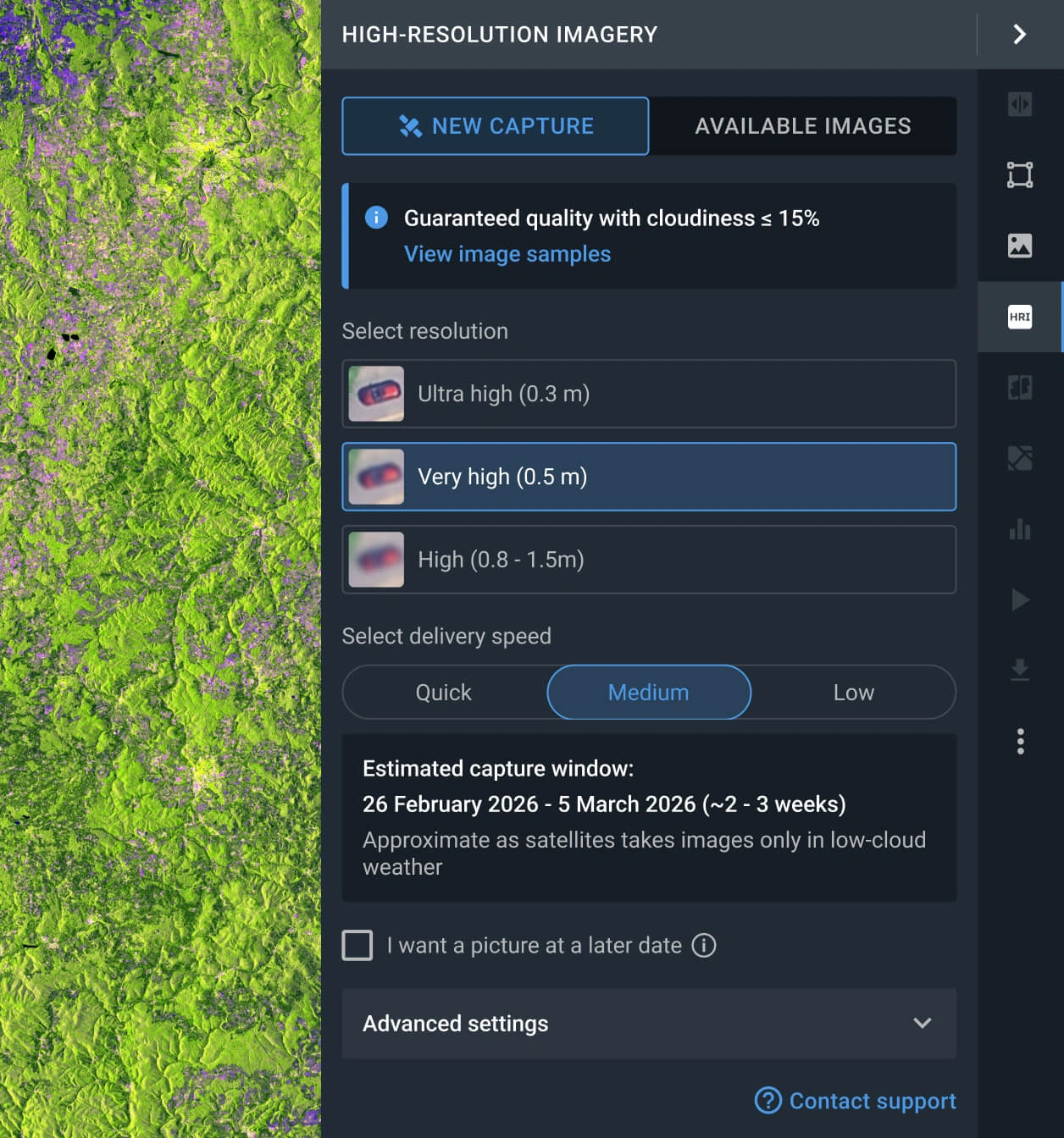
Request a new image
If the scenes available do not fit your goal, you can use the Tasking option to obtain a new one that does.
FAQ
What is the cost of a GEOSAT 2 image?
Archived GEOSAT 2 data starts at $5 per sq km, with a minimum area of 25 square kilometers. New scenes requested via the tasking option cost from $12 per sq km, with a minimum area of 100 square kilometers.
What are the primary advantages of the GEOSAT 2 satellite?
GEOSAT-2 combines a 12-km wide swath with a 75-cm resolution, making it a highly efficient choice for covering expansive project areas. It is one of the best cost-effective options for images with resolution under 1 m.
How can I schedule a new capture for my AOI?
Simply fill out the form on our website for assistance from our sales team. Alternatively, navigate to the "New Image" tab within the High-Resolution feature on the LandViewer platform. Define your AOI, and select the required resolution and preferred delivery speed to initiate a tasking service.
What level of data processing is available for the GEOSAT 2 satellite?
All GEOSAT 2 datasets are delivered with standard georeferencing, ensuring they are ready for immediate use in third party GIS software. Should your project require advanced processing like orthorectification, please consult with our support team, as we can provide this in most cases.
Can I establish a long-term monitoring program for my AOI using GEOSAT 2 data?
Certainly. Please contact our sales team or complete the inquiry form on our website. Our specialists will reach out to you shortly to discuss your specific monitoring needs.
Is it possible to get a clear image without clouds?
Yes. LandViewer has a cloud coverage filter that enables the user to set an acceptable threshold. Every scene exceeding the threshold will be hidden, leaving only the results that match the user-selected criteria. Please note that the more restrictive the threshold, the fewer images will appear.
What if I can't find relevant GEOSAT 2 satellite imagery for my AOI?
LandViewer provides access to optical data from over 15 other high-resolution providers. Just adjust the resolution filters in your search to discover suitable alternatives for your area.
Is it possible to receive additional analysis alongside the raw GEOSAT 2 image data?
Yes. For all purchased data, you will receive integrated analytics, including NDVI and NDWI indices. Furthermore, our dedicated R&D department is available to collaborate on bespoke projects and engineer advanced analytical solutions tailored to your specific requirements.
What are the most common use cases for GEOSAT 2 imagery?
It is often used for detailed urban mapping, infrastructure monitoring, and land development analysis. With sub-meter resolution imagery, it is also well suited for detecting building structures, tracking construction progress, and supporting urban planning and asset management.


