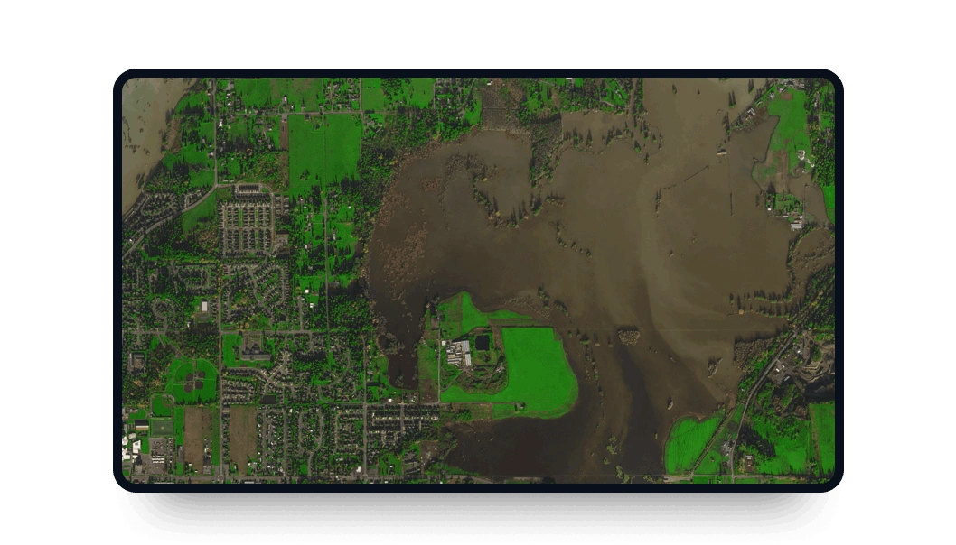
Gaofen-7 high-resolution images
Power your projects with medium-resolution, high-frequency multispectral data available on LandViewer:
-
Data type
Optical
-
Resolution
0.65 m
-
Revision
5 days
-
Spectral bands
Panchromatic, blue, green, red, NIR, red-edge 1, red-edge 2, coastal blue and yellow
-
Data archives
Archive since 2019
-
New Image Tasking
Not available

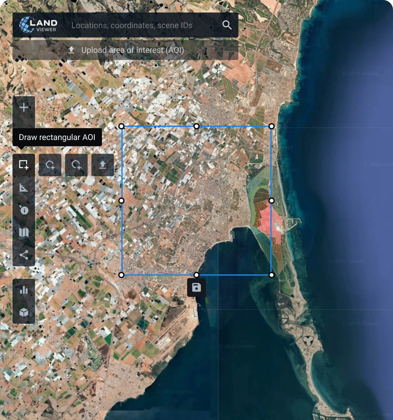
Steps to acquire Gaofen-7 data on LandViewer
Define your Area of Interest (AOI)
Pinpoint your monitoring zone by searching and drawing it on the map, or simply upload your existing area files.
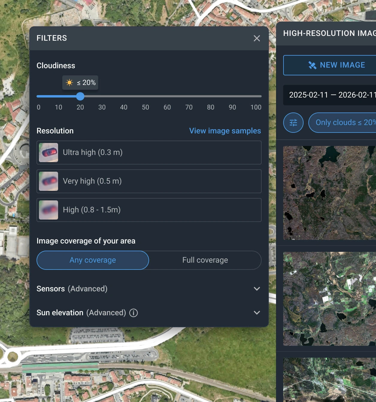
Filter the catalog
Quickly locate the perfect high-resolution data by adjusting parameters like date range, cloud cover limit, and sensor type.
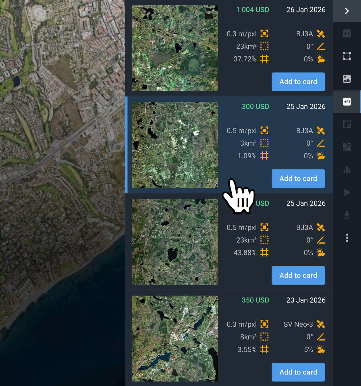
Choose the best matching scene
Evaluate the available scenes, check the specs and pricing, and pick the shot that meets your exact requirements.
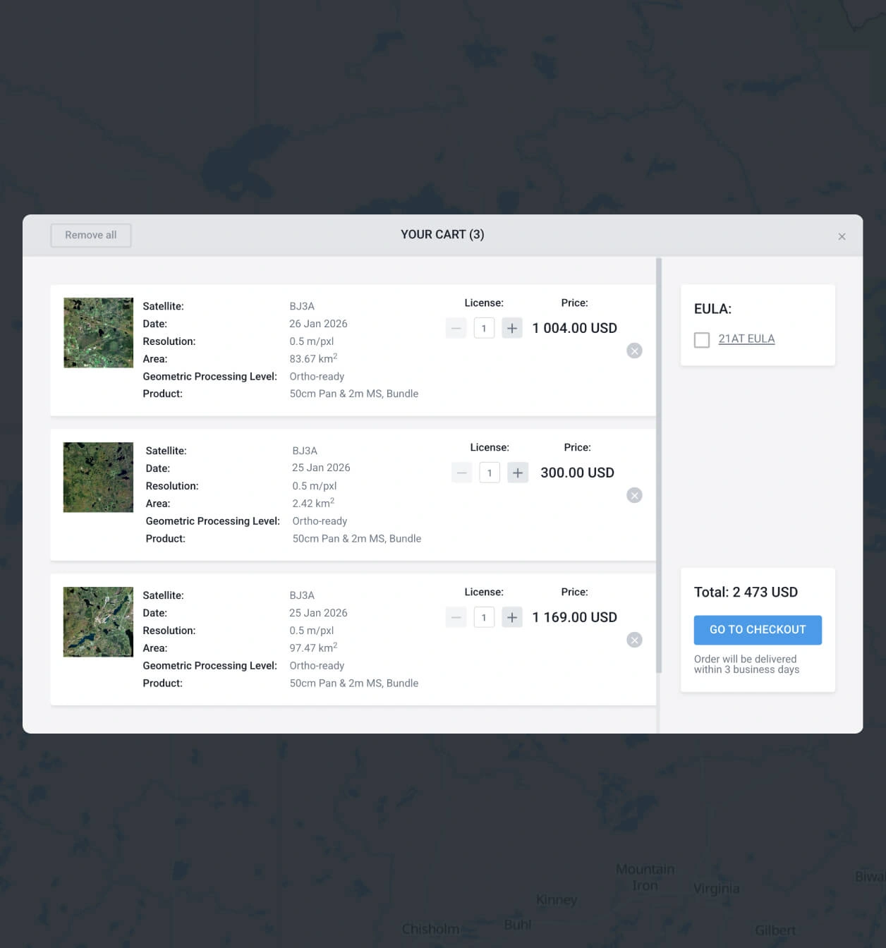
Checkout securely
Add your image to the cart to pay instantly, or reach out to our sales team to finalize the purchase.
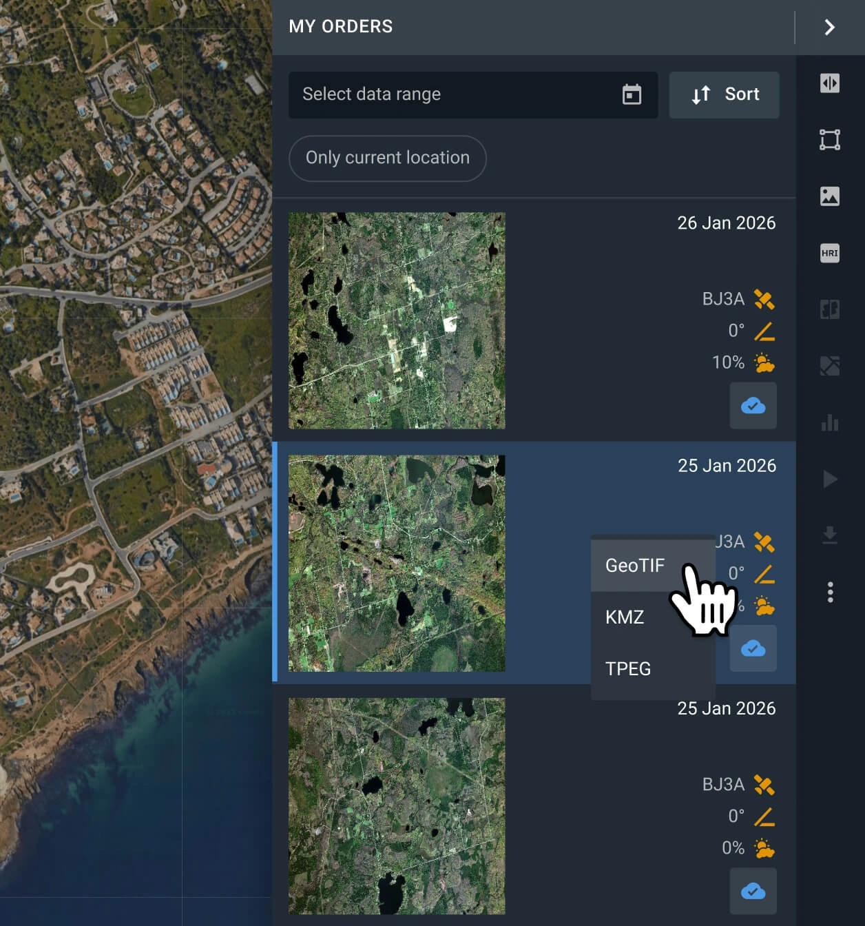
Download data or process analytics
Get your data within 2 business days. Perform instant analysis on LandViewer using band combinations, or export GeoTIF, KMZ, or JPEG files to your GIS platform.
FAQ
What is the pricing for Gaofen-7 data?
Archive imagery costs start at $10.00 per square kilometer, with a minimum order size of 25 sq km (AOI).
Can I task Gaofen-7 for new scenes?
Tasking is reserved for our newest satellites with higher resolutions and faster revisit times. You can request new image tasking on our platform via providers like BlackSky Gen 3, BJ3N, or SuperView NEO-1.
What processing levels are available?
All data comes georeferenced and ready to use in software like QGIS or ArcGIS. Need advanced processing like orthorectification? Reach out to our support team, and we can set that up for you.
Is long-term AOI monitoring available?
Yes. Fill out the contact form on this page or reach out to our sales team, and we’ll help you set up regular monitoring.
How do I filter out cloudy images?
You can use the cloud coverage filter in LandViewer. Set your acceptable cloud limit, and we’ll automatically hide any Gaofen-7 scenes that are too cloudy.
Who uses Gaofen-7 imagery the most?
Gaofen-7 captures are heavily used in urban planning, construction, utility infrastructure mapping, logistics, insurance damage assessments, and environmental consulting.
What if I can't find the right Gaofen-7 scene?
If Gaofen-7 doesn't have what you need, LandViewer features 15+ other high-resolution satellites. Adjust your search filters to explore alternative scenes for your AOI.
What are the most common use cases for Gaofen-7 imagery?
This imagery is primarily used for high‑precision topographic mapping, land surveying, urban and rural construction monitoring, and infrastructure planning.


