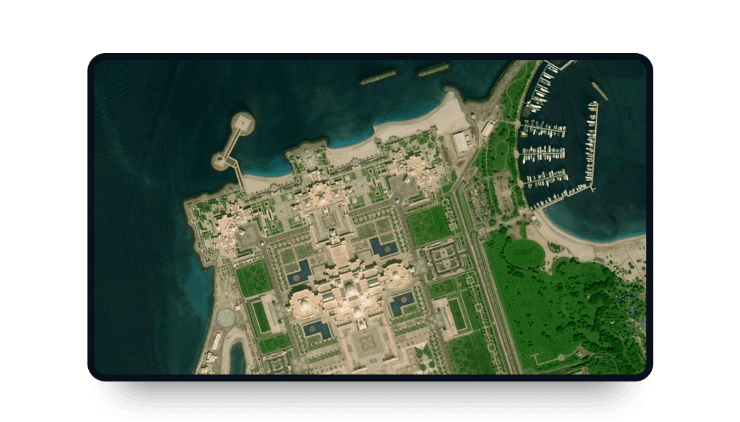
Gaofen 6 high-resolution images
Keep a close eye on vast landscapes with the high-frequency multispectral imagery available on LandViewer.
-
Data type
Optical
-
Resolution
2 m
-
Revision
4 days
-
Spectral bands
Panchromatic, blue, green, red, NIR, red-edge 1, red-edge 2, coastal blue and yellow
-
Data archives
Archive since 2018
-
New Image Tasking
Not available

Purchasing Gaofen 6 data on LandViewer
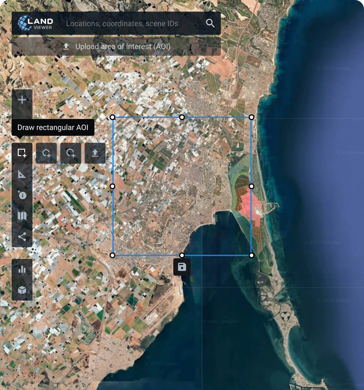
Map Your Monitoring Zone (AOI)
Search for your desired geographic location, draw a custom boundary on the map, or upload an existing shapefile directly from your device.
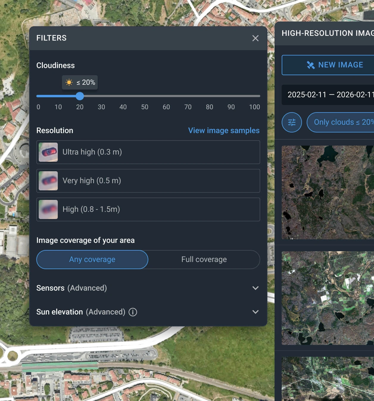
Sort the image catalog
Apply search parameters to narrow down the satellite options. Adjust the sliders for date ranges, cloud limits, and sensor types to find exactly what you need.
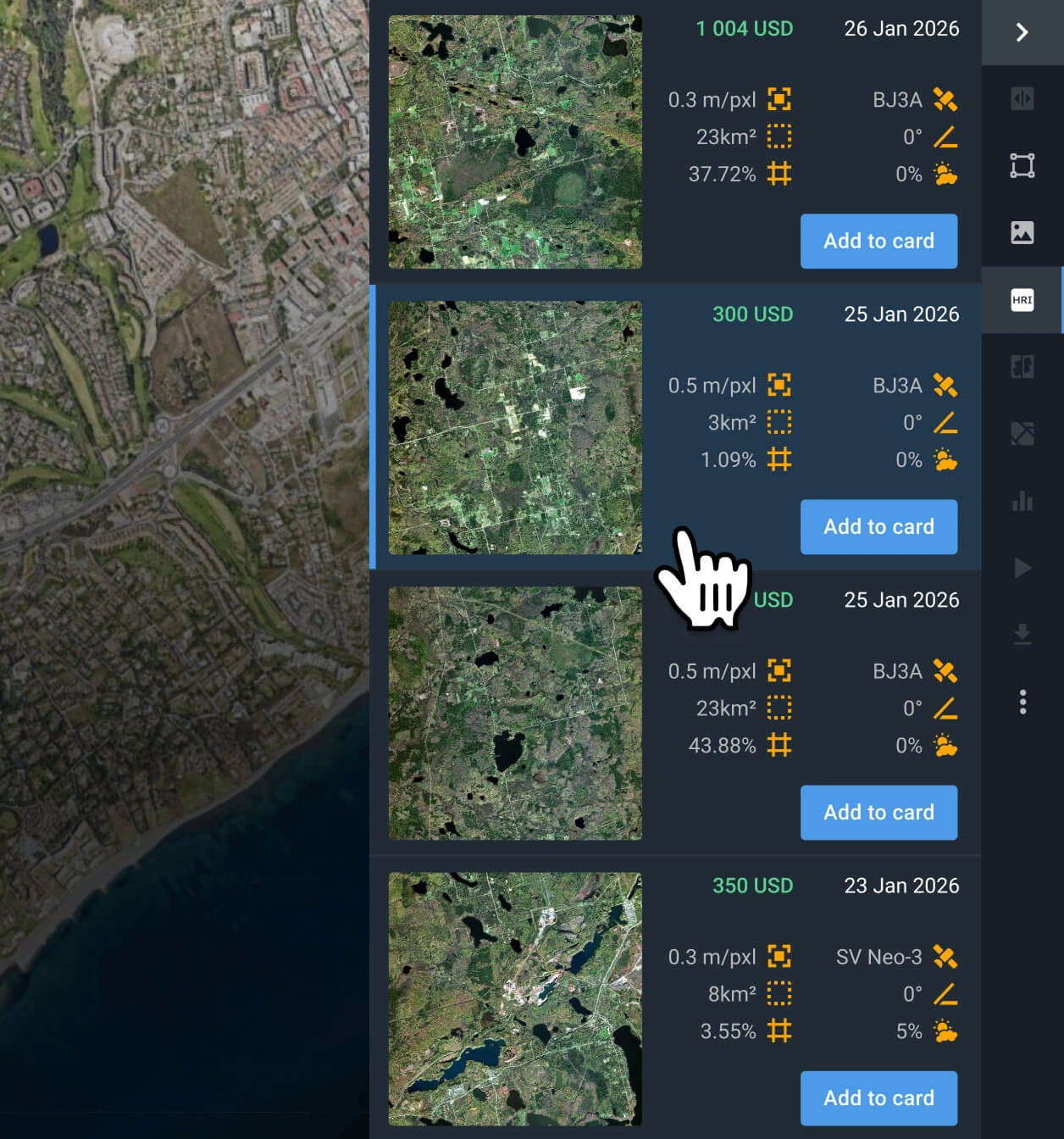
Choose the relevant image
Browse the resulting list of scenes. Check the data, review the cost, and choose the specific capture that best supports your operational needs.
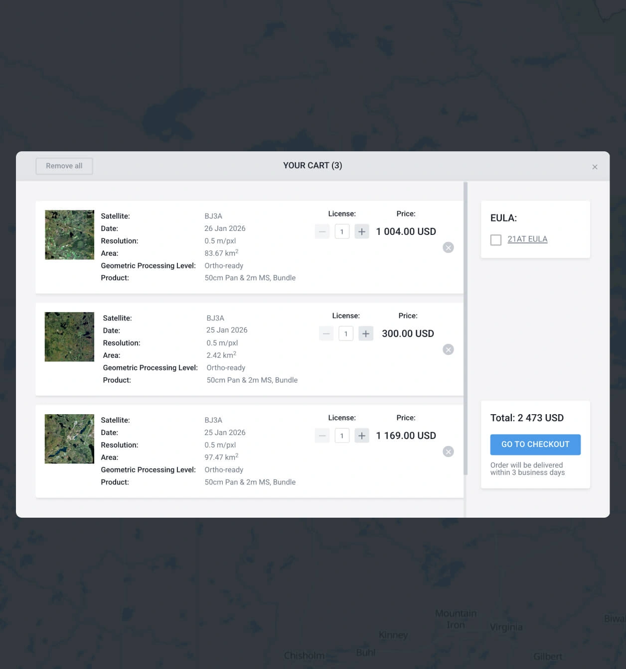
Add the scene and go to secure checkout
Place the selected item into your shopping cart. You can finalize the transaction online, or reach out to our sales representatives to arrange custom billing.
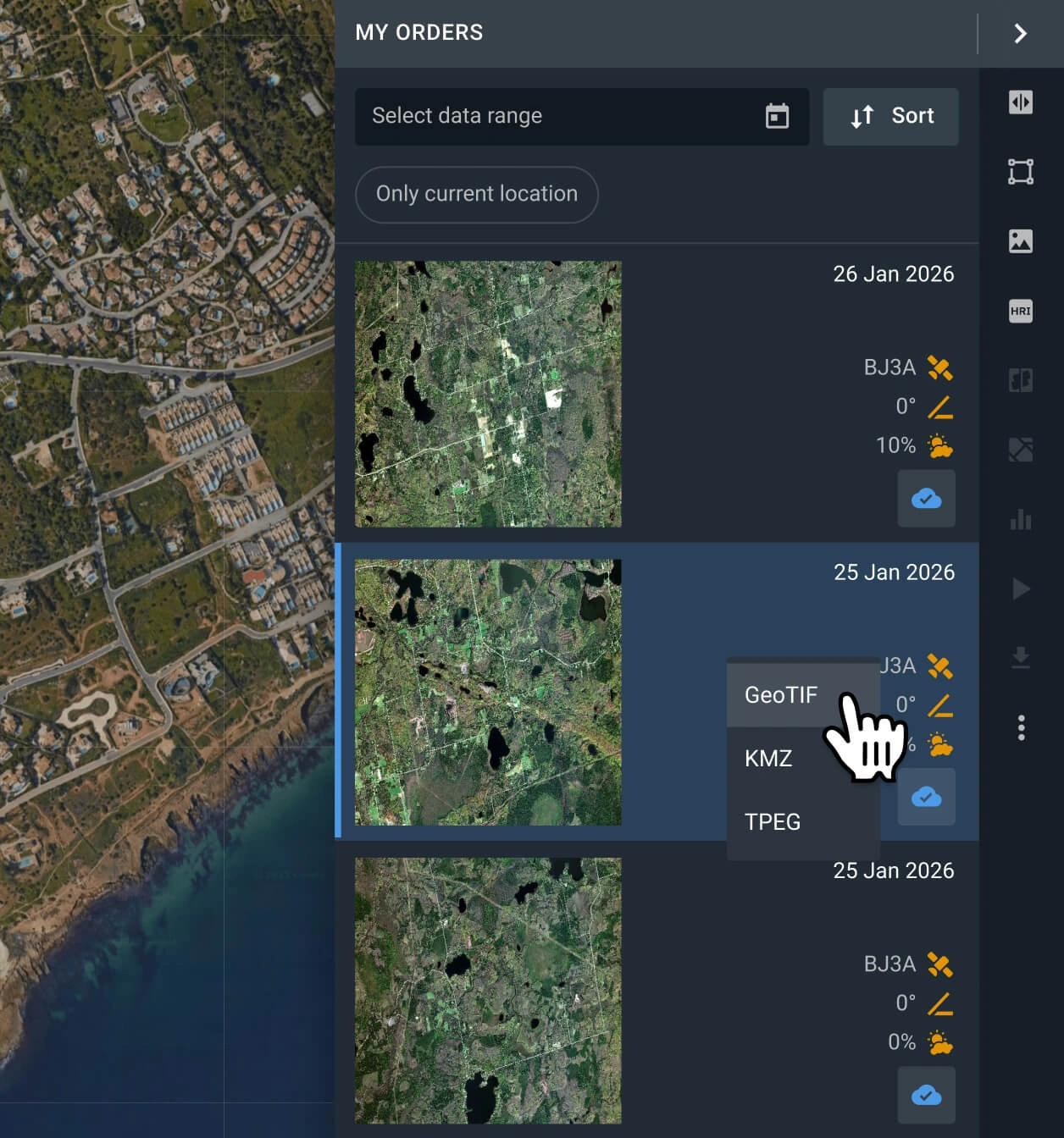
Download or analyze online
Your data will be available in LandViewer within 2 days. Export GeoTIFF, JPEG, KMZ files for tools like ArcGIS and QGIS, or use in-app bands and indices.
FAQ
How much does Gaofen 6 archive data cost?
You can access archived Gaofen 6 satellite imagery available from $1.70 per square kilometer. Please note that the minimum area of interest (AOI) required for purchase is 500 sq km.
Can I request new image tasking for Gaofen 6?
While direct tasking isn't available for the Gaofen 6 satellite, LandViewer provides tasking for newer satellites with faster revisit time and higher resolution: SuperView NEO-1, BJ3N, or BlackSky Gen 3.
What image processing levels come standard?
By default, all Gaofen 6 data is georeferenced and compatible with GIS software such as ArcGIS and QGIS. Should you require advanced processing, reach out to our support team - we can fulfill your requests in most scenarios.
Is it possible to set up continuous monitoring using Gaofen 6?
Yes! For long-term or regular monitoring of your target area with Gaofen 6, simply fill out the contact form on this page or reach out to our sales team, and we will arrange the setup for you quickly.
Do you offer extra spectral indices alongside the raw data?
Absolutely. When you purchase Gaofen 6 scenes, you automatically receive access to ready-to-use NDVI, NDWI, and Color Infrared analytics. Furthermore, our dedicated R&D team will help you create custom analytical solutions for your specific projects.
What level of detail can I expect with the Gaofen 6 resolution?
Thanks to the 2-meter Gaofen 6 resolution, you can distinguish specific surface features, individual small trees and shrubs, fences, road markings, and parked vehicles within your area of interest.
I need imagery immediately. Is emergency tasking an option?
Even though the Gaofen 6 satellite operates as an archive-only source, we offer standard, priority, and emergency tasking plans for our other active satellites. You can review pricing options in LandViewer or contact our sales department for expert guidance.
What are the most common use cases for Gaofen 6 images?
The most common use cases involve large-area land monitoring and ecological analysis. The satellite is frequently used to track forest coverage, evaluate vegetation distribution, and analyze landscape changes over time.


