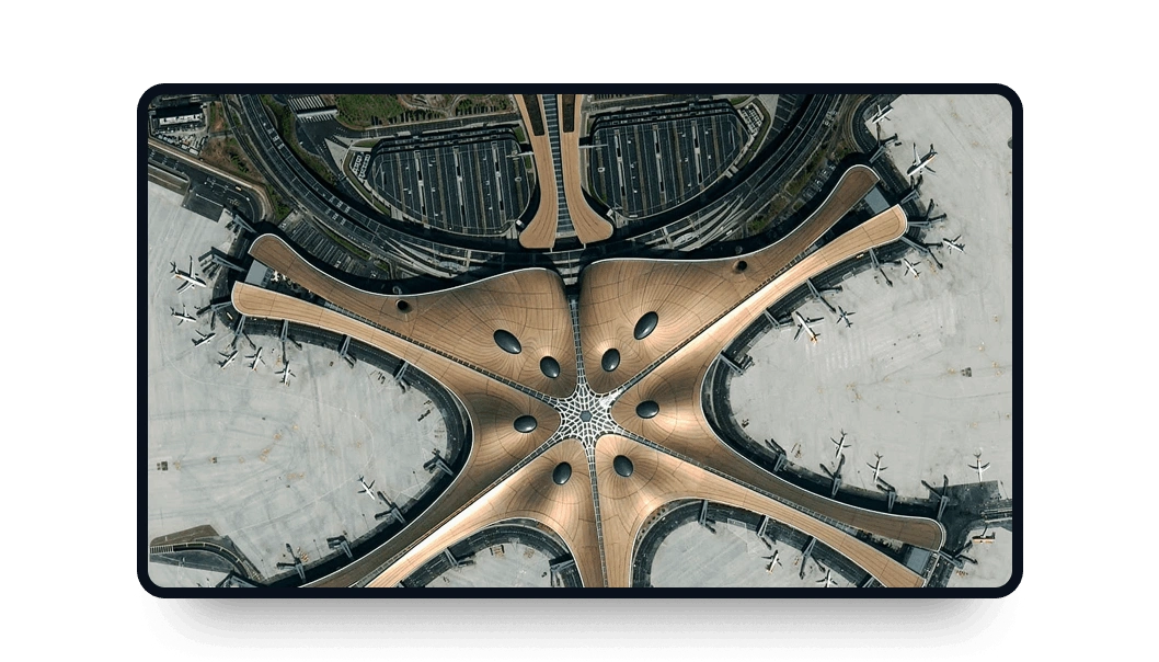
Gaofen 2 high-resolution images
Access the LandViewer platform to obtain Gaofen-2 high-definition images suitable for various purpose.
-
Data type
Optical
-
Resolution
0.8 m
-
Revision
5 days
-
Spectral bands
Panchromatic, Red, Green, Blue, NIR
-
Data archives
Archive since 2014
-
New Image Tasking
Not available

How to get the most out of the Gaofen 2 satellite with LandViewer
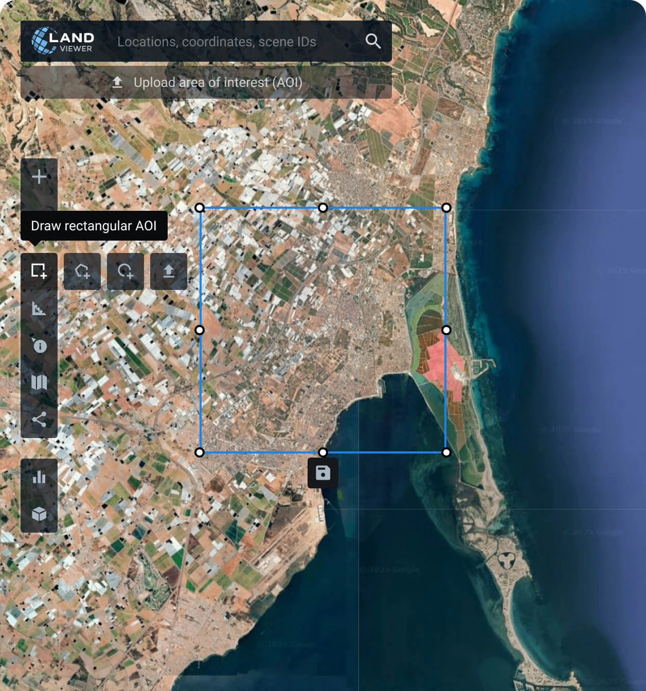
Establish your area of interest (AOI)
Define your AOI with one of the options available: search for a specific location, draw a polygon of the area, or upload a file from your device with the details.
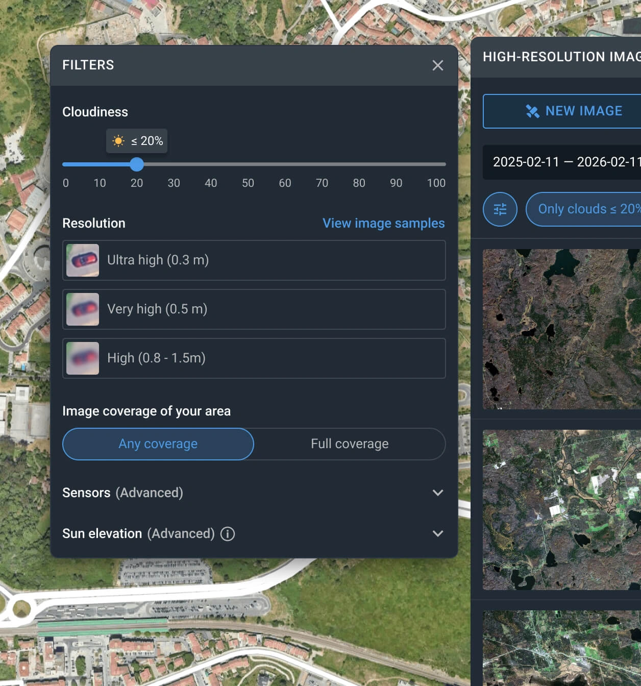
Apply filters to narrow down the search
Customize your search using filters like date range, resolution, sensor type, AOI coverage, and cloud level to quickly locate the most relevant Gaofen 2 captures.
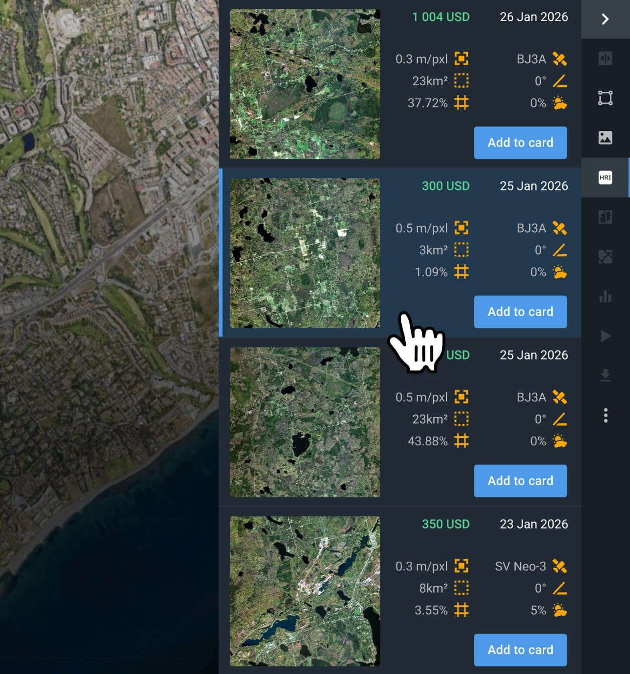
Select the most relevant captures
Browse the filtered results and review the pricing and other details for each option. Find the Gaofen 2 scenes that better fit your goal.
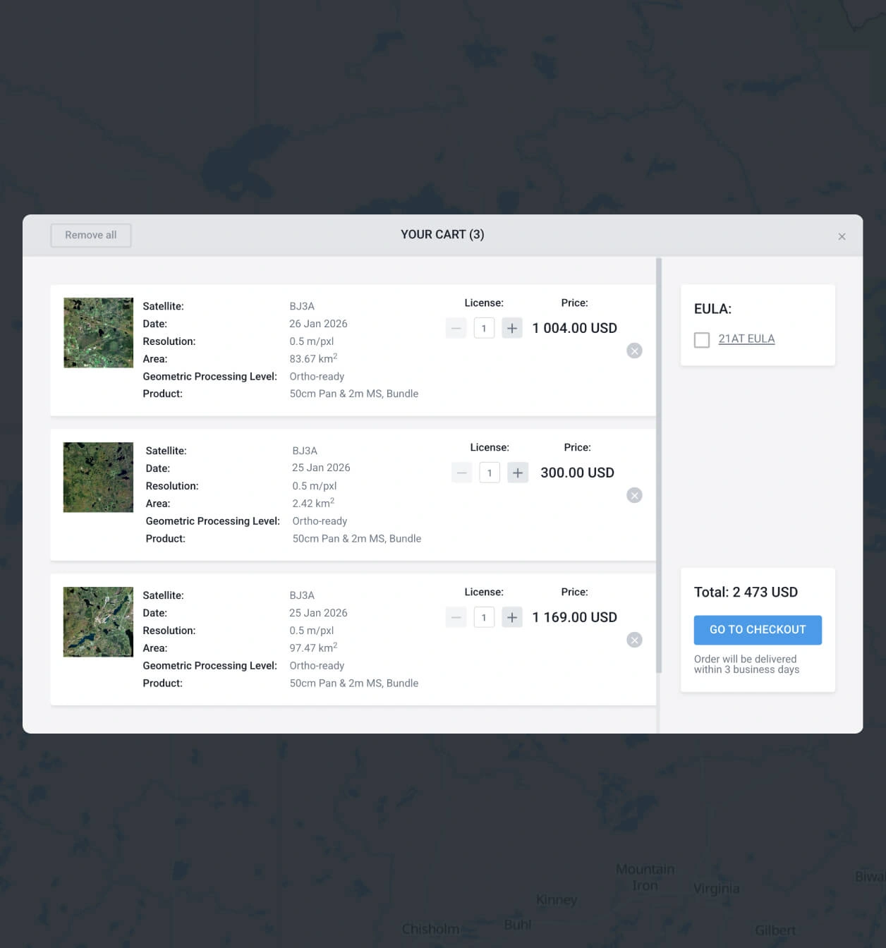
Add to the cart and make your order of Gaofen 2 data
Add as many images of Gaofen 2 as you need to the cart, and submit your order. You can purchase them yourself or reach our sales team to obtain your payment details.
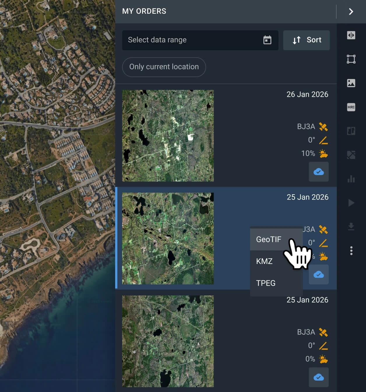
Conduct analysis on your recently purchased Gaofen 2 data or export it
Your captures will be available on the LandViewer platform within 2 days. You can run analysis on the platform, or export them in GeoTIFF, KMZ, or JPEG format.
FAQ
What is the cost of Gaofen 2 data?
When you buy Gaofen 2 images from our archive, the rate starts at $4.50 per square kilometer, with a minimum order requirement of 25 sq km.
Why is tasking unavailable for Gaofen 2?
LandViewer prioritizes tasking for the most advanced constellations in the market, with superior resolution and more frequent revisit times. To request a new capture from our premium sensors, such as BlackSky Gen 3, Beijing-3B (BJ3B), or SuperView NEO-1, visit our platform and submit a request.
What is the level of processing of Gaofen 2?
Every Gaofen 2 capture includes georeferenced data, which makes it easier to use in third-party software. like QGIS or ArcGIS. If you need advanced processing (i.e., orthorectification), please contact our support team, as we can provide it in most cases.
Can I establish a long-term monitoring program for my AOI using Gaogen 2 data?
Certainly. Please contact our sales team or complete the inquiry form on our website. Our specialists will reach out to you shortly to discuss your specific monitoring needs.
Is it possible to obtain a digital elevation map?
Yes, we accept custom orders for digital elevation maps generated with stereo images (images of the same location taken from different angles). You can contact our sales representatives or fill out the form on the website to obtain more information.
What should I do if I cannot find a suitable Gaofen 2 scene for my AOI?
LandViewer provides access to a diverse catalog of over 15 high-resolution satellites beyond Gaofen 2, including other modern satellites of the family like Gaofen 6 and Gaofen 7. We recommend using our platform filters to select your desired resolution and explore alternative imagery from other top-tier providers.
What are my options if I require a higher resolution?
For maximum clarity, we recommend exploring datasets from the following satellites: Beijing-3N (BJ3N), SuperView NEO-1, and BlackSky Gen 3. These sensors currently offer the highest resolution available on our platform.
What are the most common use cases for Gaofen 2 images?
These sub-meter-resolution images are well-suited for the analysis and mapping of land cover change, such as forest edge monitoring, agricultural field detection, regional road mapping, and suburban growth tracking.


