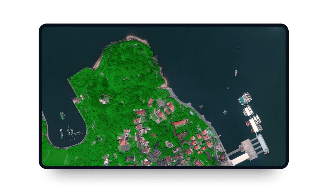
Gaofen 1 high-resolution images
Access the LandViewer platform to get Gaofen 1 imagery with medium resolution, suitable for various purposes.
-
Data type
Optical
-
Resolution
2 m
-
Revision
4 days
-
Spectral bands
Panchromatic, Red, Green, Blue, NIR
-
Data archives
Archive since 2013
-
New Image Tasking
Not available

How to get the most out of the Gaofen 1 satellite with LandViewer
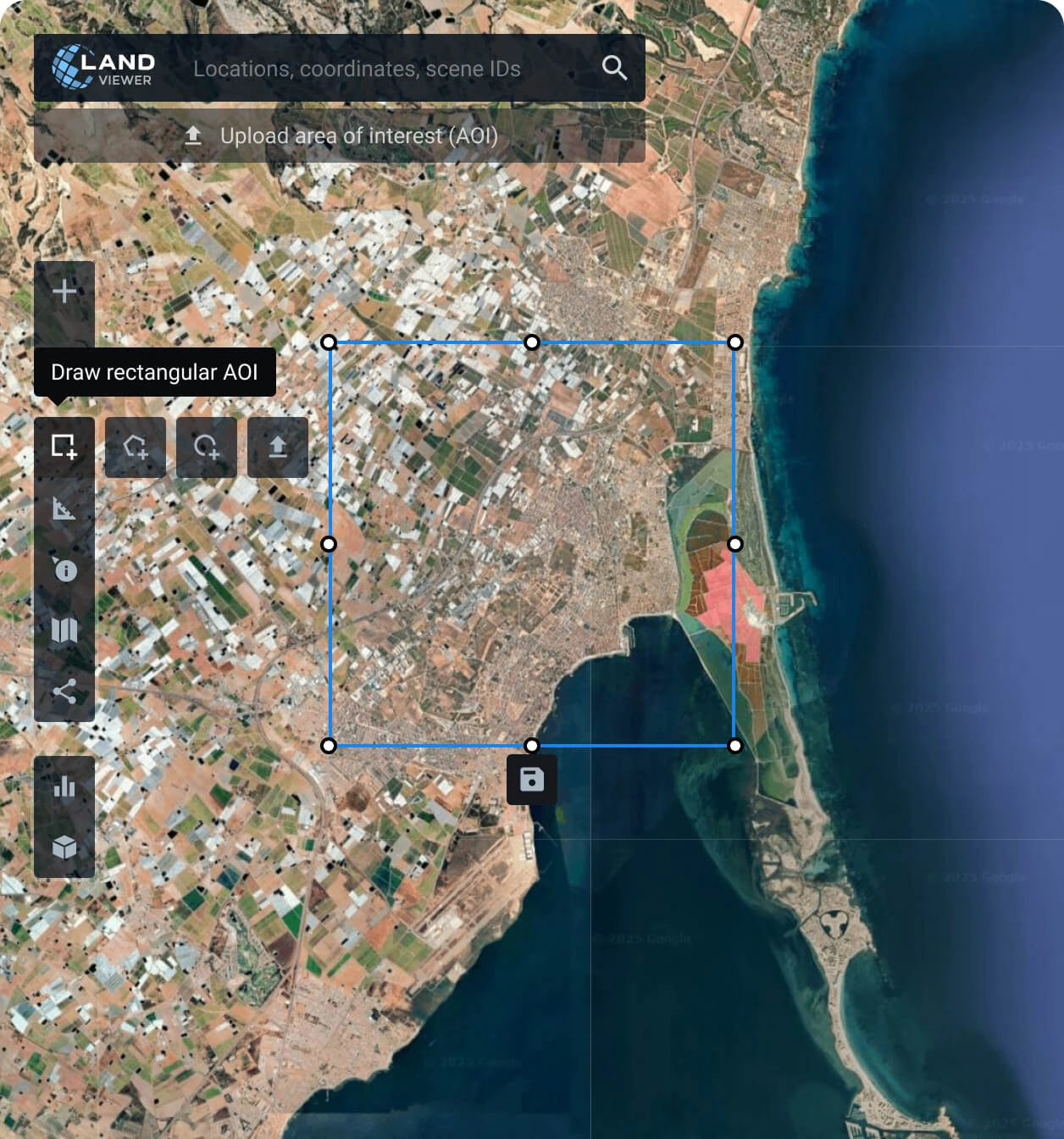
Set your AOI (area of interest)
It’s a simple step that can be done in several ways: searching for a location, drawing a polygon on the map, or uploading a file containing all the parameters needed.
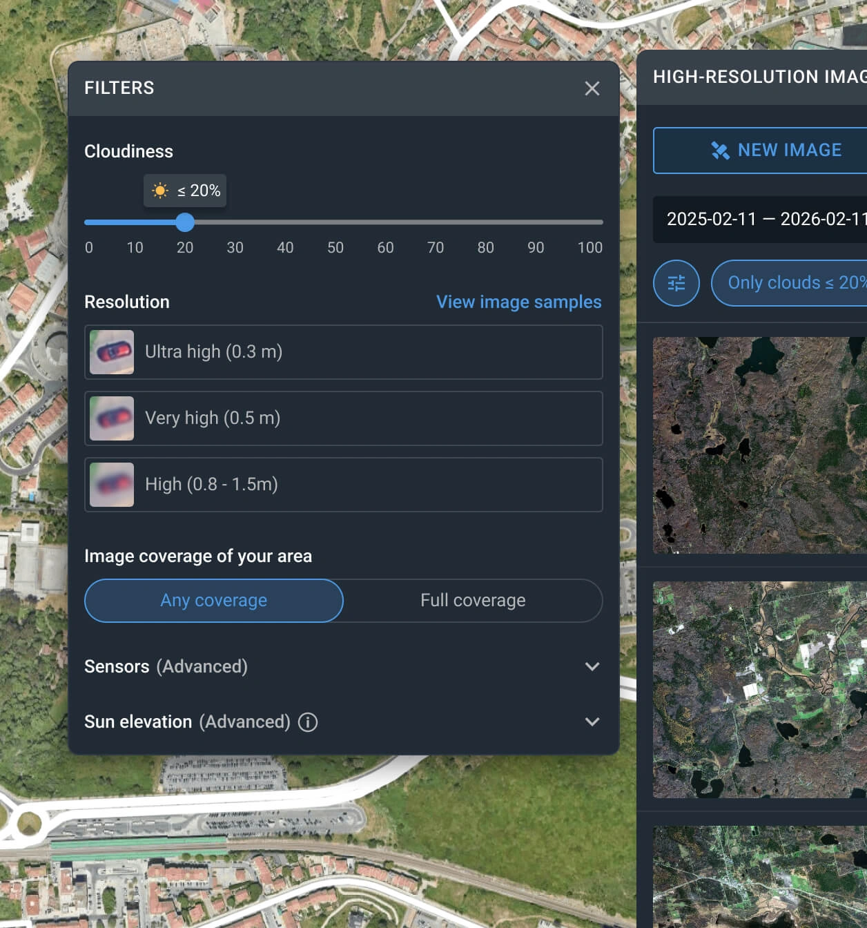
Apply the built-in filters for an advanced search of the GAOFEN 1 satellite imagery
Narrow down your search using one or more options, such as date, resolution, or AOI coverage.
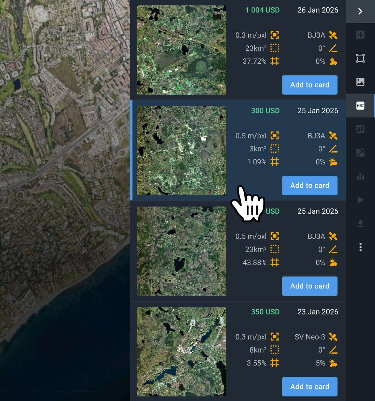
Select the most relevant scenes
Browse the filtered results and review the pricing and other details for each option. Find the Gaofen 1 image(s) that better fit your goal.
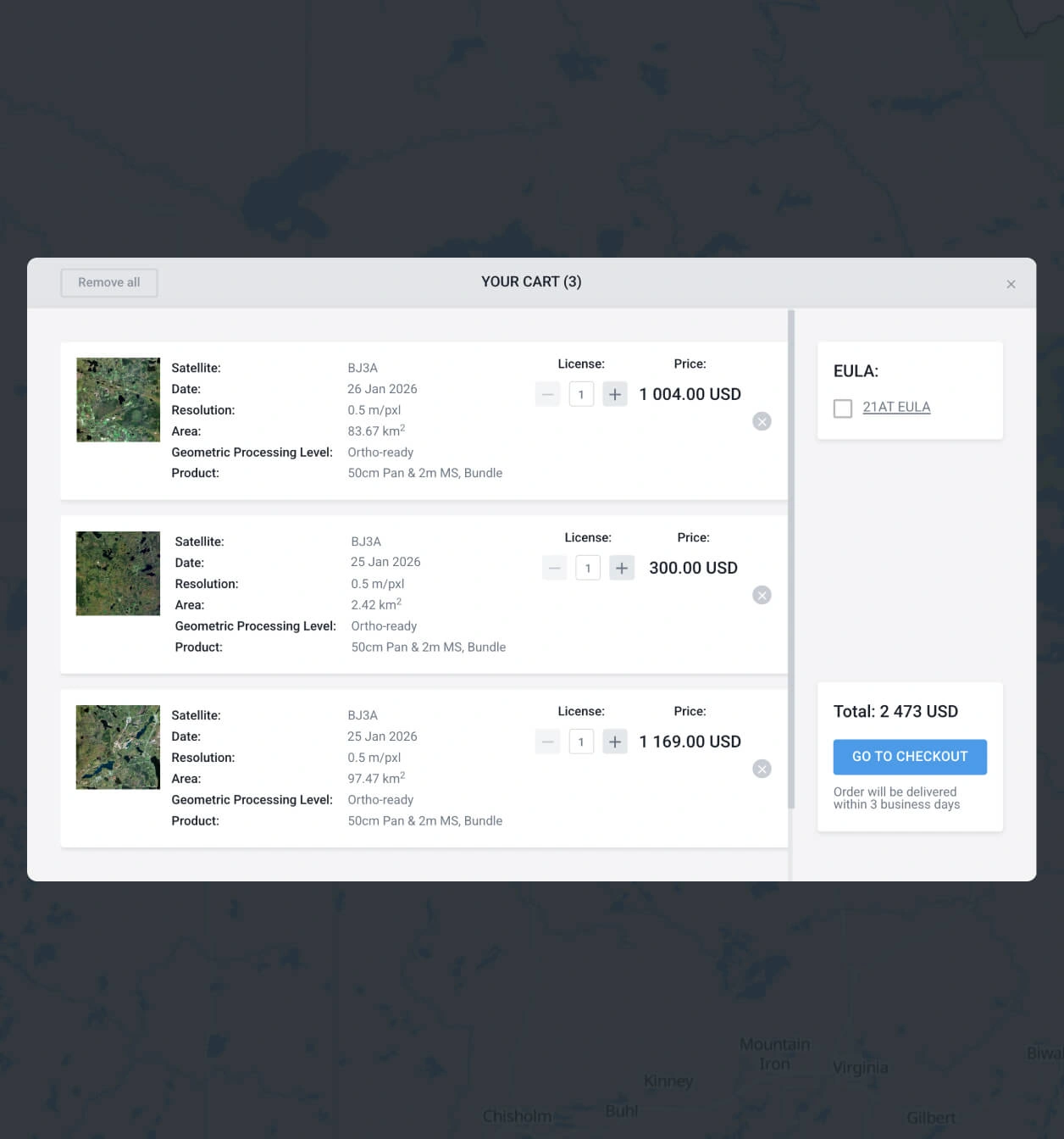
Add the Gaofen 1 images you want to the cart and purchase
Once you have found what you need, proceed to the cart and submit order. Purchase following the instructions, or contact our sales team to get your payment details.
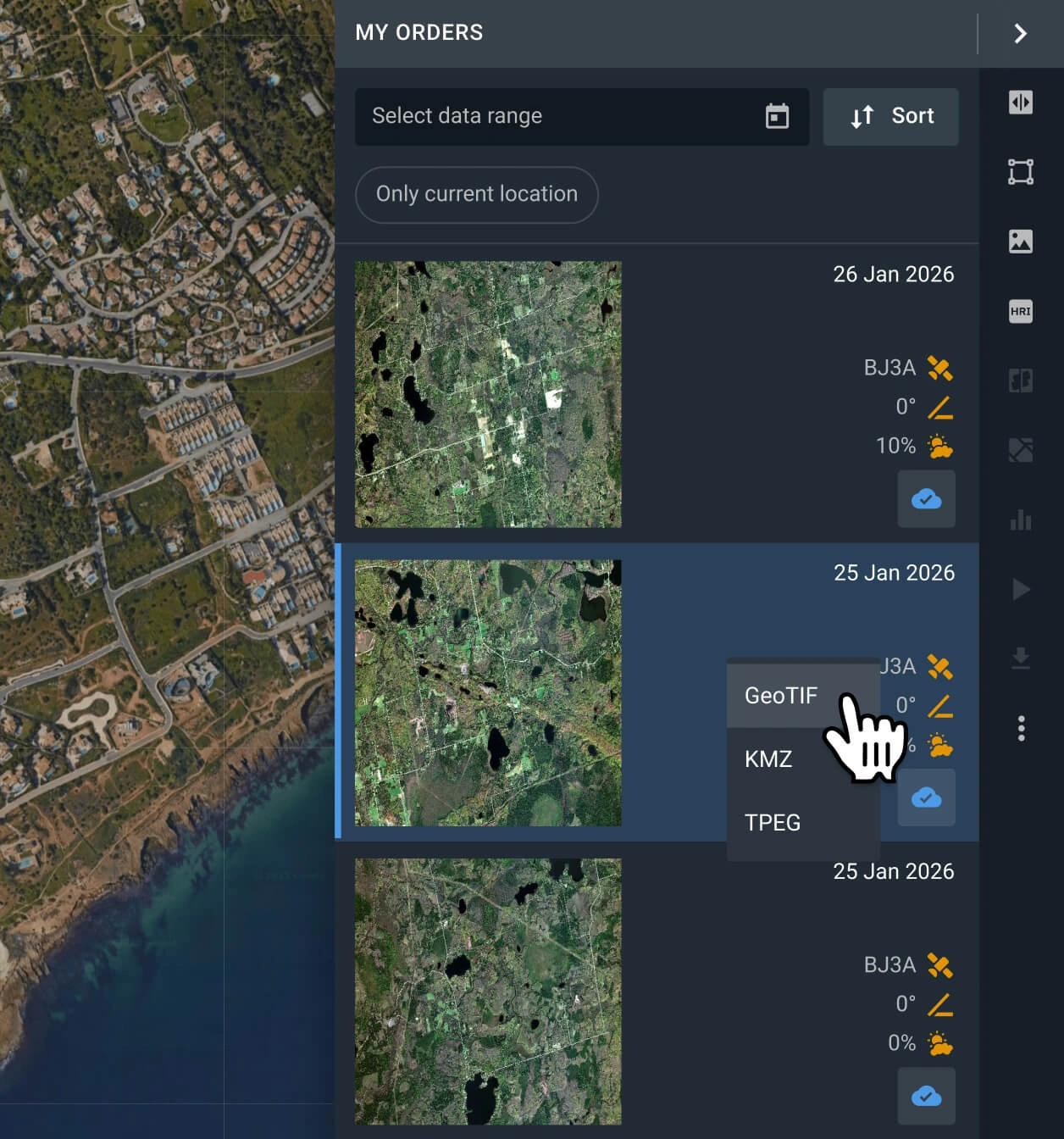
Start analyzing or exporting the data
Your order with Gaofen 1 data will be processed within 2 days. Analyze the data on the platform, or export it in multiple formats (GeoTIFF, KMZ, or JPEG).
FAQ
How much does a Gaofen 1 image cost?
Gaofen 1 archive images cost from $1.70 per sq km, and the area must be at least 500 sq km.
Why is tasking unavailable for Gaofen 1?
LandViewer prioritizes tasking for the most advanced constellations in the market, with superior resolution and more frequent revisit times. To request a new capture from our premium sensors, such as BlackSky Gen 3, Beijing-3N (BJ3N), or SuperView NEO-1, visit our platform and submit a request.
What is the level of processing of Gaofen 1?
Every Gaofen 1 scene includes georeferenced data, which makes it easier to use in third-party software. If you need advanced processing (i.e., orthorectification), please contact our support team, as we can provide it in most cases.
Does the Gaofen 1 satellite support a scheduled, regular monitoring of my AOI?
Yes, regular, long-term monitoring is possible once it's set up. To do it, please contact our sales department or fill out the contact form on our website, and our specialists will contact you.
Which industries typically utilize Gaofen 1 imagery?
Gaofen-1 data is widely adopted by industries requiring consistent Earth observation. It is essential for land-use transformation mapping and provides the foundational data needed for strategic territorial planning. Furthermore, environmental specialists rely on these datasets for ecological change detection, enabling precise analysis of long-term environmental dynamics.
How can I obtain data with even greater detail?
You can access superior detail by selecting scenes from other sources, such as Beijing-3B (BJ3B), SuperView NEO-1, or BlackSky Gen 3. These sensors offer the highest resolution in our catalog, ideal for precision-heavy applications.
What are the most common use cases for Gaofen 1 images?
Images from this satellite are most commonly used for disaster prevention and relief, as well as environmental and resource surveying, including land cover change, vegetation/forest monitoring, inland water quality, and mineral exploration.


