BlackSky Gen 3 high-resolution imagery
Access the LandViewer platform to get the latest BlackSky high-definition imagery from its third-generation satellite.
-
Data type
Optical
-
Resolution
0.35 m
-
Revision
15 times a day
-
Spectral bands
Panchromatic, Red, Green, Blue, SWIR
-
Data archives
Archive since 2023
-
New Image Tasking
Available

How to obtain BlackSky Gen-3 satellite data on LandViewer
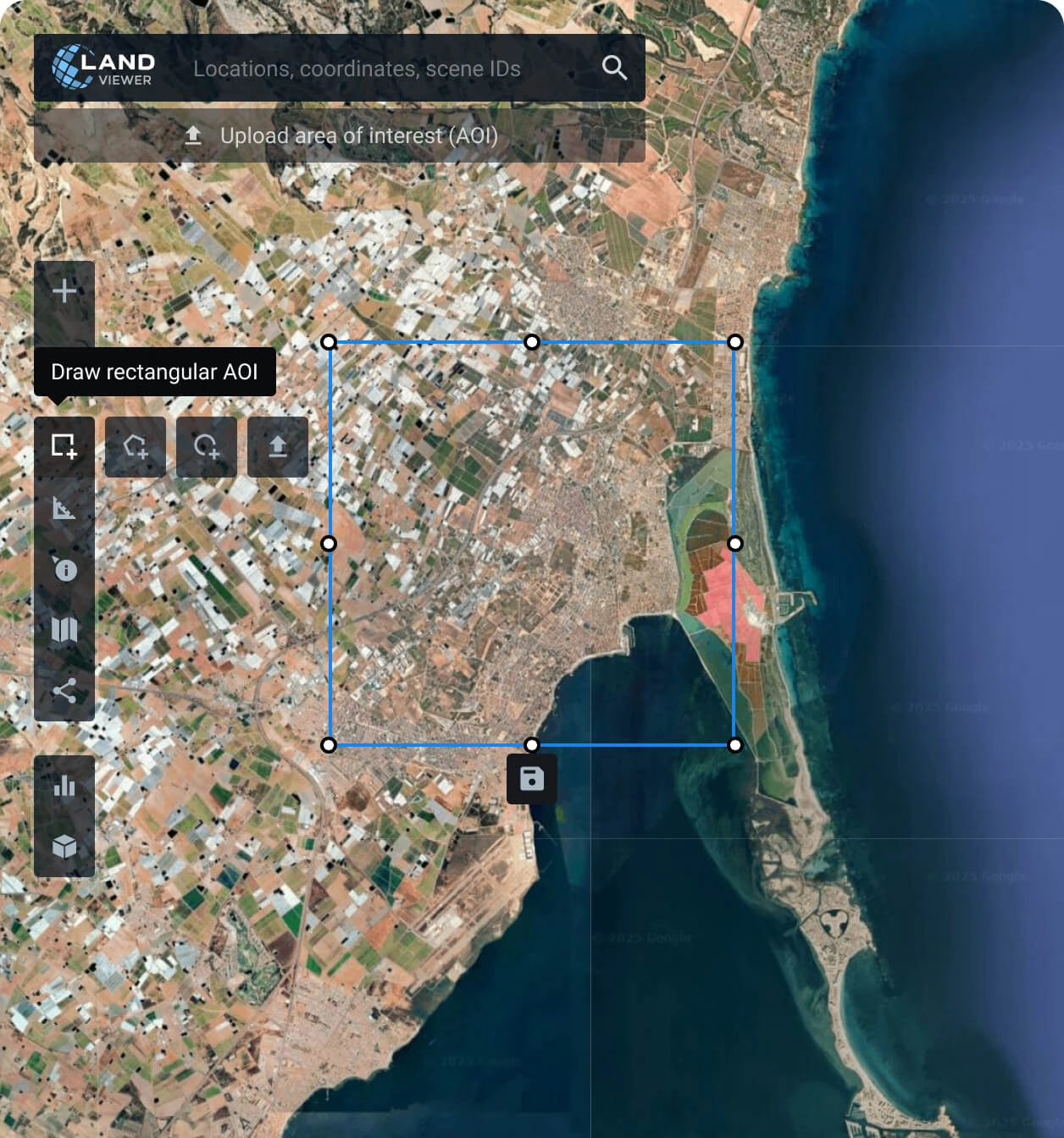
Establish your area of interest (AOI)
Define your AOI with one of the options available: search for a specific location, draw a polygon of the area, or upload a file from your device with the details.
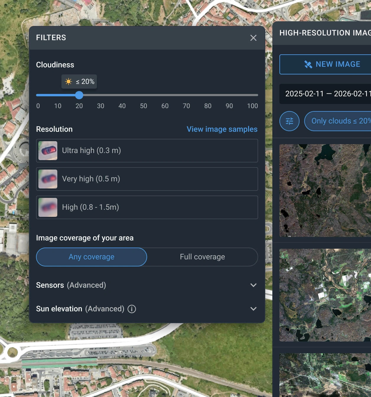
Apply the built-in filters for an advanced search
Narrow down your search using one or more options, such as date, resolution, or AOI coverage.
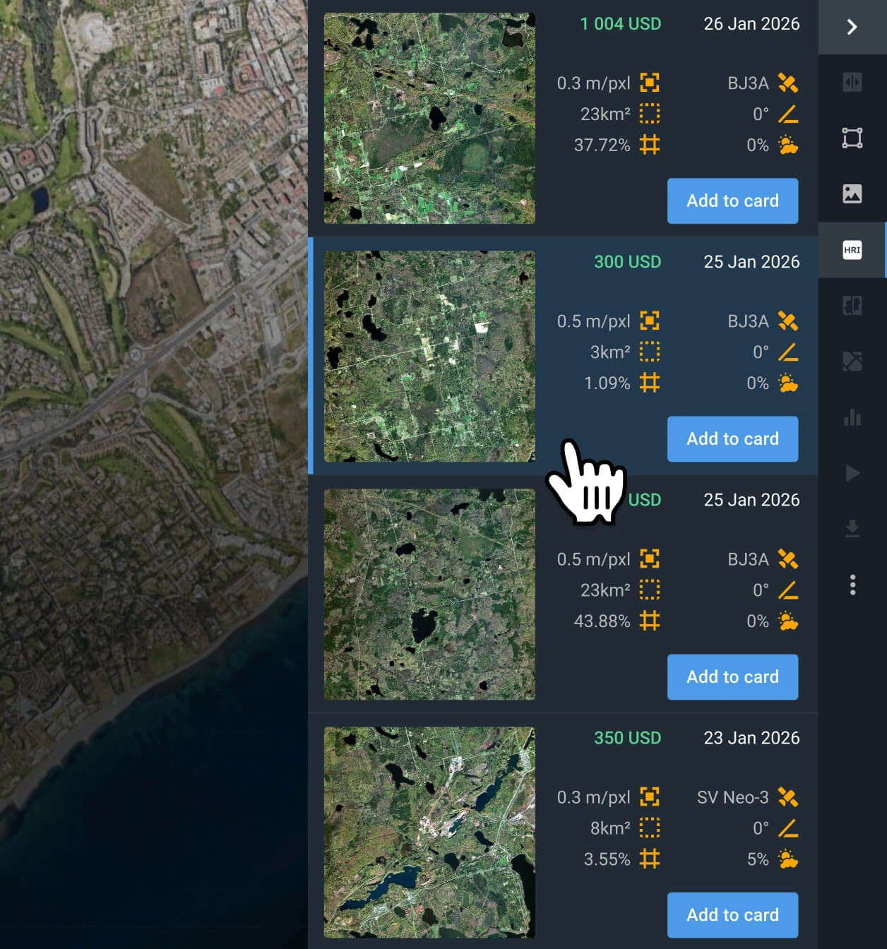
Select the Blacksky Gen-3 scenes that you need
Browse through the filtered results to find the most relevant captures for your case. Check the pricing and other details before selecting.
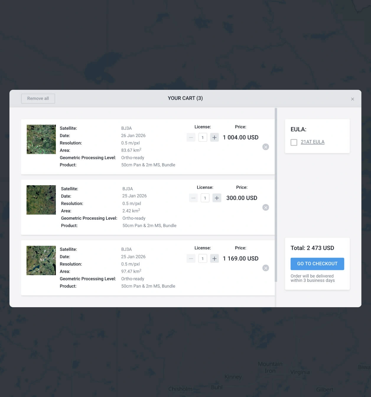
Add the BlackSky Gen-3 images you want to the cart and purchase
Once you have found what you need, add to the cart and submit your order. Purchase following the instructions, or contact our sales team to get your payment details.
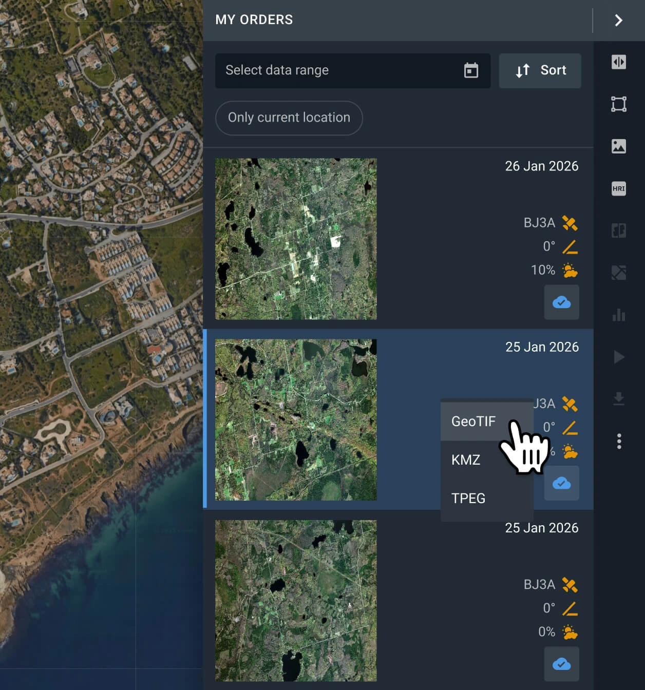
Export or analyze Blacksky Gen 3 satellite data
Your captures will be available on the LandViewer platform within 2 days. You can run analysis on the platform or export them in GeoTIFF, KMZ, or JPEG format.
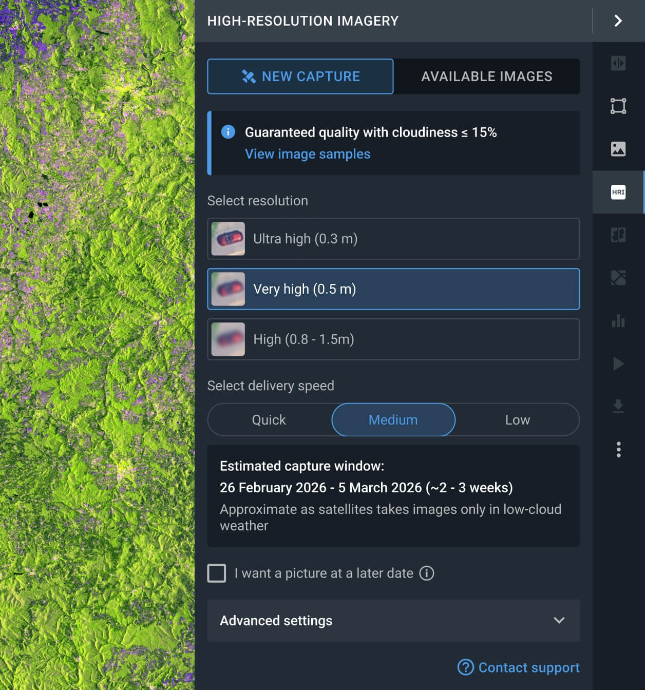
Request a new image
If the images available do not fit your goal, you can use the Tasking option to obtain a fresh image that meets your criteria.
FAQ
What is the pricing of the BlackSky Gen 3 imagery?
BlackSky imagery pricing is not established per km2, but per scene. When it is an archive scene, the price starts at $550. The pricing of the BlackSky satellite tasking option starts from $1100 per capture and depends on the requested area, with a minimum of 10 square kilometers.
How does the BlackSky Gen 3 tasking option work?
Access the LandViewer platform, navigate to the High-resolution imagery feature, and choose a new scene. After that, establish the resolution, delivery speed, and the AOI to be covered. Alternatively, you can fill out the form on our website or reach out to our sales team.
What is the level of processing of the BlackSky Gen 3 satellite?
All BlackSky Gen-3 satellite data is delivered georeferenced and fully compatible with third-party GIS platforms. Should your project require advanced processing, such as orthorectification, please contact our support team; we can accommodate these requirements in most instances.
Can I establish a long-term monitoring program for my AOI using BlackSky Gen 3?
Certainly. Please contact our sales team or complete the inquiry form on our website. Our specialists will reach out to you shortly to discuss your specific monitoring needs.
Is there a tasking service available when a new image is needed in very short advance?
Yes, there are 3 distinct tasking options (Standard, Priority, and Emergency), each tailored to different delivery timelines and budgets. You can select the plan that best fits your urgency through the LandViewer platform or contact our sales department for a detailed breakdown of each option.
What is the level of precision of BlackSky Gen 3 imagery?
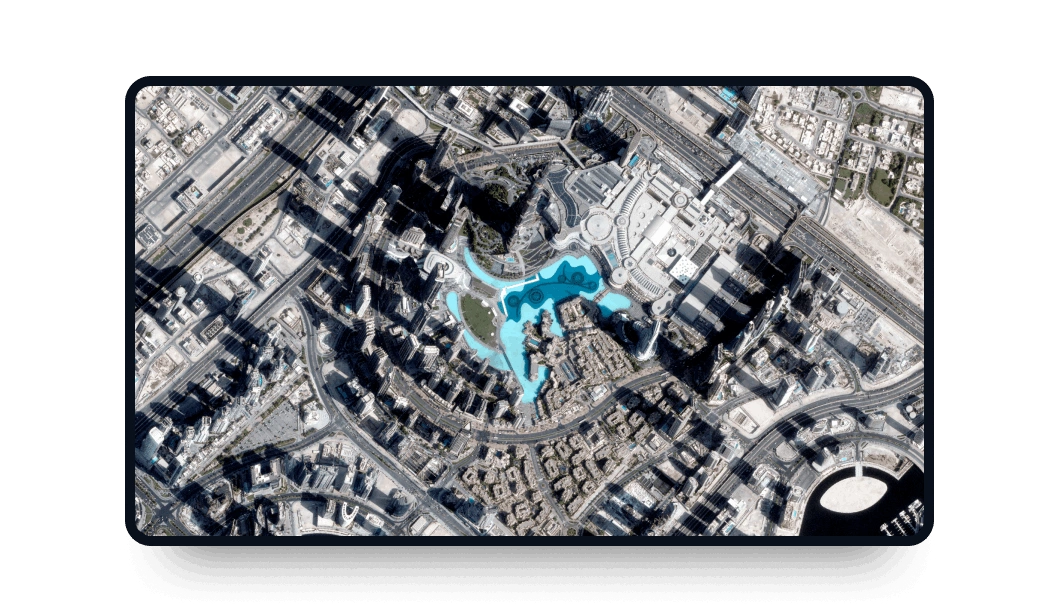
The very high resolution provided by BlackSky Gen-3 allows for the identification of small objects, such as small trees and bushes, fences, or parked cars.
What are the primary advantages of the BlackSky Gen 3 satellite?
High resolution and enhanced spectrum. BlackSky Gen-3 satellite offers 35 cm resolution for rich, detailed observations. Its sensors include shortwave infrared (SWIR) capabilities, enabling clear imaging through smoke, atmospheric haze, and challenging low-light conditions.
What are the most common use cases for BlackSky Gen 3 images?
This high-resolution imagery is most commonly used for risk- and time-sensitive tasks, such as real-time monitoring of air bases and vehicle movements, vessel tracking and port operations, and border surveillance.


