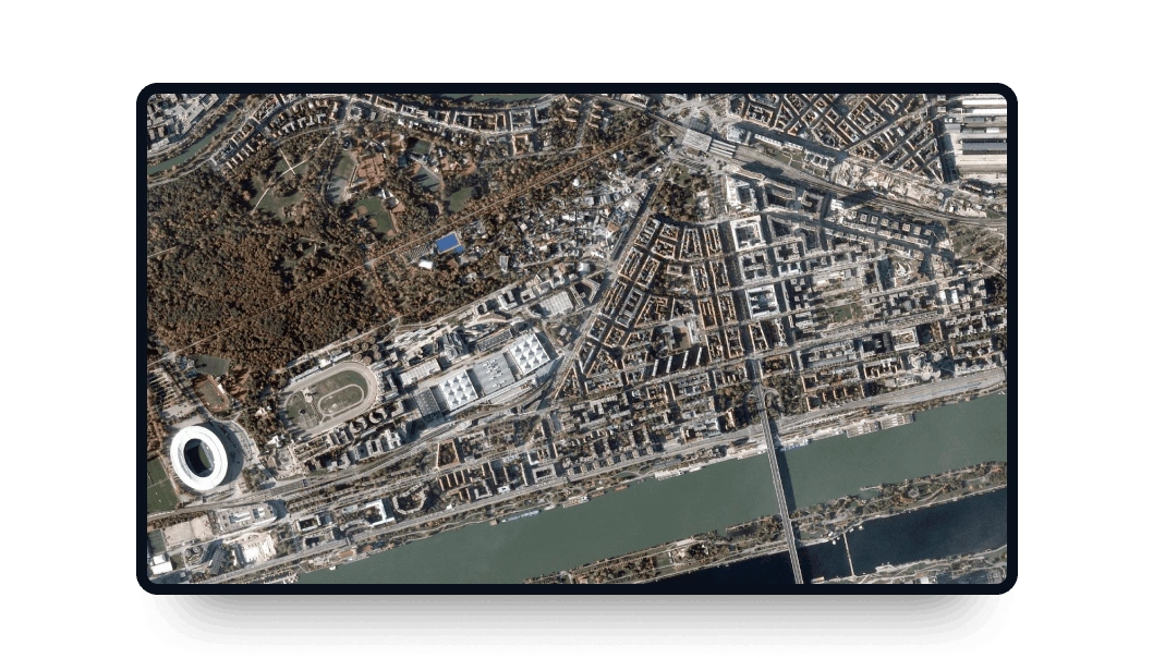
BlackSky Gen 2 high-resolution images
Explore LandViewer and get the BlackSky Gen 2 high-resolution imagery you need with several revisits per day.
-
Data type
Optical
-
Resolution
0.8-1.3 m
-
Revision
7 times a day
-
Spectral bands
Panchromatic, Red, Green, Blue
-
Data archives
Archive since 2020
-
New Image Tasking
Available

How to get the most out of BlackSky Gen 2 with LandViewer
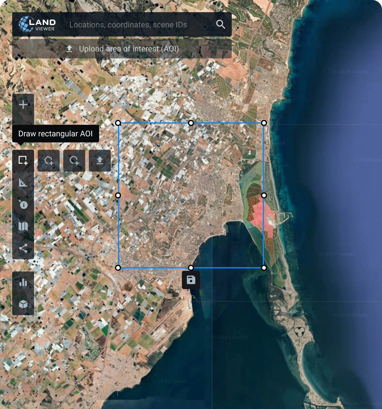
Establish your area of interest (AOI)
Define your AOI with one of the options available: search for a specific location, draw a polygon of the area, or upload a file from your device with the details.
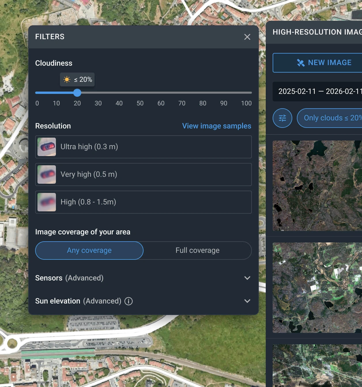
Apply filters to narrow down the search
Customize your search using filters like date range, resolution, sensor type, AOI coverage, and cloud level to quickly locate the most relevant satellite scenes.
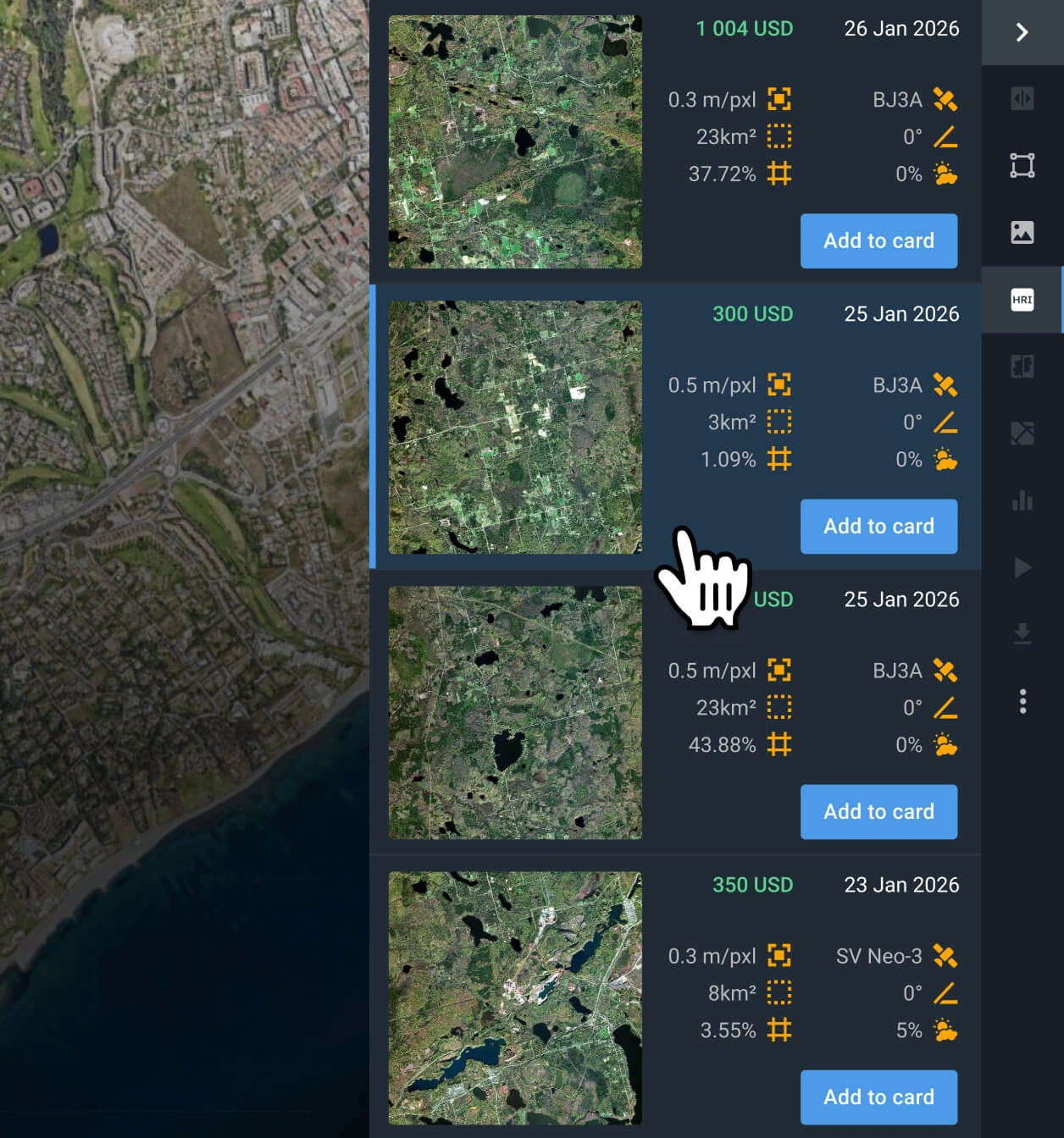
Select the most relevant images
Browse the filtered results and review the pricing and other details for each option. Find the BlackSky Gen 2 captures that better fit your goal.
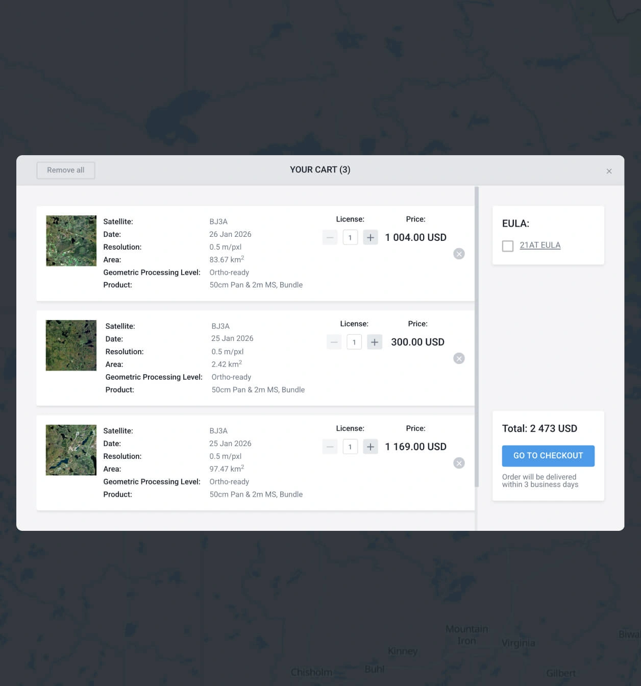
Add the BlackSky Gen 2 images you want to the cart and purchase
After you receive needed data, add it to the cart and submit your order. Purchase following the instructions, or contact our sales team to get your payment details.
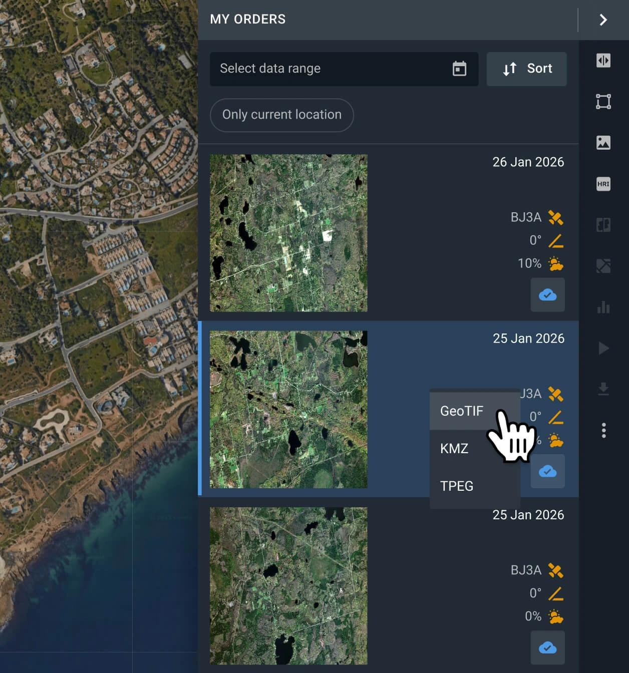
Start analyzing or exporting the data
Your order with BlackSky Gen 2 data will be processed within 2 days. Analyze the data on the platform, or export it in multiple formats (GeoTIFF, KMZ, or JPEG).
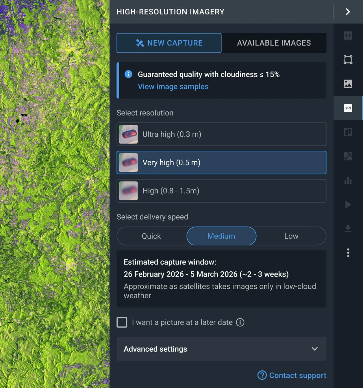
Request a new image
If the scenes available do not fit your goal, you can use the Tasking option to obtain a fresh satellite shot that capture your criteria.
FAQ
What is the cost of a BlackSky Gen 2 image?
Archived satellite scenes start at $120 per 1 scene (~25 square kilometers). New captures requested via the tasking option cost from $250 per scene.
What are the most common use cases for BlackSky Gen 2 imagery?
It is primarily used for high‑cadence monitoring of strategic sites such as ports, borders, industrial facilities, and military installations, where frequent revisits enable rapid change detection. Commercial applications like supply‑chain and logistics monitoring, construction and infrastructure tracking, insurance damage assessment, etc. are also common.
What are the main benefits of the BlackSky Gen 2 satellite?
BlackSky Gen 2 is defined by its high-frequency revisit rate, up to 7 times per day, and a highly flexible on-demand Tasking option. It's able to offer unparalleled temporal resolution for rapid change detection.
How can I task BlackSky Gen 2 for a specific area?
To schedule a new capture, please complete the inquiry form below, and our sales team will assist you. Alternatively, you can use the LandViewer platform: navigate to the "High-resolution imagery" feature, select the "New Image" tab, define your AOI, and choose your preferred resolution and delivery speed to place your tasking order.
What level of data processing is provided?
All BlackSky Gen 2 scenes are standard georeferenced, ensuring full compatibility with GIS software such as QGIS or ArcGIS. If your project requires advanced processing, such as orthorectification, please contact our support team, as we can provide these services in most instances.
Can I set up regular or long-term monitoring for my AOI using BlackSky Gen 2?
Yes, recurring monitoring is available. Please contact our sales department directly or submit the contact form on this page. Our specialists will reach out shortly to discuss your specific monitoring requirements.
Is additional analytics available beyond the raw data?
Certainly. For all purchased BlackSky Gen 2 imagery, we provide supplementary indices including NDVI and NDWI. Furthermore, our dedicated R&D department is available to build bespoke, advanced analytical solutions tailored to your unique project needs.
How can I obtain data with even greater detail?
You can access superior detail by selecting satellite captures from other sources, such as Beijing-3N (BJ3N), SuperView NEO-1, or BlackSky Gen 3. These sensors offer the highest resolution in our catalog, ideal for precision-heavy applications.


