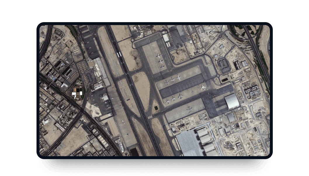
BJ3N high-resolution images
Explore LandViewer and access BJ3N satellite imagery (former BJ3B) with its very-high resolution, even better than BJ3A.
-
Data type
Optical
-
Resolution
0.3 m
-
Revision
5 days
-
Spectral bands
Panchromatic, Red, Green, Blue, NIR
-
Data archives
Archive since 2024
-
New Image Tasking
Available

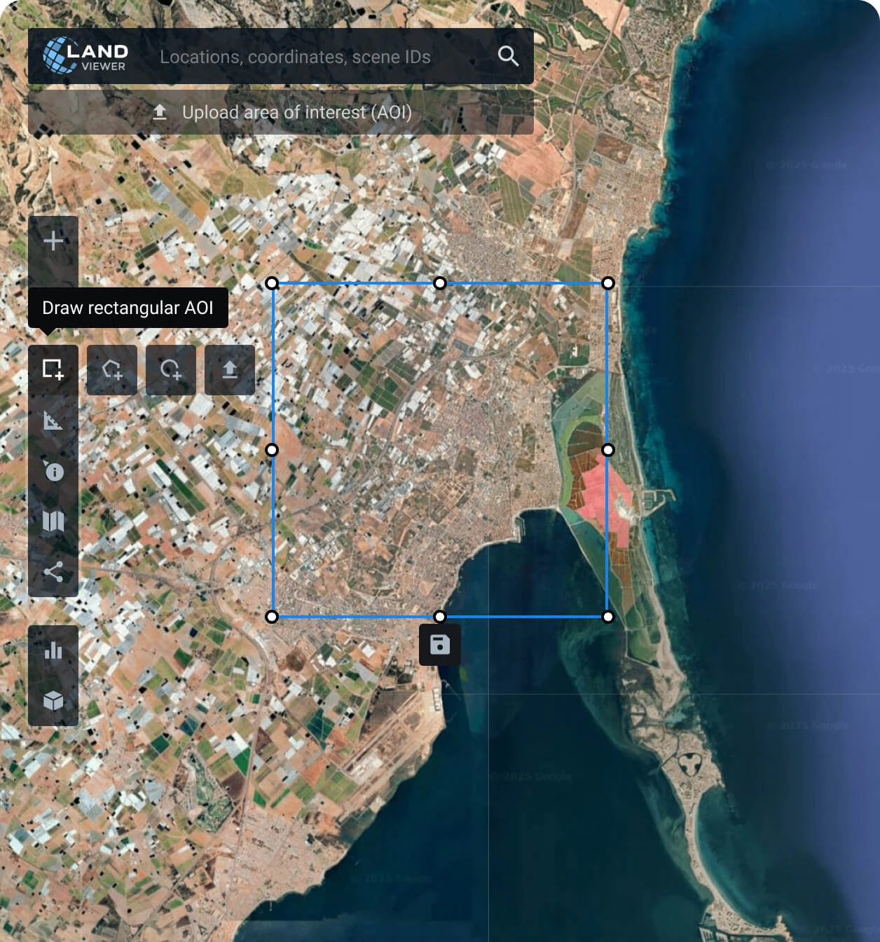
How to obtain scenes from the BJ3N satellite on LandViewer
Specify your area of interest (AOI)
Set your target area: manually draw a polygon, search for a location, or upload your file to find the perfect coverage.
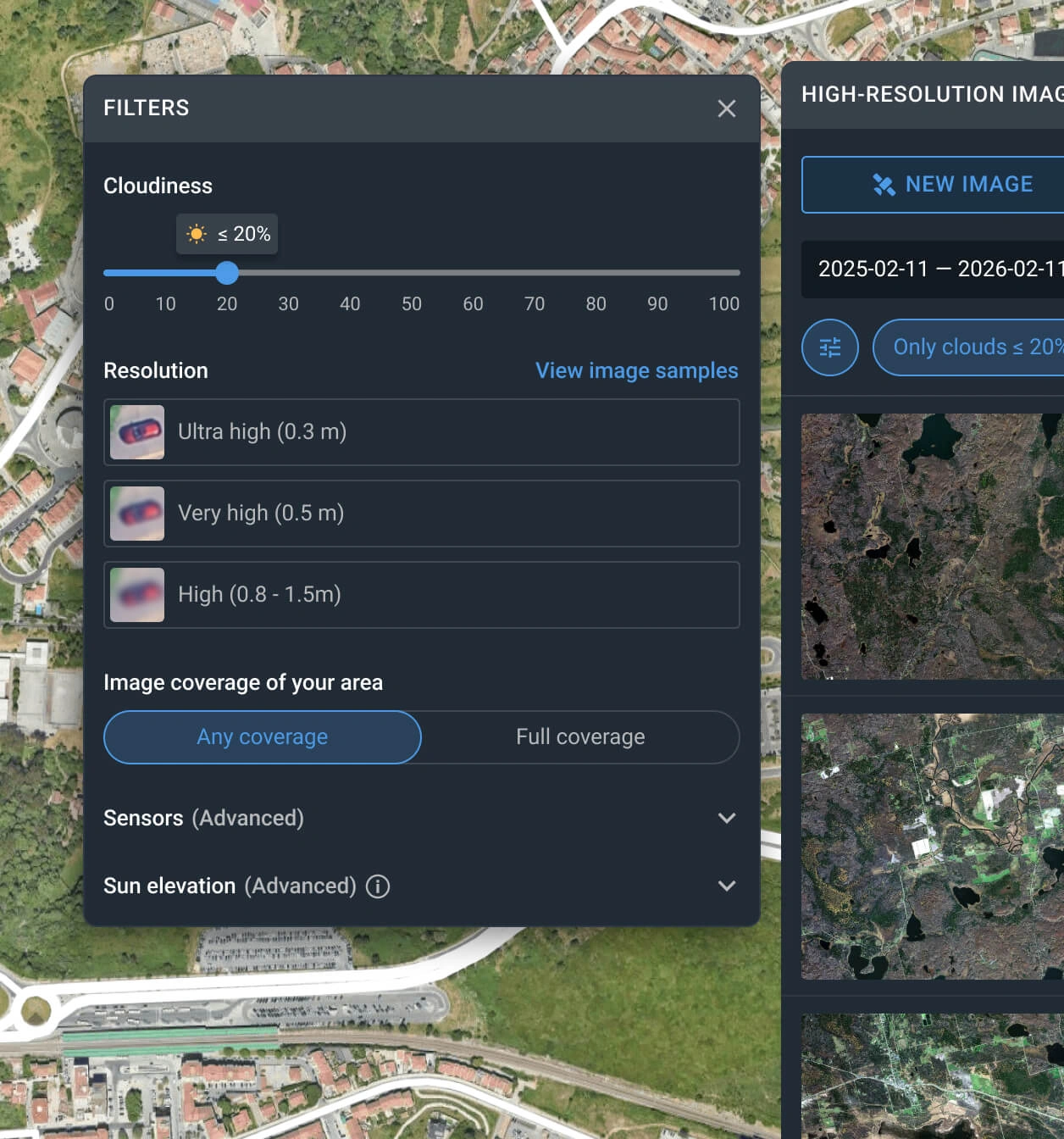
Use the filters to narrow down the search
Apply one or more filters, such as resolution, date, or cloud coverage, to find the Beijing-3N captures that best match your needs.
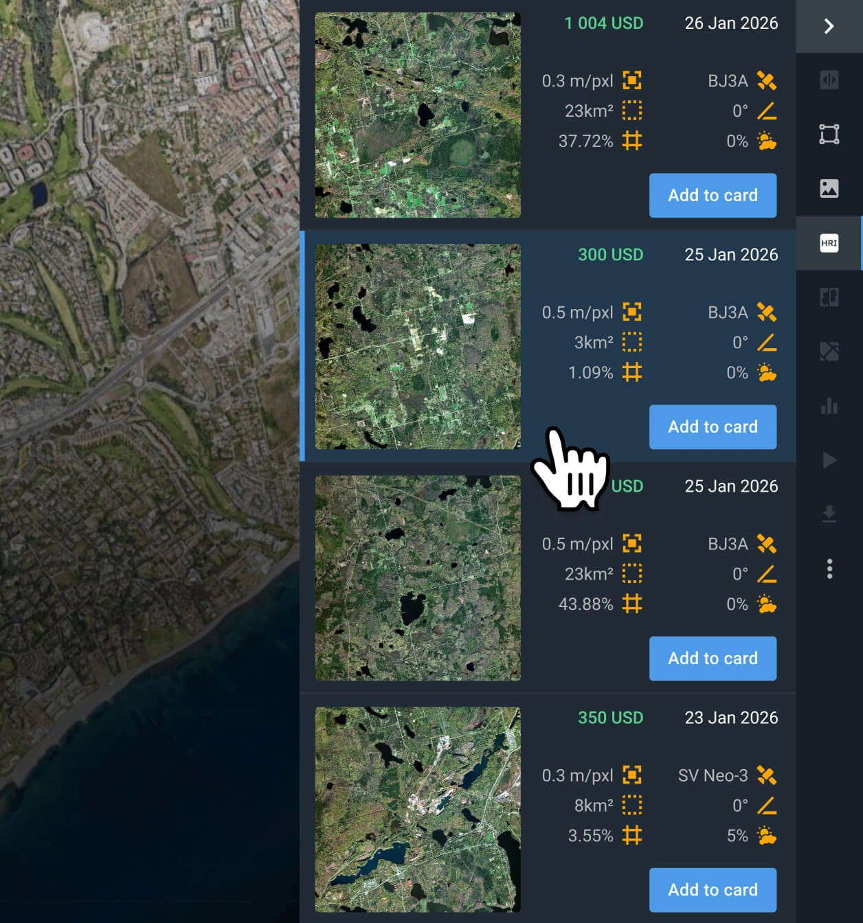
Select the most relevant image(s)
Browse the filtered results and review the pricing and other details for each option. Find the Beijing-3N data that better fit your goal.
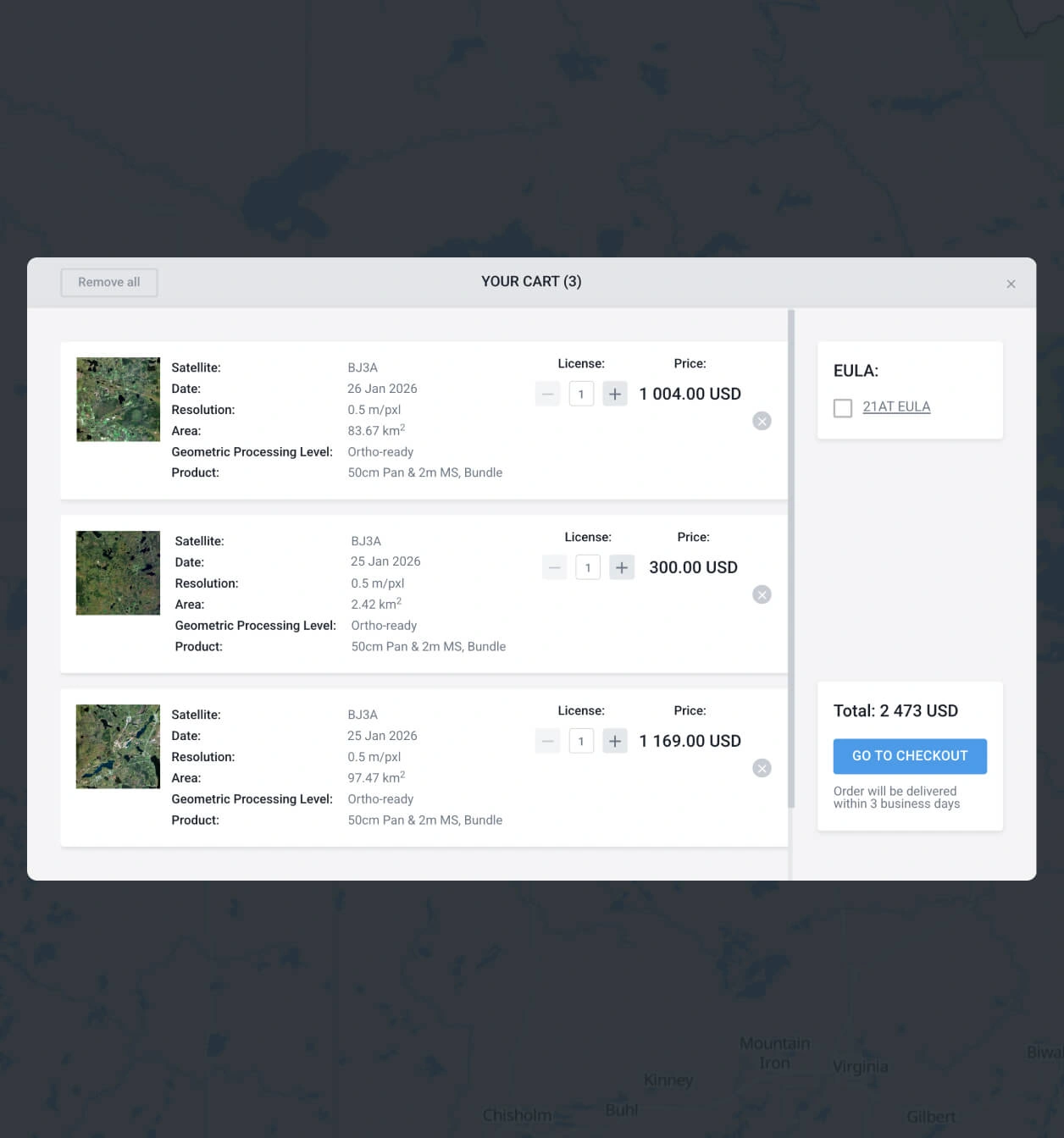
Add to the cart and make your order of BJ3N images
Add Beijing-3N satellite scenes to the cart, then submit your order. You can purchase them yourself or reach our sales team to obtain your payment details.
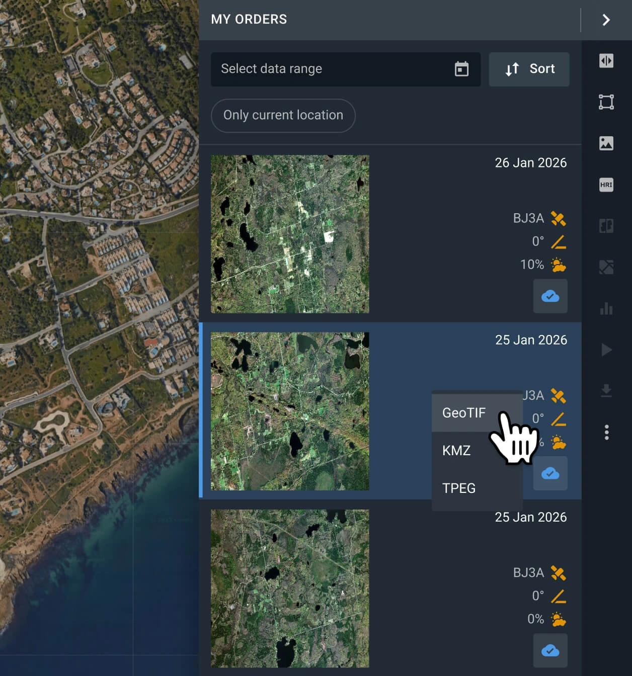
Conduct analysis on your recently purchased BJ3N data or export it
Your captures will be available on the LandViewer platform within 2 days. You can run analyses on the platform or export them in GeoTIFF, KMZ, or JPEG format.
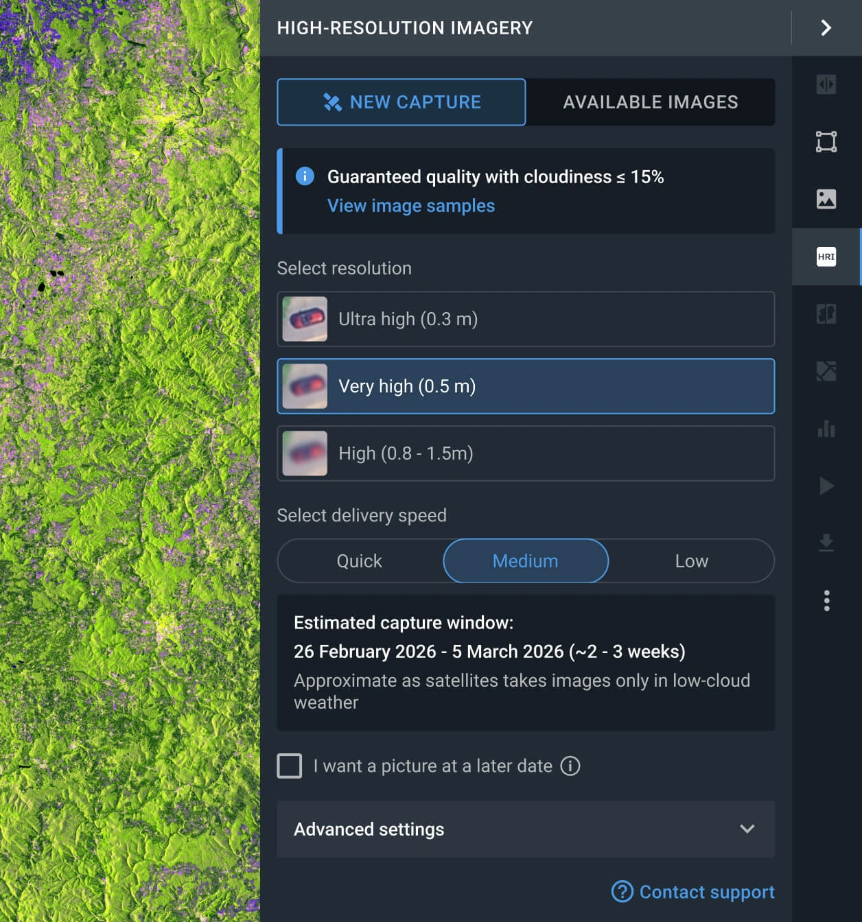
Request a new image with the tasking option
If the available scenes do not meet your requirements, you can use the Tasking option to request fresh data from Beijing-3B satellite that does.
FAQ
What is the cost of BJ3N data?
Archived Beijing-3N images start at $16 per sq km, with a minimum area of 15 square kilometers. New images requested via the tasking option cost from $24 per sq km, with a minimum area of 50 square kilometers.
What are the most common use cases for BJ3N images?
This imagery is most commonly used for land resource management, construction tracking and planning, urban change comparison, and infrastructure monitoring because its 0.3m resolution allows detecting individual objects like vehicles, buildings, and field boundaries.
How do I task Beijing-3N for my specific area?
To order tasking, simply fill out the contact form below, and our sales team will assist you. Alternatively, go to the LandViewer platform, open the "New Image" tab in the High-resolution imagery section, select your desired resolution and delivery speed, and place the order for your AOI.
What is the level of processing of BJ3N?
Every Beijing-3N capture includes georeferenced data, which makes it easier to use in third-party software. If you need advanced processing (i.e., orthorectification), please contact our support team, as we can provide it in most cases.
Can I set a regular monitoring program for my AOI using Beijing-3N?
Yes, you can. Get in touch with our sales representatives or fill out the inquiry form on our website. Our specialists will contact you to discuss your specific needs.
Is it possible to receive additional analysis alongside the raw BJ3N satellite data?
Yes. For all purchased data, you will receive integrated analytics, including NDVI and NDWI indices. Furthermore, our dedicated R&D department is available to collaborate on bespoke projects and engineer advanced analytical solutions tailored to your specific requirements.
What are the primary advantages of the BJ3N satellite?
The Beijing-3N satellite delivers high-precision 2D and 3D geospatial datasets designed for critical applications across multiple industries. It serves as a vital tool for environmental monitoring, urban planning, and oil & gas operations, while also providing the granular detail necessary for modern agriculture and land resource management.
Is it possible to obtain a digital elevation map?
Yes, we accept custom orders for digital elevation maps generated from stereo images (images of the same location taken from different angles). You can contact our sales representatives or fill out the form on the page to obtain more information.


