BJ3A high-resolution images
Easily access the high-resolution imagery offered by the Beijing-3A (BJ3A) satellite via the LandViewer platform.
-
Data type
Optical
-
Resolution
0.5 m
-
Revision
4 days
-
Spectral bands
Panchromatic, Red, Green, Blue, NIR
-
Data archives
Archive since 2024
-
New Image Tasking
Available

How to get the most out of the BJ3A satellite with LandViewer
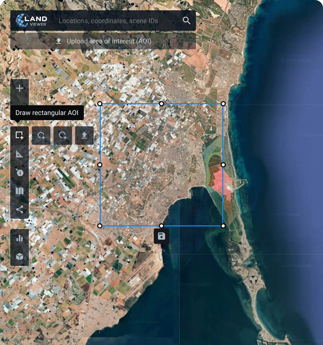
Set your AOI (area of interest)
There are different ways to do it: searching for a location, drawing a polygon on the map, or uploading a file from your device containing the area's parameters.
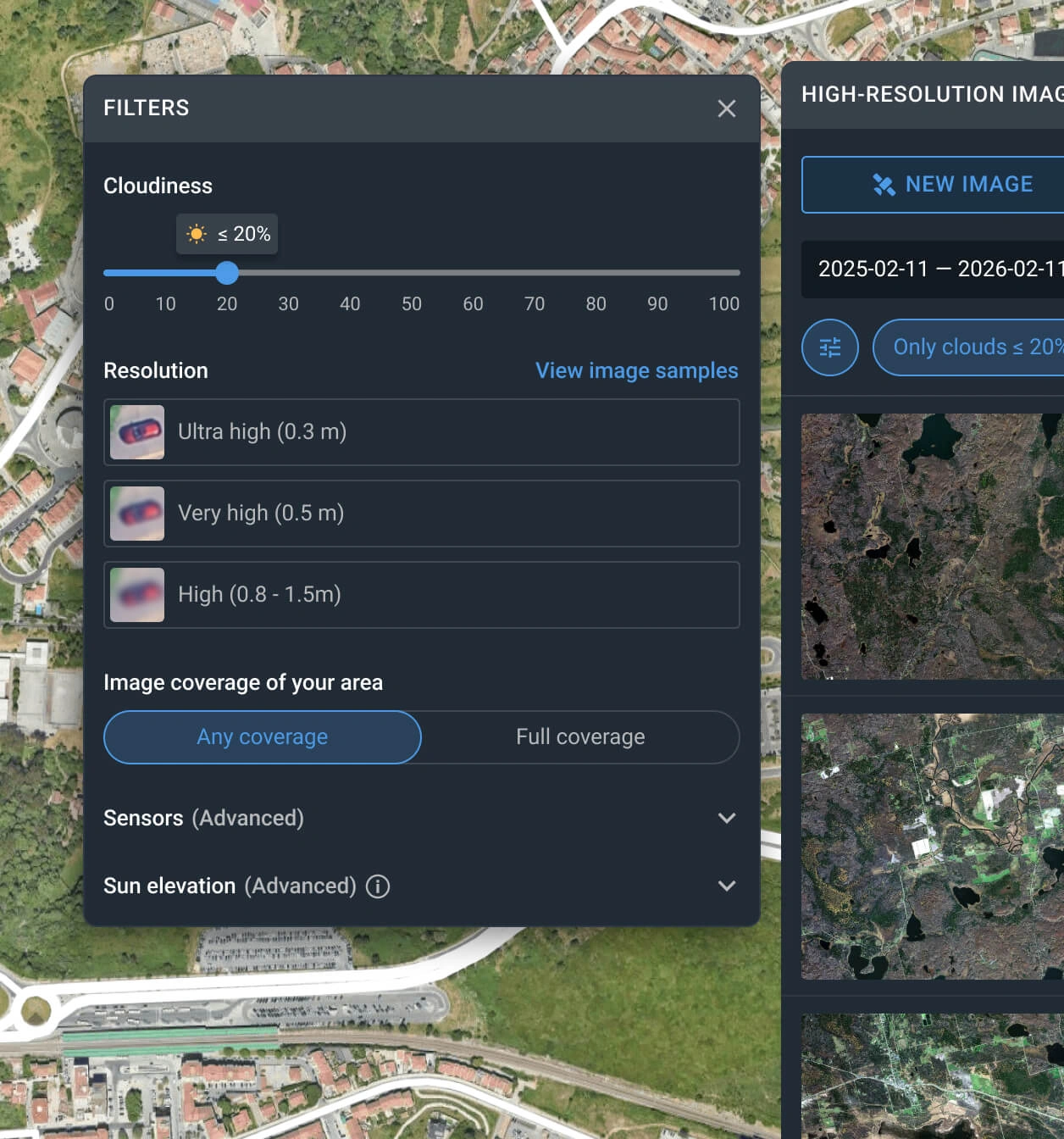
Apply the filters to reduce the number of BJ3A images
The filter can be used with one or more conditions, such as date, resolution, sensor, cloud coverage, and AOI coverage.
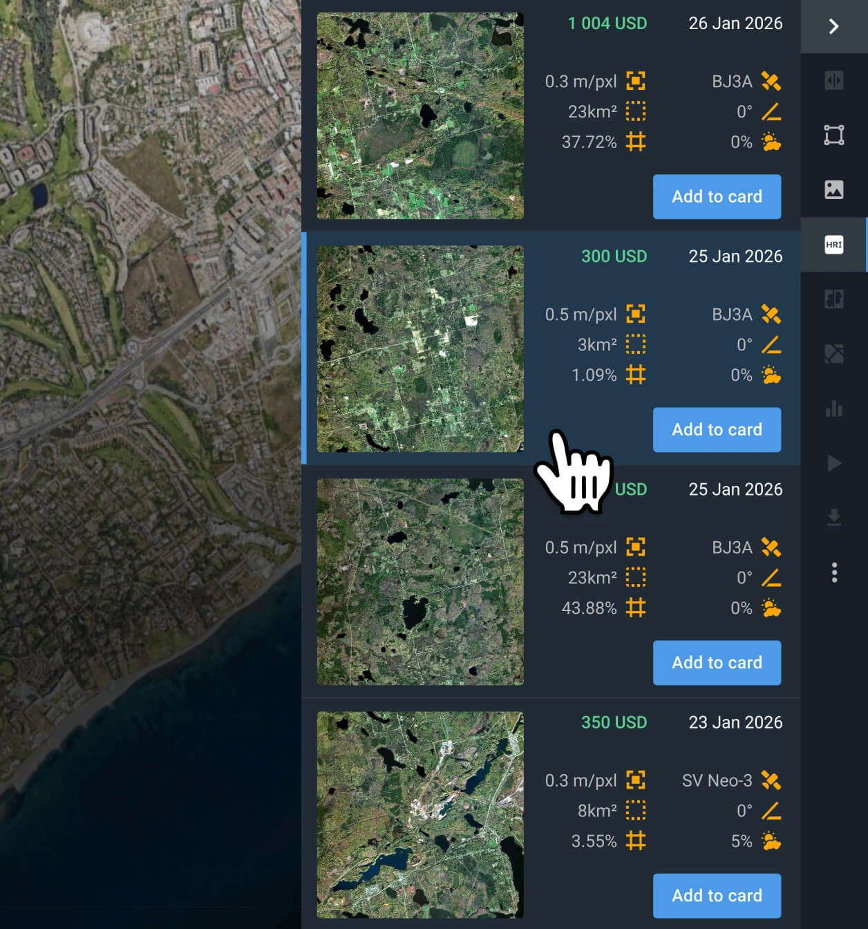
Select the most relevant scenes
Browse the filtered results and review the pricing and other details for each option. Find the Beijing-3A image(s) that better fit your goal.
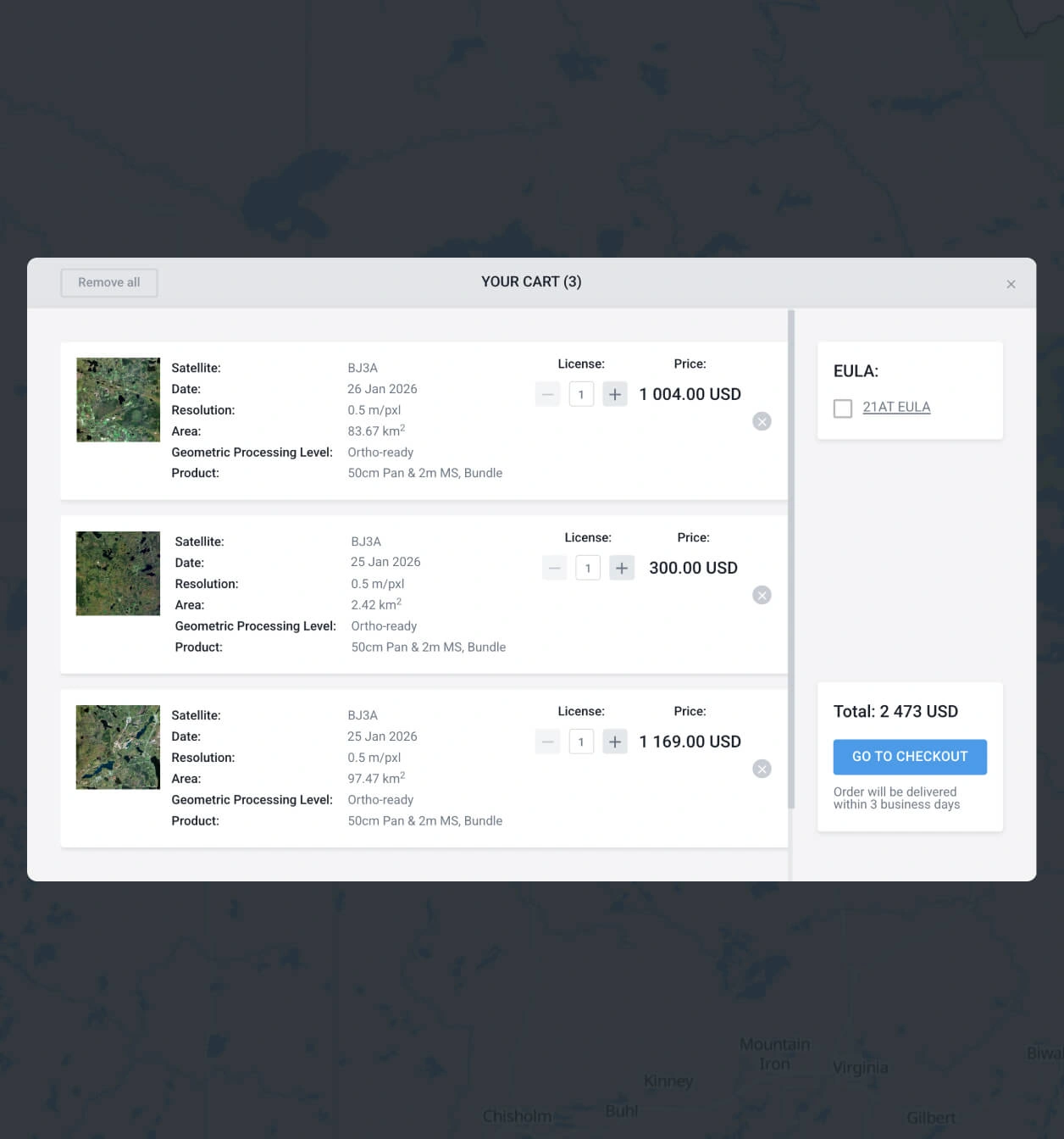
Add to the cart and make your order of BJ3A images
Add as many BJ3A captures as you need to the cart, then submit your order. You can purchase them yourself or reach our sales team to obtain your payment details.
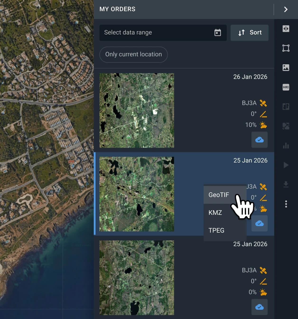
Start with your analysis or export the data
Your BJ3A satellite imagery will be available within 2 business days. Conduct analysis with the built-in options, or export the data in GeoTIFF, KMZ, or JPEG format.
Task a satellite for new captures
No archive match? Explore the BJ3A tasking option and command its sensors for a fresh scene that will match your needs.
FAQ
How much does a BJ3A scene cost?
Accessing archived BJ3A data starts at $12 per square kilometer, with a minimum area of interest (AOI) of 15 sq km. If you need a new capture (tasking), it is priced from $21 per square kilometer, with a minimum AOI of 50 sq km.
What are the most common use cases for BJ3A images?
B3JA imagery is most commonly used for land and resource management, agricultural surveys, environmental monitoring, and urban planning
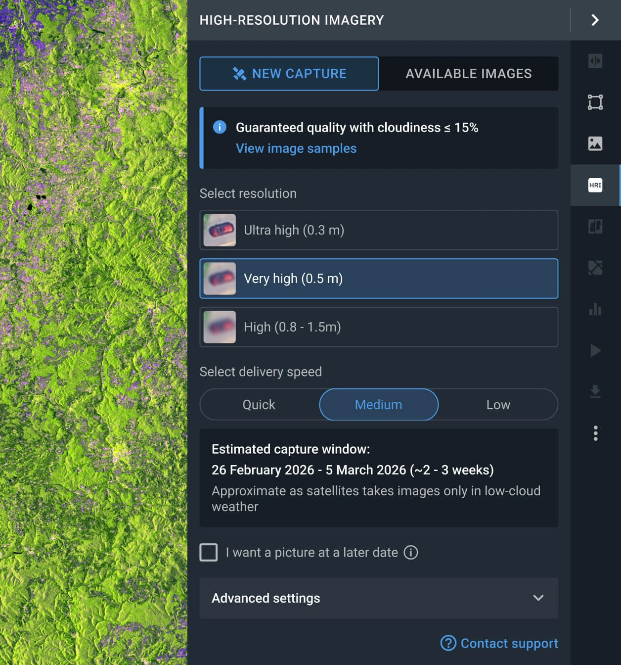
How does the B3JA tasking option work?
You have two options for requesting a fresh image. One is to fill out the form on our website and wait for our sales team to reach out to you shortly after to assist you. The other one is logging in to the LandViewer platform, navigating to the High-resolution imagery section, and clicking the New Image option. There, you can select the resolution, delivery speed, and AOI for your tasking order.
What levels of data processing are available?
All BJ3A images are delivered georeferenced for seamless integration into GIS software like QGIS or ArcGIS. Should your project require advanced processing, such as orthorectification, please contact our support team; we can accommodate these requests in most instances.
Can I set a recurring or long-term monitoring for my AOI with BJ3A?
Yes, this service is available. Please reach out to our sales team or complete the inquiry form on our website. Our specialists will contact you shortly after to discuss the details of a customized monitoring schedule.
How can I ensure my images are cloud-free?
LandViewer features a built-in cloud coverage filter that lets you set your maximum acceptable cloudiness limit. Any B3JA that exceeds this threshold is automatically hidden, ensuring you only see the clearest and most suitable results.
What should I do if I cannot find a suitable BJ3A scene for my AOI?
LandViewer provides access to a diverse catalog of over 15 high-resolution satellites beyond BJ3A, including other modern satellites of the family like B3JB. We recommend using our platform filters to select your desired resolution and explore alternative scenes from other top-tier providers.
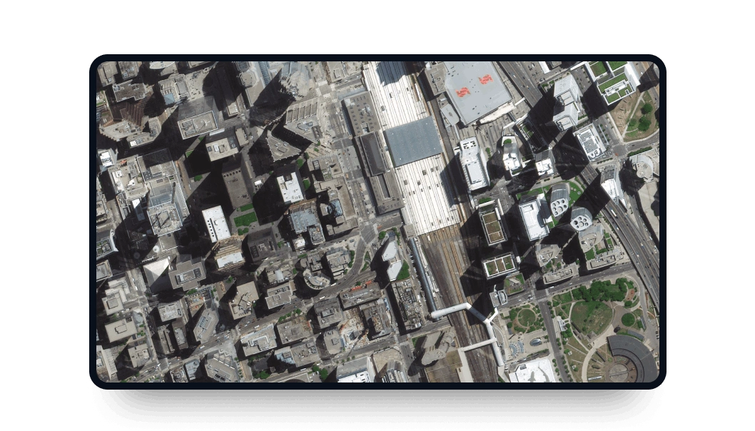
What level of clarity can I anticipate from these images?
Utilizing the resolution provided by B3JA, you can achieve very high-precision identification. This data allows you to clearly distinguish boundary fencing, narrow alleys, parked vehicles, and curbs.


