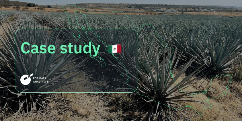
Digital Tools Improve Soil Health And Yields In Mexico
In Guanajuato, Mexico, farmers contend with harsh conditions: rugged landscapes, clay-rich soils, and little rainfall. Here, you can’t simply plant crops and let nature do the rest. To achieve even average yields, farmers must constantly innovate and adapt.
EOS Data Analytics and ITTA helped local farmers make this adaptation easier. Our experts designed contour lines to help retain soil moisture and guided farmers on how to implement the new field layout effectively. Read on to discover how the project unfolded and the yield improvements it delivered.
| Challenge | The farm in Guanajuato struggled with soil erosion, moisture loss, and unstable yields due to sloped terrain and clay-rich Vertisol soils. |
| Solution | EOSDA delivered detailed DEMs, vegetation maps, and clear recommendations for contour-line design and soil practices. Training and feedback helped the farmer integrate satellite data into their everyday fieldwork. |
| Outcome | Soil structure improved, erosion decreased, and fields retained more moisture, resulting in higher yields and improved profitability. |
Overview: Agricultural Landscape Of Guanajuato
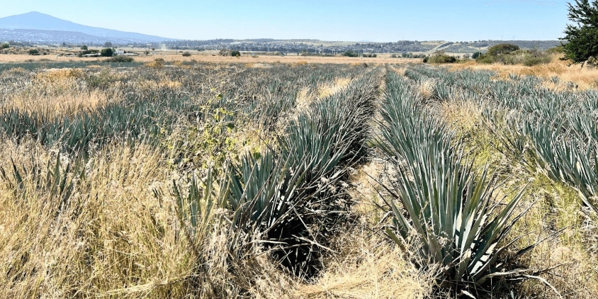
Guanajuato’s farmland lies on the Bajío high plain, a region with both irrigated valleys and rainfed uplands. Corn is the main crop here, grown mostly on Vertisol soils, high in clay. These soils hold water well but are tough to manage when too wet or too dry. Agave is also a popular crop in the region, thanks to the growing demand for tequila and mezcal. It’s being planted in more marginal, semi-arid zones because it can handle drought better than most other crops.
Corn farming depends heavily on steady summer rains. Harvests on rainfed farms can drop sharply even due to a short drought. Using irrigation, though, puts extra strain on underground water sources. Agave is better suited to dry conditions, but it’s still challenging to grow because of soil cracking, shallow profiles, and water stress.
One of the biggest issues Guanajuato’s farmers face is the nature of Vertisol soils, which lack organic matter to keep their structure stable. These clay-heavy soils crack badly when they dry out. Cracks make it hard to plant and manage crops, which hurts productivity.
However, with the right mix of fertilization and soil cultivation, farmers can reduce these problems even in rainfed fields. Studies focused on Vertisol soils show that proper fertilization and soil treatments can lead to much higher yields . Satellite-based elevation maps and NDVI technology help lay out contour plowing, planting rows, and furrows to reduce soil erosion and conserve water.
Challenge: Soil Erosion, Moisture Loss, And Nutrient Inefficiency
The farm in Guanajuato works on land where erosion has always been a serious problem. Before the project, drought led to deep cracks in the soil, which dried out quickly and damaged agave roots. As the roots broke, plants lost vigor and became vulnerable to diseases such as Fusarium. Even though agave does not need much water, the extreme dryness lowered its productivity to about 20 kg/plant (while blue agave typically produces 30–90 kg/plant after 6–8 years) .
Corn plots faced similar issues. With poor moisture retention and low nutrient efficiency, yields stayed low and unstable. In bad years, rainfed fields produced only 3–4 t/ha, and even in better years, they rarely exceeded 6–7 t/ha. The farms had few tools to plan contour lines or shape their fields in a way that protected moisture and reduced runoff.
At the start, the team also lacked experience working with satellite data. They needed clear guidance on how to monitor soil conditions, understand stress signals, and plan field work more precisely.
All these challenges increased costs and threatened long-term soil health. This created a need for practical support that could help stabilize the land, preserve moisture, and improve yields without adding complexity for agronomists and field workers.
Solution: Contour Lines For Soil Conservation
Crop producer Luis León teamed up with EOSDA and ITTA to solve problems with water retention and soil erosion. The solution was simple at its core, but comprehensive and combined satellite technology, modern agronomic practices, and crop rotation.
The project began with contour-line planning. EOSDA and ITTA created digital elevation models (DEMs) and identified patterns of where the contour lines should be placed. These layouts were shared with the farmer and their tractor operators, who followed them in the field. At first, when the process was new, the team needed additional support from EOSDA, but with some practice, the team learned to trace the lines on their own.


The farm changed its soil cultivation practices: minimum tillage and surface cover helped keep organic matter on the ground and supported the new contour layout. The team also introduced a simple rotation: corn first, then agave. Corn broke the fungal disease cycle and became a source of residues, which are beneficial for agave production.
These steps also helped reduce root damage and the entry of pathogens. With higher organic content and moisture retention due to the new layout, the soil held together better and stayed more stable even through dry spells.
Proper furrow management combined with increased organic matter helps the soil retain moisture, keeps roots from drying out, and reduces the risk of diseases like Fusarium.
The project moved forward through constant cooperation. EOSDA experts worked with Guanajuato’s farm to set up the tools and connect satellite insights with everyday fieldwork. EOSDA Crop Monitoring precision agriculture platform supported this process and was integrated with the farm’s machinery and planning routines.
We came to Mexico from Ukraine to help implement a comprehensive model, positioning this farm as an example of global agricultural innovation.
Throughout 6–7 years, the farm’s team received field monitoring, training, and regular feedback from EOSDA experts. Our long-term support helped them confidently use the tools even without built-in GPS at the start. What began as outside guidance became local skill, rooted in the fields of Guanajuato.
Outcome: Healthier Soil And Higher Yields
After several years of applying contour layouts, minimum tillage, and crop rotation, the fields in Guanajuato began to change steadily and visibly. The soil held together better, even on slopes, and erosion losses dropped. Water stayed longer in the fields, and organic matter increased because crop residues no longer washed away with the first heavy rain.
Corn yields became more predictable. In rainfed plots, the team now reached 5–6 t/ha even in poor rainfall years with about 400 mm of rain. In seasons with close to 800 mm, the field reached a record productivity of 11.7 t/ha. Over six years, the average yield kept climbing, showing that the new layout and soil practices worked across both dry and wet seasons.
Agave fields changed as well. The crop grew more evenly across the plots because the soil stopped cracking as much and held moisture longer. Plants developed stronger roots and kept their vigor, which helped reduce the damage that previously opened the door to crop diseases. As a result, the farm moved from historical yields of about 20 kg per plant toward a projected target of around 35 kg per plant.

In corn, we improved nutrient use and prevented soil cracking. In agave, after 8–9 years, we’re seeing significant changes, with yields expected to rise from 20 to 35 kg per plant. While implementing contour-line layout was initially complex, we now confidently apply contour lines, even without integrated GPS.
Nutrient retention also improved, so farmers no longer lost as much fertilizer to runoff. Costs went down because the soil required fewer corrections, and crops needed fewer replacements. With stronger soil and better productivity, the farms improved their profitability year over year.
Satellite tools like EOSDA Crop Monitoring allow us to protect our most valuable asset — our soils — while increasing farming productivity and profitability.
These results set the farm apart from neighbors who had not adopted similar practices. The combination of contour planning, soil management, and satellite-based monitoring became a working model that can be applied in other regions with similar soils. It shows that steady improvements in structure and moisture can transform both productivity and long-term sustainability.
About the author:
Maksym Sushchuk is at the forefront of realizing EOSDA's vision to make space tech a global driver of sustainability on Earth. He has over 15 years of experience in journalism and content creation for prominent Ukrainian startups, charitable funds and ESG businesses. As Head and Co-founder of PR Army Maxim brings attention to the human and social tolls of the aggression against Ukraine.
Recent articles

EOSDA Forecasts Yields For 2025 In Saskatchewan
EOSDA created RM-level crop yield forecasts for Saskatchewan to address limitations of official data. The project shows how satellite and weather inputs reveal local yield changes during the season.

Analyze 2025 & Plan Your Best Year Yet: LandViewer Christmas Offer
It’s the most wonderful time of the year! The Christmas holidays are here, and so is your chance to analyze 2025 and plan a prosperous 2026 with more affordable Pro plans in LandViewer.
EOSDA Models Climate Change Impact On Sugarcane Yields
EOSDA modeled future temperature, rainfall, and other climate impacts on Veracruz sugarcane. The results help growers plan long-term adaptation strategies, including timing, varieties, and irrigation.