Agroclimatic reports for region-level crop state insights
EOSDA agroclimatic reports combine satellite and climate data with advanced modeling to deliver accurate regional crop health analysis and yield forecasts. WOFOST simulations integrated with machine learning ensure timely, data-driven decisions.
- Monthly crop and climate insights.
- NASA POWER weather datasets and MODIS imagery.
- Customizable, decision-ready reports.

Benefits
Business & policy planning
- Production and sourcing planning
- Supply chain optimization
- Market analysis and agricultural intelligence
- Policy formulation and compliance supports reporting on land use and crop production
On-field poductivity & resilience
- Agricultural monitoring & food security supports risk assessment and food security analysis
- Land use planning and sustainable resource management
- Crop health analysis and yield risks insights
- Insights for better disease and pest control
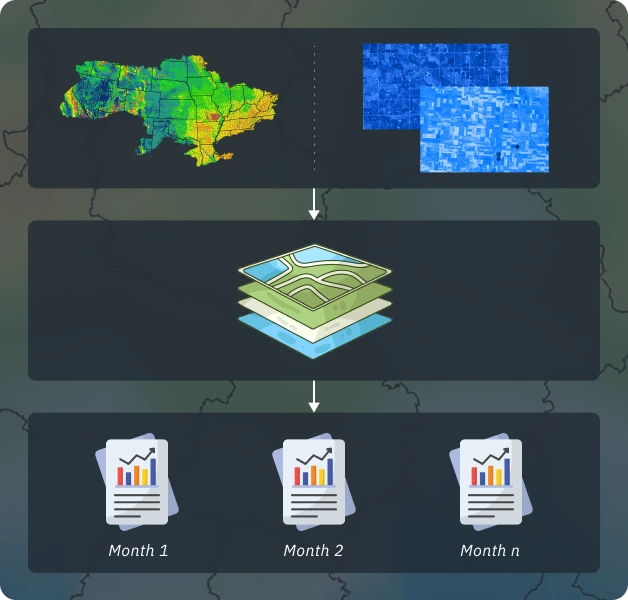
Approach and Methodology
Model: Automated pipelines prepare satellite and climate datasets. WOFOST and machine learning models are applied to analyze biophysical parameters and forecast yields.
Climatic data: Uses NASA POWER datasets, including minimum and maximum temperatures, solar radiation, precipitation, wind speed, and air humidity.
Satellite data: Incorporates MODIS satellite imagery for regional-scale analysis.
Resolution: Spatial resolution ranges from 300 meters to 10 km, depending on the data layer - sufficient for regional analysis. Biophysical parameters and yield estimates are provided per administrative unit (region, district, etc.).
Limitations: Accuracy may be lower for specific crops such as coffee, cocoa, bush and tree crops, or other exotic varieties in regions without reliable official yield statistics.
WOFOST (WOrld FOod STudies) is a mechanistic simulation model used to analyze crop growth and yield. It explains how processes like photosynthesis and respiration interact with environmental conditions. Using WOFOST, it’s possible to estimate potential crop production, biomass, and water use for specific soil, crop types, weather data, and management practices.
Our yield forecasts are powered by a machine learning model that combines satellite data, weather and terrain variables, historical yield statistics, and WOFOST biophysical model outputs. Incorporating WOFOST outputs makes the final predictions more accurate and reliable.
Project Deliverables and Output Formats
MS Word or PDF report with the following key sections:
- Overview of region-level agrometeorological conditions
- Analysis of region-level crop growth conditions
- Region-level crop yield forecasts for key crops
- Report frequency: Monthly during the crop season, with 2–5 reports per season
Customization available: Content and sections can be tailored to meet specific customer requirements.
Required Data
Inputs from the customer:
- Area of interest: entire country or target regions, with required detail level (regions, districts, etc.)
- Crop calendar (if available, to select the optimal analysis period)
Data prepared by EOSDA
- Satellite imagery
- Historical yield data
- Climatic data
- Other data layers (soil, phenology, etc)
Typical Project Stages
Project duration: 3-5 months (vegetation season) with monthly report delivery
Vegetation analysis: Investigate vegetation features for AOI and assess available data sources
Data acquisition: Search, download, and preprocess satellite, climatic, and historical yield data
Modeling and monitoring: Run and support yield prediction models, including calculation of derivative parameters
Verification and final outputs: Validate results and prepare final deliverables