NewSat high-resolution images
Access the LandViewer platform to get the latest Newsat by Satellogic satellites imagery in high-definition.
-
Data type
Optical
-
Resolution
0.7 - 0.8m
-
Revision
4 times per day
-
Spectral bands
Blue, Green, Red, NIR
-
Data archives
Archive since 2016
-
New Image Tasking
Available

How to get the most out of the NewSat constellation with LandViewer
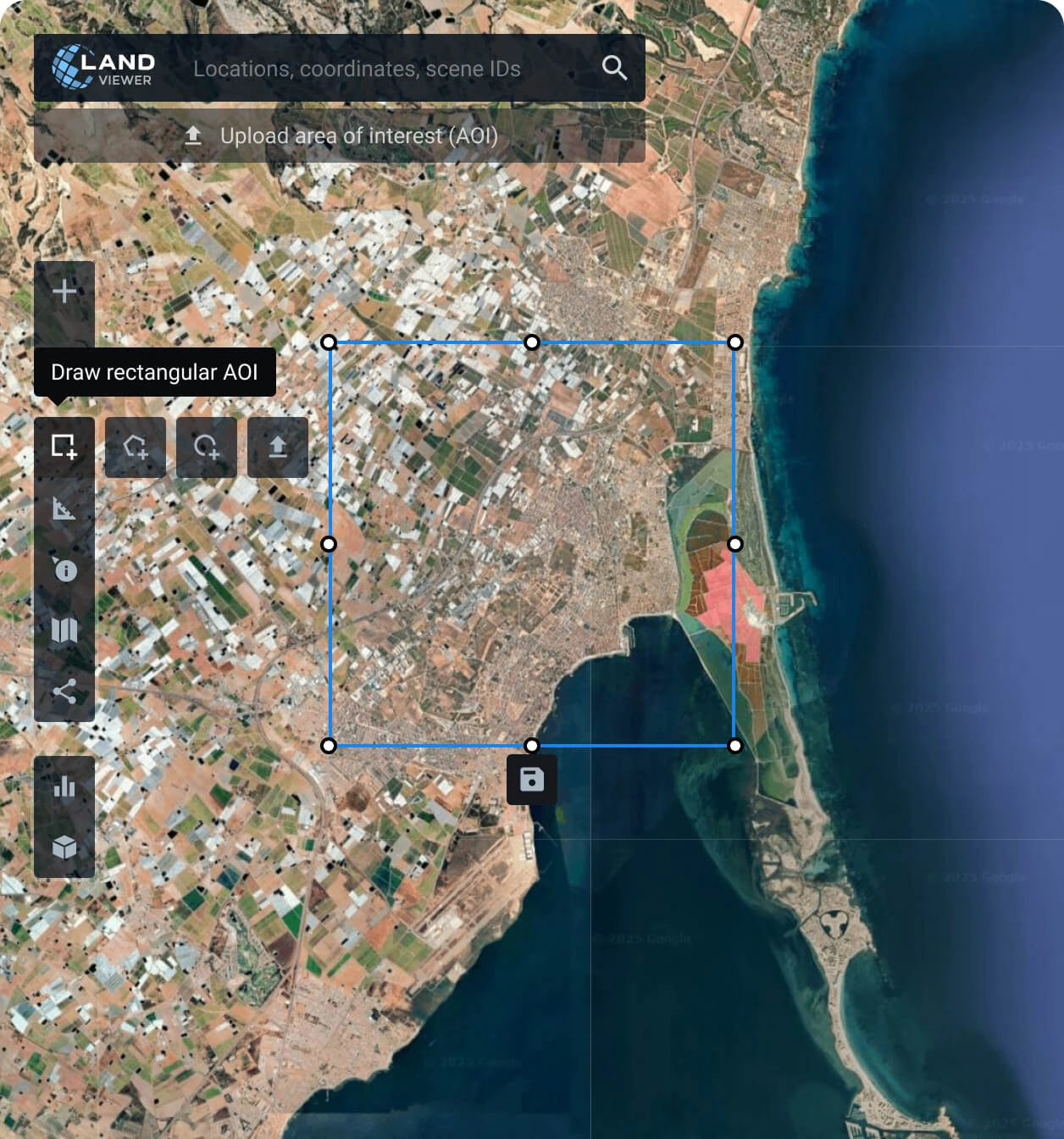
Establish your area of interest (AOI)
Define your AOI with one of the options available: search for a specific location, draw a polygon of the area, or upload a file from your device with the details.
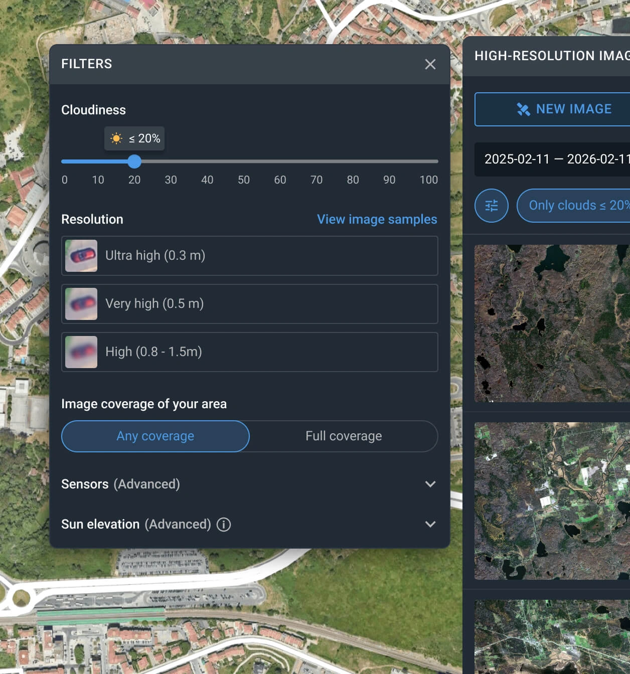
Apply filters to reduce the number of NewSat scenes
The filter can be used with one or more conditions, such as date, resolution, sensor, cloud coverage, and AOI coverage.
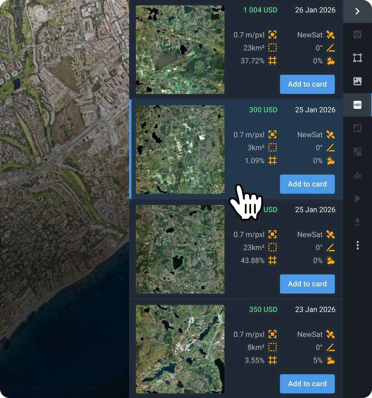
Choose the NewSat scenes that better fit you
Examine the NewSat by Satellogic captures, their pricing details and other relevant information for the filtered results, selecting those that work for your use case.
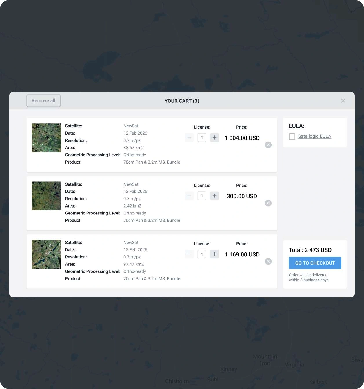
Add the scene and go to secure checkout
Place the selected item(s) into your shopping cart. You can finalize the transaction online, or reach out to our sales representatives to arrange custom billing.
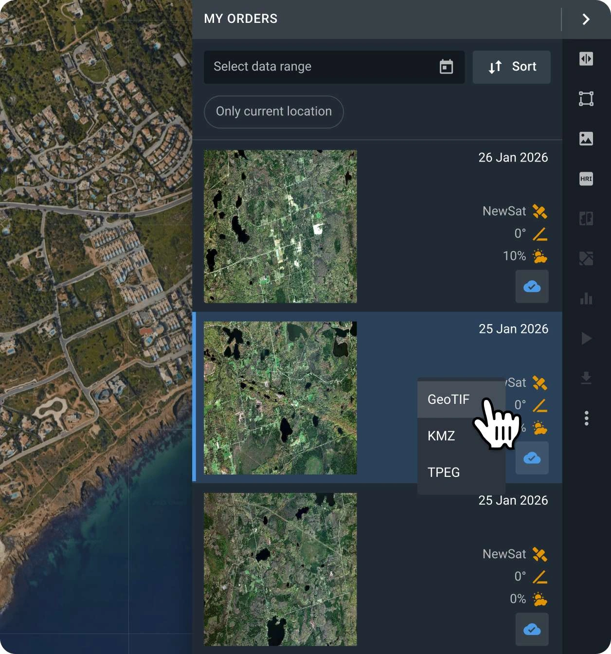
Conduct analysis on your purchased satellite data or export it
Your captures will be available on the LandViewer platform within 2 days. You can run analysis on the platform or export them in GeoTIFF, KMZ, or JPEG format.
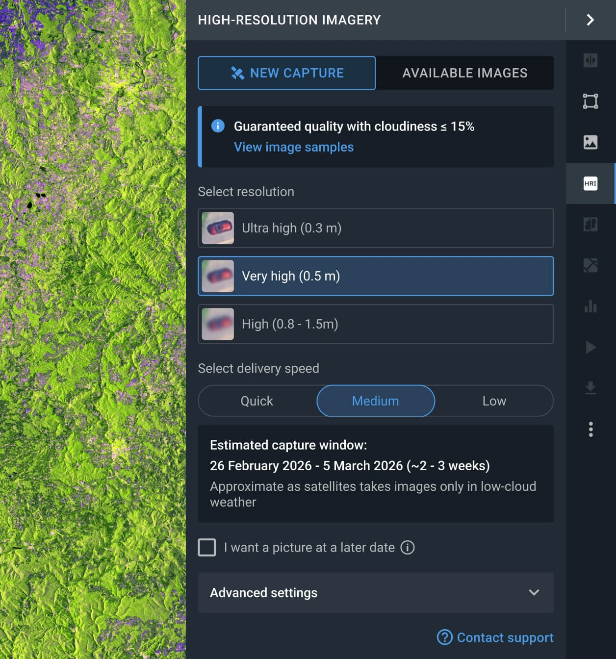
Request a new image
If the scenes available do not fit your goal, you can use the Tasking option to obtain a new one that does.
FAQ
How much does a NewSat (Satellogic) image cost?
Accessing archived NewSat costs from $4.50 per square kilometer, with a minimum area of interest (AOI) of 16 sq km. If you need a new image (tasking), the price starts at $12.00 per square kilometer, depending on the AOI size.
How does the tasking option work for Satellogic's NewSat EO satellites?
Access the LandViewer platform, navigate to the High-resolution imagery feature, and choose a new scene. After that, establish the resolution, delivery speed, and the AOI to be covered. Alternatively, you can fill out the form on our website or reach out to our sales team.
What are the main applications of Satellogic imagery?
Thanks to the NewSat (Satellogic) spectral bands available, it's is widely used for monitoring remote assets, managing large operational areas, and maintaining continuous oversight of critical sites. Its high resolution and frequent revisit rates make it possible to detect changes quickly, respond faster, and reduce potential risks. It also supports better planning by improving impact analysis and situational awareness
What level of data processing is provided?
All NewSat by Satellogy scenes are standard georeferenced, ensuring full compatibility with GIS software such as QGIS or ArcGIS. If your project requires advanced processing, such as orthorectification, please contact our support team, as we can provide these services in most instances.
Can I set a regular monitoring program for my AOI using NewSat (Satellogic) satellites?
Yes, you can. Get in touch with our sales representatives or fill out the inquiry form on our website. Our specialists will contact you to discuss your specific needs.
Is there a tasking service available when a new image is needed in very short advance?
Yes, there are 3 distinct tasking options (Standard, Priority, and Emergency), each tailored to different delivery timelines and budgets. You can select the plan that best fits your urgency through the LandViewer platform or contact our sales department for a detailed breakdown of each option.
Is it possible to receive additional analysis alongside the raw NewSat (Nusat) data?
Yes. For all purchased data, you will receive integrated analytics, including NDVI and NDWI indices. Furthermore, our dedicated R&D department is available to collaborate on bespoke projects and engineer advanced analytical solutions tailored to your specific requirements.


