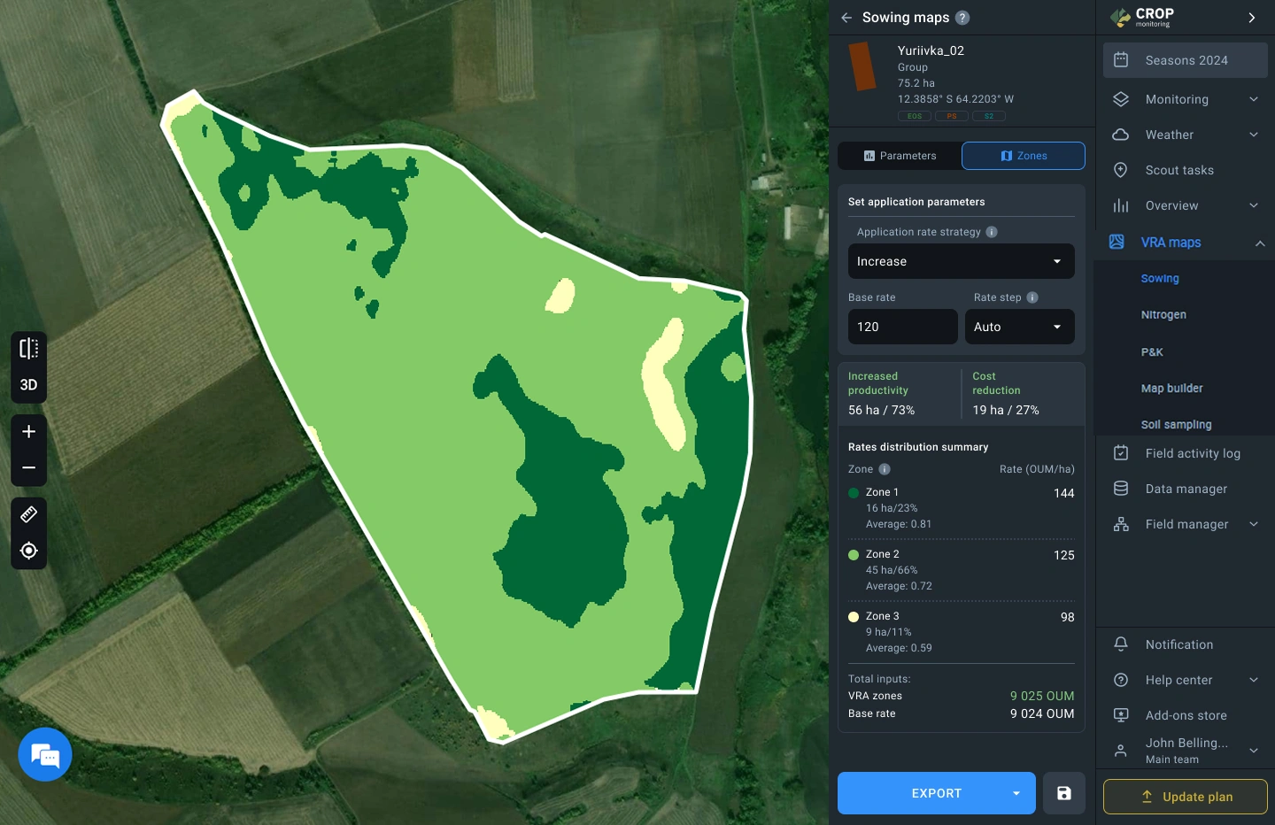
Create VRA maps for sowing and macro fertilizer application with enhanced efficiency and precision, powered by improvements to the generation algorithm. With automated rate distribution now integrated, fertilizer rates are calculated based on a predefined average — ensuring optimal resource use without the need for manual adjustments.
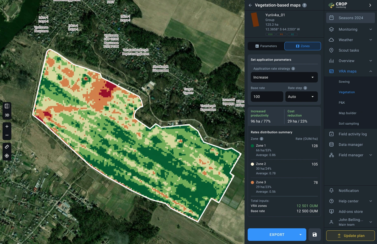
Create variable-rate application maps for different technological operations using the most relevant vegetation indices. Automatically distribute application rates in vegetation-based VRA maps according to a specified average rate to ensure efficient and accurate input application — with no need for manual adjustments.
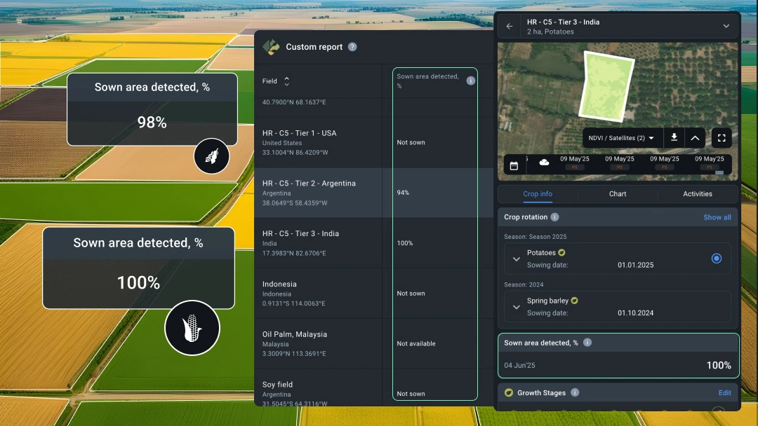
With the new sown area detection feature, you can quickly assess the uniformity and emergence rate of annual crops, adjust field activities based on this metric, or plan scouting for a more detailed analysis. The “Sown Area” metric is available on the Field analytics page and can be added to reports in the Custom report section.
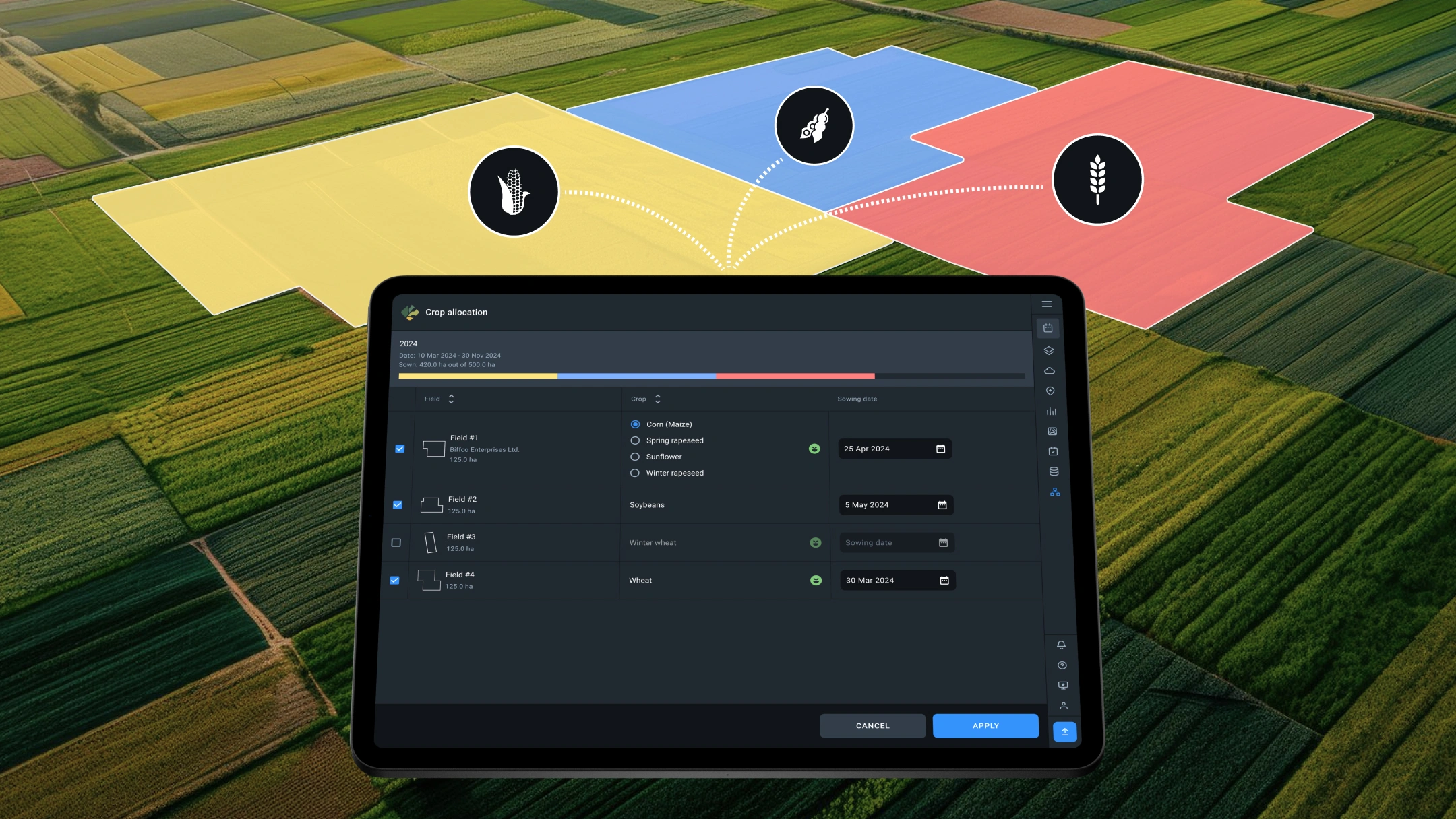
We have introduced a new feature in the Crop Rotation section called Crop Allocation, which automates crop planning. With just a few clicks, you can automatically allocate 13 crops: Corn, Winter Wheat, Spring Wheat, Soybean, Sunflower, Winter Rapeseed, Spring Rapeseed, Canola, Winter Barley, Spring Barley, Sugar Beet, Rice, and Sugarcane. The list of crops will expand with future updates.
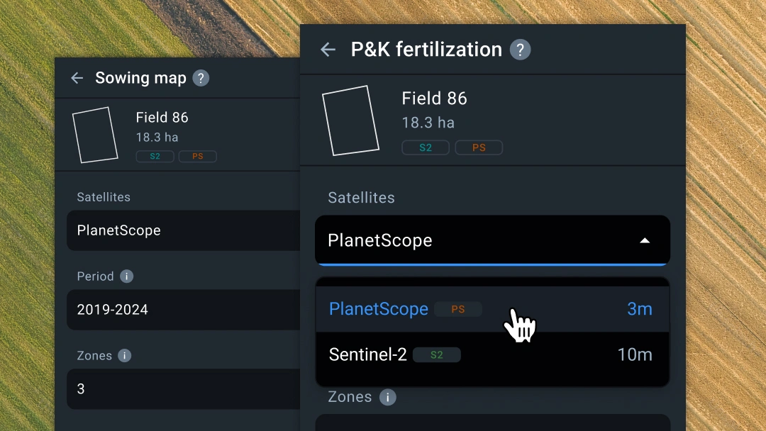
Generate differential seeding and P&K macronutrient application maps based on PlanetScope satellite images with even greater efficiency! This feature enhances efficiency by enabling the creation of differential seeding and primary macronutrient application maps from daily 3-meter resolution satellite images. Use this feature for more effective differential seeding and primary macronutrient application thanks to the increased detail of the source satellite imagery.
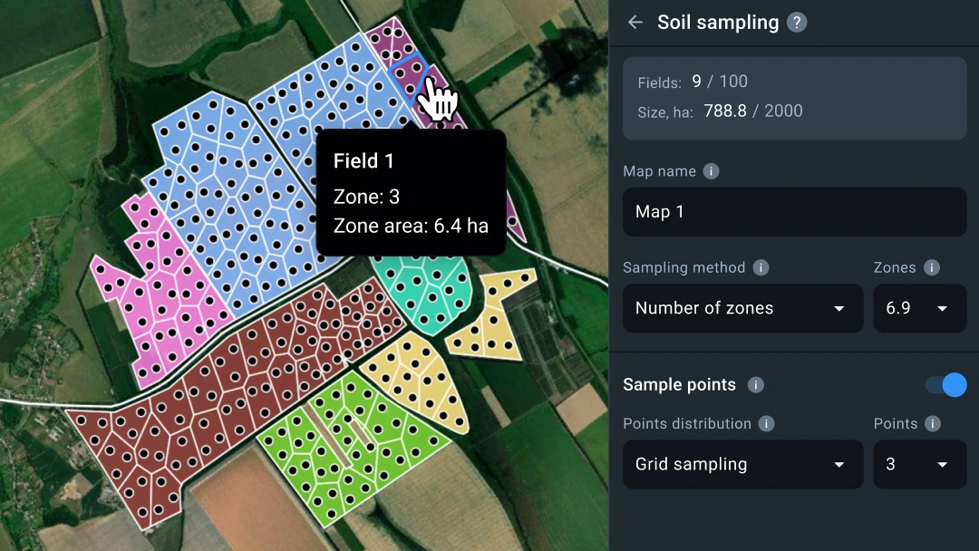
Create soil maps with enhanced efficiency! We’re thrilled to introduce new features on the VRA maps page: Soil Sampling Maps. Now, you can generate soil maps based on zone size and ensure even distribution of sampling points across your fields. This tool simplifies your processes by allowing you to analyze soil conditions across multiple fields or your entire farm at once, boosting productivity and improving accuracy with an easy-to-use soil survey planning tool.
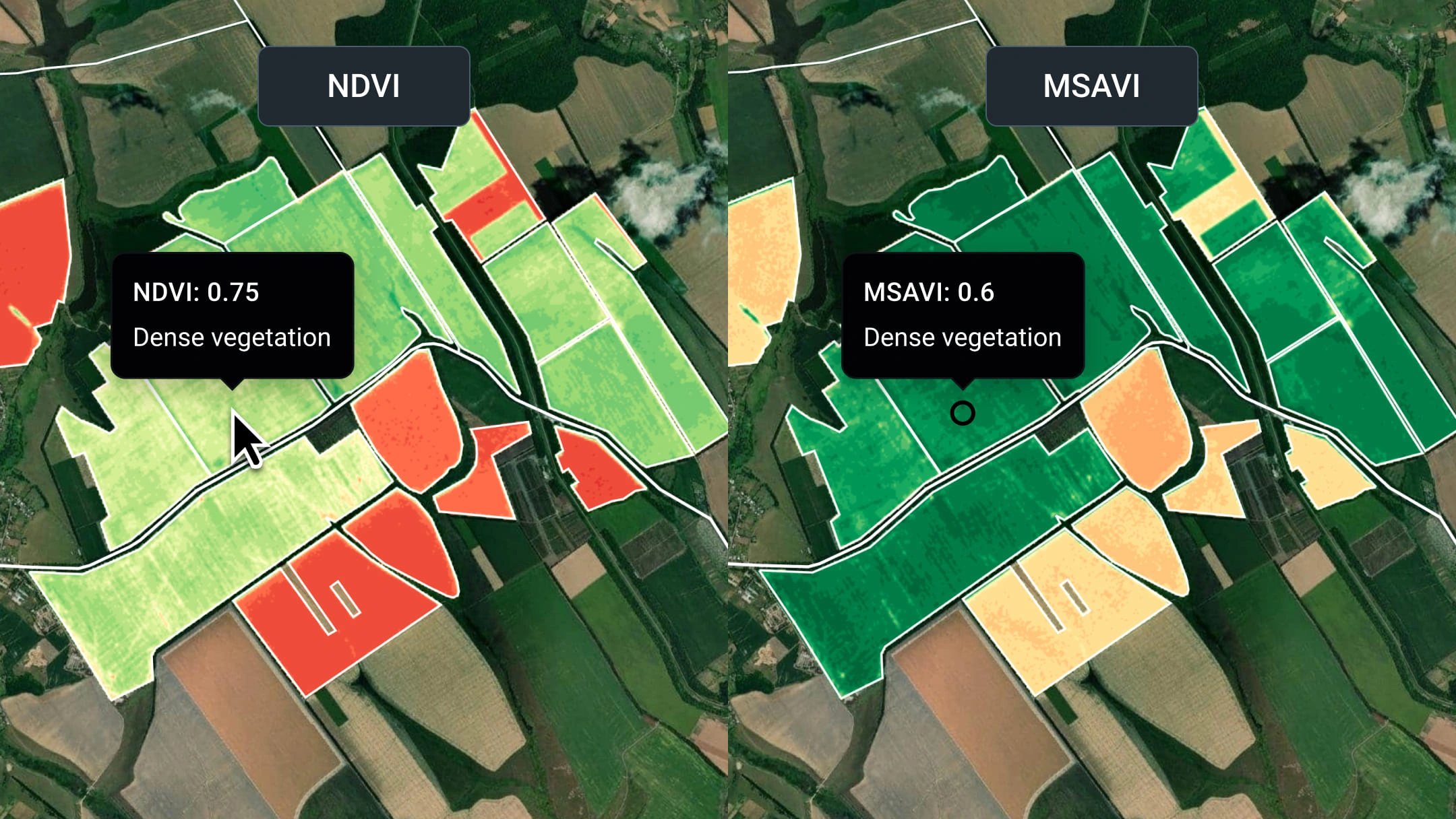
Perform satellite image analysis of your fields with even greater efficiency! We’re excited to introduce a new feature on the Global View page: Split View mode. This feature lets you compare satellite images of different indices across various time periods for all your fields. Easily analyze multiple layers of visual or multispectral satellite images, along with other data layers, simultaneously for your entire farm.

We’ve introduced several improvements to streamline adding activities by field. You can now use drag-and-drop functionality in the activity calendar to add activities to multiple fields and define the duration of a new activity.
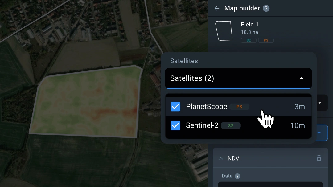
Create unique VRA maps for various agricultural operations using Planetscope satellite images! Integrating Planetscope satellite images with the Map Builder feature allows you to generate maps for different field operations based on daily 3-meter resolution images. Use it to make faster decisions and reduce risks when managing resources on your fields.
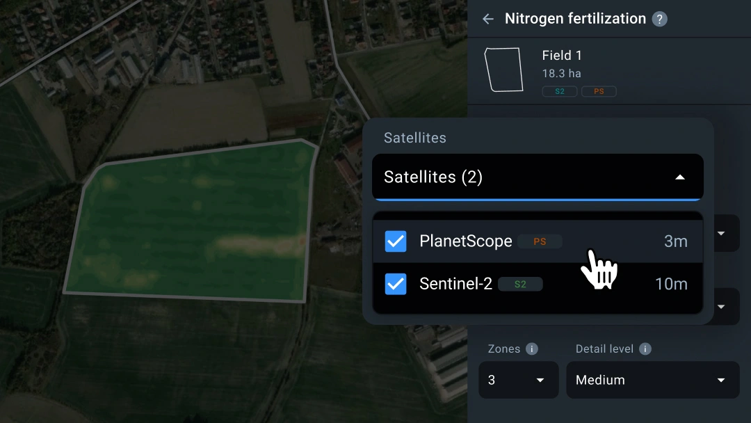
Generate VRA maps for nitrogen fertilization based on Planetscope satellite images with even greater efficiency! This feature enhances efficiency by enabling the creation of nitrogen application maps from daily 3-meter resolution satellite images. Use this feature for faster decision-making and risk reduction during additional nitrogen fertilization of your future crops.