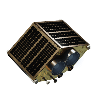
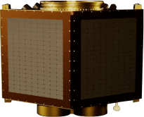
EOS SAT-1 Satellite
An optical Earth observation satellite created for EOS Data Analytics.
An optical Earth observation satellite created for EOS Data Analytics.
Design a satellite with an instrumental role in fighting climate change and satisfying global food demand by providing valuable insights for smart farm management.


The communication module consists of two transmitters. One is used to transmit captured data to the ground, the other sends the information about the state of the satellite.


A structural part of the satellite to which the rest of the parts are attached. It protects the satellite’s internal components during the launch and ensures all components stay in place at all times.


A dual-telescope camera that’s based on radiation-resistant optical components with a low coefficient of thermal expansion. It surveys the Earth from orbit and gets high-resolution images in 11 bands.


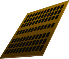
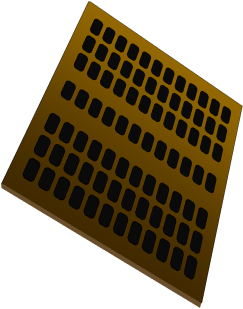
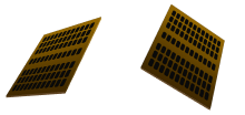
One of many distinctive alloy panels. These panels offer structural rigidity during launch and shield the payload from the hostile environment in orbit.

Solar panels help transform sunlight into electrical power for the operation of a satellite. It’s a primary source of power and thereby one of the most essential parts of a spacecraft.

With two solar panels, EOS SAT-1 can catch more sunlight and thus generate more electrical power.

The communication module consists of two transmitters. One is used to transmit captured data to the ground, the other sends the information about the state of the satellite.

A structural part of the satellite to which the rest of the parts are attached. It protects the satellite’s internal components during the launch and ensures all components stay in place at all times.

A dual-telescope camera that’s based on radiation-resistant optical components with a low coefficient of thermal expansion. It surveys the Earth from orbit and gets high-resolution images in 11 bands.

One of many distinctive alloy panels. These panels offer structural rigidity during launch and shield the payload from the hostile environment in orbit.
Solar panels help transform sunlight into electrical power for the operation of a satellite. It’s a primary source of power and thereby one of the most essential parts of a spacecraft.
Here's how it's going to go
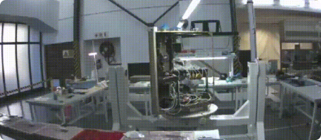
Once the payload is integrated into the launcher, the vehicle gets moved to the pad and erected. Then, system close-out, fueling, and testing are completed. 24 hours before satellite launch, the Launch Readiness Review (LRR) is held. Once the approval is given, the countdown begins.
First, the vehicle executes a series of checkouts. Automated software sequencers control all critical vehicle functions during the terminal countdown. Final launch activities include verifying flight termination system status, transferring to internal power, and activating the transmitters. Engine ignition occurs shortly before the liftoff. The flight computer evaluates engine ignition and full-power performance during the prelaunch hold-down.
The first-stage powered flight lasts approximately three minutes, with the commanded shutdown of the nine first-stage engines based on remaining propellant levels. The second stage continues for additional five to six minutes to reach the initial orbit, with the early deployment of the fairing typically taking place. Subsequent operations are unique for each spacecraft.
After reaching the spacecraft injection orbit and altitude of 50+ miles, the rocket issues a spacecraft separation command by providing the necessary electrical impulses. Indication of separation is available in the second-stage telemetry.
The fairing has the form of a nose cone at the top of the rocket and protects the spacecraft's payload from the impact of dynamic pressure and aerodynamic heating during its flight through the atmosphere.
Payload separation is a timed event that happens once the engine is off and the spacecraft is coasting. It provides a signal to separate the payload and power it up.
The first stage booster makes it back down to Earth. Engineers come to the rocket and secure it. Grom launch to landing, the process takes about nine minutes.


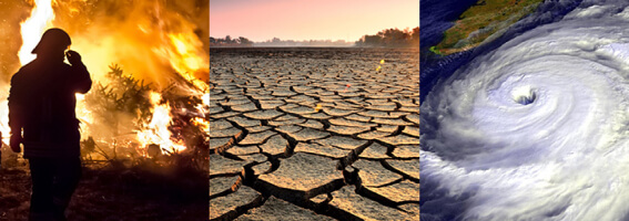
Many global issues are happening around the world right now. Satellite monitoring can be of great help in preventing and addressing them. Want to find out how EOS SAT-1 can help?
EOS SAT-1 can help measure SOC at a lower cost with remote sensing carbon sequestration detection.
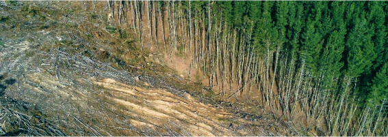
Track tree cover changes and detect deforestation rates based on historical imagery. Develop and adapt management strategies to mitigate deforestation and weather uncertainties.
Track illegal deforestation and intervene in a timely manner. See the extent of deforestation in your area caused by logging or natural changes in forest cover, and compare it to data from other periods and regions. Watch how Greenpeace used EOSDA LandViewer to track deforestation in Gran Chaco Americano.
Set up thermal anomalies notifications to get more time to protect your trees from forest fires. Reveal potential fire risks with a global map of heatwaves based on NASA’s Fire Information for Resource Management System (FIRMS).
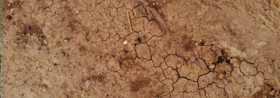
Find out how much water each of your field zones requires to avoid plant stress, reduced bioproductivity and yield, and, ultimately, soil degradation using EOS SAT-1’s soil moisture sensors.
EOS SAT-1 provides data necessary to define the maximum productivity of field zones and precise amounts of mineral and organic fertilizers to use.
Detect soil salinity caused by the lack of water, high evaporation rate, and poor drainage. Three SWIR spectral bands enable measuring the amount of heat emitted from the soil. With it, you’ll obtain data on materials identification, wildfire response, food security, and mining/geology.

Prevent famine, boost local economies, and implement sustainable agricultural practices by leveraging crop yield forecasts provided by EOS SAT-1.
Identify problems with pests or plant diseases and timely address them by getting omnichannel spectral data from seven satellites. Multiple kinds of vegetation maps based on remote sensing of vegetation will help you quickly see ways to secure the highest crop productivity.
Monitor lands, river banks, and forests from space to assess your plants, their vegetation health, soil erosion, and other issues with natural resources. Learn how we helped analyze the consequences of oil spills for Ecuadorian indigenous people that suffer from drastic resource shortages.
Keep an eye on your irrigation activities and moisture levels to detect and address problems caused by droughts and floods early. Learn more about the NDMI index.
Track surface water changes caused by climate changes, floods, and anthropogenic influences to mitigate and address greenhouse gas absorption and subsequent soil degradation due to the low quality of the water.
Obtain reliable weather data to identify crop and heat stress and forecast possible landslides. Using this information, you’ll be able to better protect your crops and ensure high-quality produce for thousands of people.
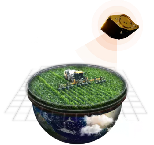
EOS SAT-1 is a small satellite designed to serve various purposes through its cutting-edge technology, particularly focusing environmental disaster management, urban and infrastructure monitoring, agriculture and carbon management, forestry management.
SSO
140 W
5-7 years
178 kg
24.5 V - 33.6 V
Panchromatic 1.4 m
Multispectral 2.8 m
> 22 km for the 500km altitude
10 million km2
every 1-5 days
every 6-60 days