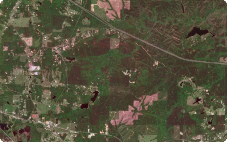
EOS SAT-1: High-resolution multispectral imagery and analytics
Get superior insights and make business decisions confidently with EOS SAT-1. Designed for multiple purposes, this optical satellite has a specific focus on agriculture, forestry, natural disaster management, and urban monitoring.
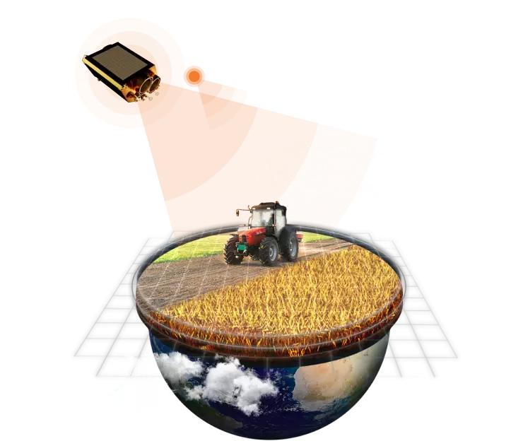
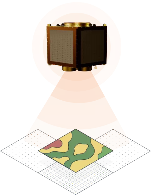
Concept of the EOS SAT-1 satellite
Priority tasking, Standard tasking, Archive
Total area covered in 1 day: 1 150 000+ km2
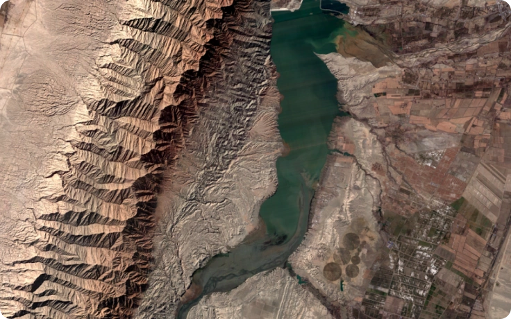
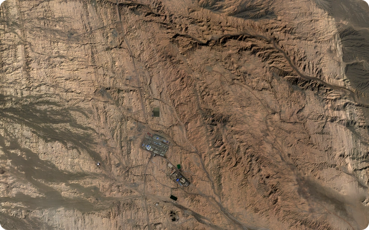
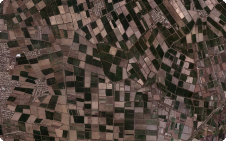
Super-resolution 4-band stack, 0.75m RGBN bands
1-day revisit of target areas on tasking
Performs monitoring for agriculture, forestry, environment preservation, infrastructure management, and other spheres.
Full cycle from data acquisition to aсtionable insights delivery in 16-24 hours
Complete Cycle from Satellite Assembly to Data Processing
Together with the companies which, like EOSDA, are all part of the Noosphere ecosystem, we've established a full-cycle operational process: from manufacturing and maintenance of satellite details to transforming satellite data into actionable products.
Upstream
- Satellite & payload manufacturing
- Satellite launch
- Space engineering and imager products
Satellite's Assembly and Launch
Manufacturing, assembling, and launching EOS SAT-1. Satellites follow the Earth on a sun-synchronous orbit and collect refracted light through 11 specialized bands
Independent, high-quality data
Manufacturing and integration of EO satellites through tasking or continuous monitoring
Midstream
- Mission control center
- Data acquisition & storage
Receiving and Processing stations
Acquisition of imagery data by 4 ground stations in different parts of the world for the finest output
Downstream
- Data processing
- Data fusion
- Algorithms & Analytics
- Product & services
Quality business insights from our solutions and software
Raw satellite imagery is processed by our proprietary algorithms and transformed into already existing and fully-functional products & services to benefit end-users
Discover how EOS SAT-1 can be used to make more informed, data-driven decisions
Environment, Disaster Management, and Damage Assessment
- Improved flood forecasting: Leverage advanced imaging to predict and mitigate the impacts of floods
- Visualization of changing conditions: Track alterations in land, water, and ecosystems with high-resolution imagery
- Monitoring of coastal risks: Stay ahead of evolving risks to coastlines through continuous observation
Urban and Infrastructure Monitoring
- City expansion detection: Identify and monitor the growth of urban areas and the emergence of new zones
- Construction monitoring: Keep a close watch on the development of large facilities, ensuring timely progress
- Infrastructure development: Track the construction of railways, highways, bridges, and crossings with precision
- Project progress assessment: Evaluate the speed and quality of construction or rebuilding efforts
- Strategic object surveillance: Monitor critical infrastructure for potential threats and destruction
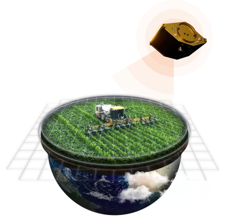
Agriculture and Carbon Management
- Vegetation indices analysis: Utilize indices like NDVI, NDRE, MSAVI, GNDVI, EVI, SIPI, ARVI, and more for comprehensive crop health assessment
- Crop damage evaluation: Assess the extent of crop damage using visual indicators
- Field harvest monitoring: Observe and analyze harvesting activities through satellite imagery
- Agricultural zone changes: Monitor and document changes in agricultural areas over time
- Soil carbon quantification: Measure the amount of carbon in soil using the SOC model
- Carbon sequestration potential: Predict soil’s carbon sequestration capabilities with the RothC model
Forestry Management
- Forest cover monitoring: Track changes in forest cover, including deforestation, reforestation, and other logging activities
- Forest road planning: Discover and plan forest roads with the help of satellite data
- Fire damage assessment: Detect and assess damage from forest fires, and monitor ongoing fires using satellite technology.
EOS SAT-1 Technical Characteristics
- Reference Orbit
- SSO
- Orbit Average Power
- 140 W
- Design Lifetime
- 5-7 years
- Mass
- 178 kg
- Bus Voltage
- 24.5 V - 33.6 V
- GSD (Ground Sample Distance), Resolution
- Panchromatic 1.4 m
Multispectral 2.8 m
- Swath Width
- > 22 km for the 500km altitude
- Spectral Bands
- 11 Bands:
- RGB
- 2 NIR Channels
- 3 RedEdge
- WaterVapor
- Aerosol
- Pan
- Delivery options
- Maximum possible delivery configuration is 9-bands
- RGBN
- PS4
- SR4
- Bundle PAN + MS
- Tasking Type
- Priority tasking, Standard tasking, Archive
We combine multiple data points that can be applied to various business sectors
Would you like to invest in the future of SatTech?
Satellite-as-a-service
Step 1
Imagery with custom band configurations
Infrastructure changes mapping, monitoring, and detection, Deforestation monitoring, Resource mapping, Land reclamation monitoring
Step 2
Analytics and visualization
Data-driven sustainability reporting, Land use and land cover mapping, Crop classification & yield prediction, Carbon stock estimation, Risk and damage assessment
Step 3
Products based on satellite analytics
Imagery integration in EOSDA Crop Monitoring to power precision agriculture, Imagery integration into the carbon stock estimation and management platform